A Brief Check on Our Weather Situation Right Around 10 am
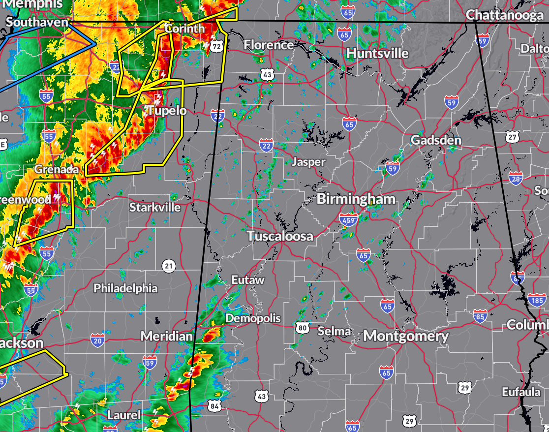
RADAR CHECK: At 9:34 am, the first wave of storms with this system is about to enter the northwestern corner of the state and there is the threat of damaging winds with that line as severe thunderstorm warnings are currently in effect. Out ahead of hat line, we have some scattered light shower activity spread across the area, and a cluster of storms with heavy rain moving across the southern portions of Sumter County.
TORNADO WATCH: A Tornado Watch has already been issued for Colbert, Cullman, Franklin, Lauderdale, Lawrence, Limestone, Madison, and Morgan counties in the Tennessee Valley, and for Bibb, Dallas, Fayette, Greene, Hale, Lamar, Marengo, Marion, Perry, Pickens, Sumter, Tuscaloosa, Walker, and Winston counties in Central Alabama until 5 pm this evening.
AREAL FLOOD WATCH: An Areal Flood Watch is up until 12 pm Wednesday for Autauga, Barbour, Bullock, Chambers, Chilton, Coosa, Dallas, Elmore, Lee, Lowndes, Macon, Marengo, Montgomery, Perry, Pike, Russell, and Tallapoosa counties in Central Alabama.
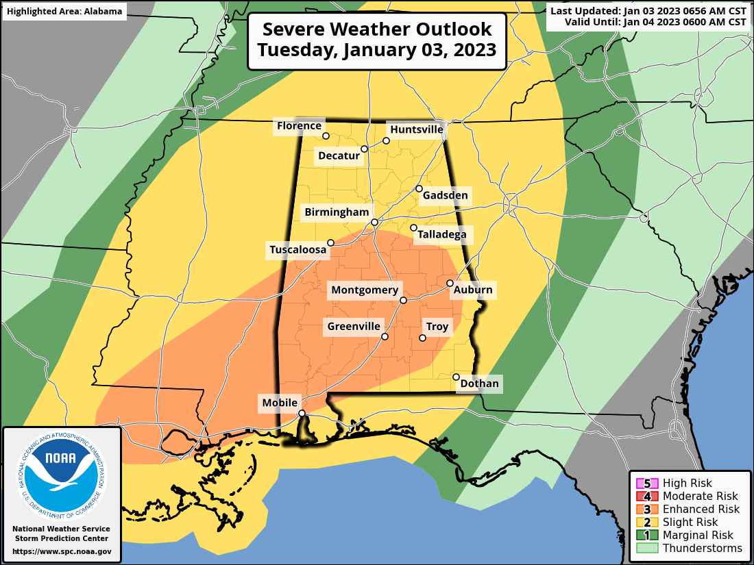
SEVERE WEATHER RISKS: An Enhanced Risk is up for today through 6 am Wednesday for locations along and south of a line from Geiger (Sumter Co.) to Tuscaloosa (Tuscaloosa Co.) to Bessemer (Jefferson Co.) to Wadley (Chambers Co.) to Opelika (Lee Co.). The rest of North/Central Alabama is in a Slight Risk of severe storms.
THREATS & TIMING: Two rounds of severe weather are possible during this event, with the window just opening in the western portions of the area and set to last until 3 am, from 11 am to 5 am Wednesday for the central locations, and from 1 pm today to 7 am Wednesday for the east and southeastern locations. All modes of severe weather will be possible… tornadoes (strong tornadoes of EF2 or greater in Enhanced Risk locations possible), damaging winds up to 70 mph, and hail up to 1 inch in diameter.
Category: Alabama's Weather, ALL POSTS, Severe Weather
About the Author (Author Profile)
Scott Martin is an operational meteorologist, professional graphic artist, musician, husband, and father. Not only is Scott a member of the National Weather Association, but he is also the Central Alabama Chapter of the NWA president. Scott is also the co-founder of Racecast Weather, which provides forecasts for many racing series across the USA. He also supplies forecasts for the BassMaster Elite Series events including the BassMaster Classic.Subscribe
If you enjoyed this article, subscribe to receive more just like it.


