Mesoscale Discussion — New Tornado Watch Likely to the East of Current Watch
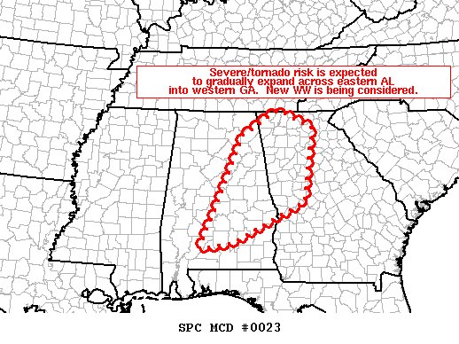
SUMMARY… Tornado risk ongoing at this time across central Alabama is forecast to continue expanding eastward/northeastward. New Tornado Watch issuance will likely be required in the next hour or so.
DISCUSSION… Latest radar loop shows a cluster of small, rotating updrafts shifting northeastward into/across central Alabama, within eastern portions of Tornado Watch 7. The storms are occurring in an amply unstable environment where low-level dewpoints are generally in the upper 60s. While cloud cover continues to inhibit more robust surface heating, CAPE values will continue to weakly increase from southwest to northeast this afternoon.
Meanwhile, kinematically, a favorably sheared environment persists, with gradual veering/increasing of the flow with height yielding both low-level and deep-layer shear supportive of updraft rotation (as evidenced by the aforementioned cluster of supercells in central AL).
As this environment translates eastward with time, expect associated tornado potential to likewise spread east of the current bounds of WW 007, which will require new WW issuance across eastern Alabama and into portions of western Georgia.
Category: Alabama's Weather, ALL POSTS, Severe Weather
About the Author (Author Profile)
Scott Martin is an operational meteorologist, professional graphic artist, musician, husband, and father. Not only is Scott a member of the National Weather Association, but he is also the Central Alabama Chapter of the NWA president. Scott is also the co-founder of Racecast Weather, which provides forecasts for many racing series across the USA. He also supplies forecasts for the BassMaster Elite Series events including the BassMaster Classic.Subscribe
If you enjoyed this article, subscribe to receive more just like it.


