A Quick Look At Our Weather Situation Before 6 pm
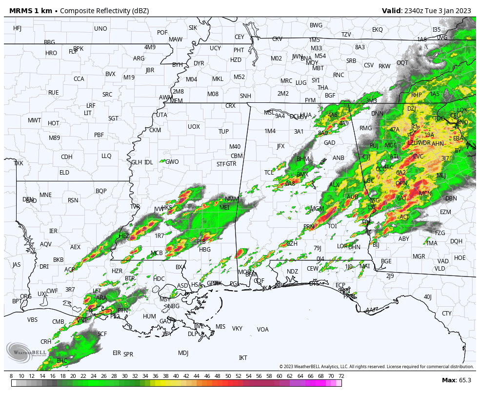
At 5:40 pm, radar continues to show the first round of rain and storms exiting out of the east and southeastern parts of the area, while another wave of storms is forming out to our west in central and southern parts of Mississippi and back into Louisiana. We also have a few scattered cluster of showers and storms over portions of Central Alabama and up into the Tennessee Valley.
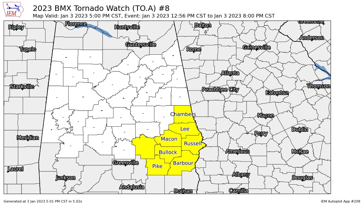
Only a few counties remain in a Tornado Watch in the southeastern portions of Central Alabama (Barbour, Bullock, Chambers, Lee, Macon, Montgomery, Pike, Russell counties) until 8 pm tonight. However, we will be watching to see if another watch (tornado or severe thunderstorm) will be issued tonight, maybe as early as 9-10 pm.
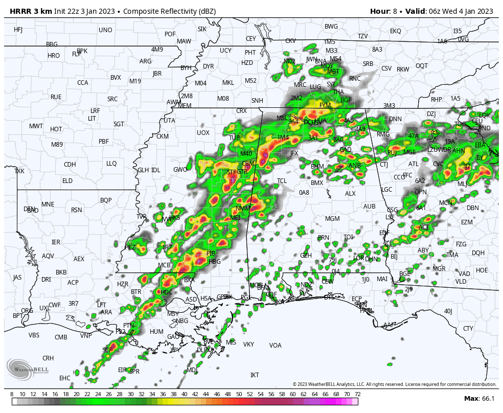
This is the HRRR valid at midnight tonight, and you see that a new line of rain and storms has built up and will be moving into and across the western parts of the area. We are still seeing plenty of instability in place (800-1800 J/kg) at that time, along with shear values in the 40-50 knot range, and helicity values in the 150-350 m2s2 range. This all means that ingredients will be there for the development and livability of stronger to severe storms later tonight. STP values are also elevated, topping out in the 3-6 range. A significant tornado is possible with values of 1 or greater.
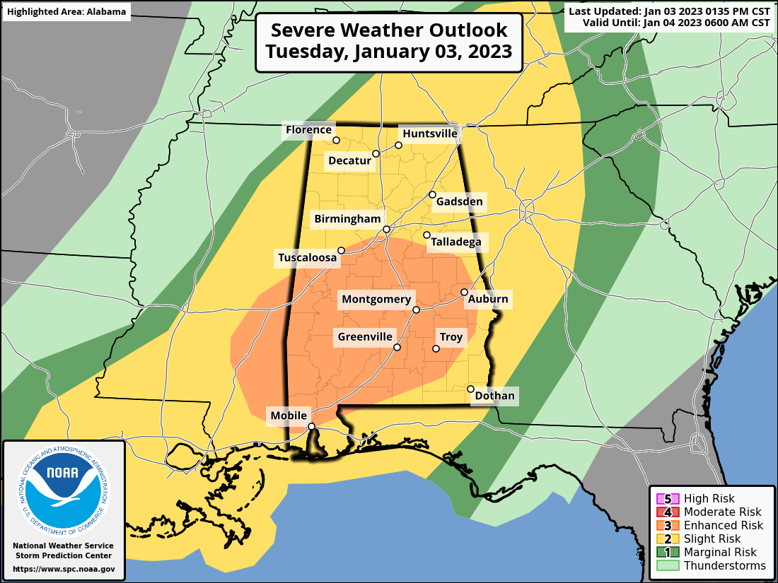
No change in the Day One Severe Wm the SPC, as nearly all the southern half of Central Alabama remains in an Enhanced Risk for severe storms, while the rest of North/Central Alabama remains in a Slight Risk. This graphic goes through 6 am Wednesday morning.
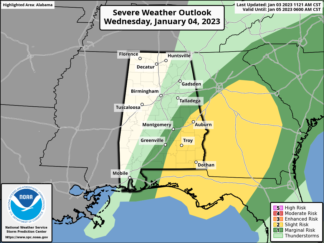
The Day Two Severe Weather Outlook has the southeastern portions of Central Alabama in a Slight Risk for severe storms, while several miles north and west of that, a Marginal Risk is up for those locations. This graphic is valid from 6 am Wednesday to 6 am Thursday, but the threat of severe storms will be out of here by midday on Wednesday.
Category: Alabama's Weather, ALL POSTS, Severe Weather
About the Author (Author Profile)
Scott Martin is an operational meteorologist, professional graphic artist, musician, husband, and father. Not only is Scott a member of the National Weather Association, but he is also the Central Alabama Chapter of the NWA president. Scott is also the co-founder of Racecast Weather, which provides forecasts for many racing series across the USA. He also supplies forecasts for the BassMaster Elite Series events including the BassMaster Classic.Subscribe
If you enjoyed this article, subscribe to receive more just like it.


