Radar Update at 7:35 a.m.: Strong Storms Advancing Across Mississippi, Northwest Alabama
We are off and running this morning with our severe weather situation for Alabama.
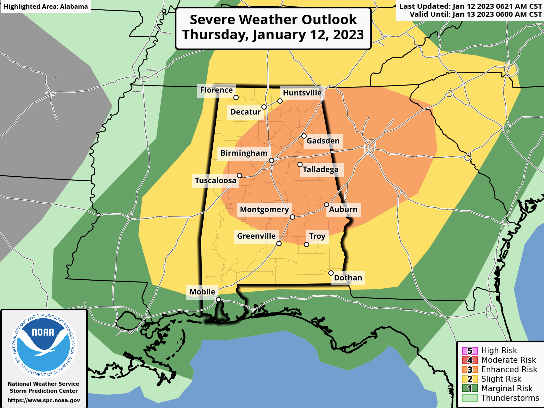
The SPC has much of Alabama in a Slight Risk (level 2 out of 5) for today into this evening and a large chunk of the northeastern and Central portions of the state in an Enhanced Risk (level 3 out of 5) as well.
The Level 2 Threat Zone includes cities like Florence, Huntsville, Hamilton, Fayette, Aliceville, Thomasville, Andalusia, Dothan, and Atmore.
The Level 3 Threat Zone includes Birmingham Fort Payne, Albertville, Cullman, Jasper, Tuscaloosa, Clanton, Anniston, and Gadsden.
A tornado watch has been issued for much of eastern Mississippi and the northwestern half of Alabama through 1 p.m.
Here is the radar jat 7:35 am:
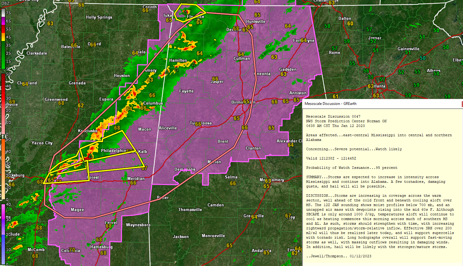
There are 3 Severe Thunderstorm Warnings in central Mississippi in the Philadelphia, Carthage, and Jackson Metro areas. Those storms will begin affecting portions of Pickens and Sumter Counties between 9 and 9:30 this morning.
Damaging winds are the biggest threat today, but the tornado threat has increased. The moving will be moving very fast today, which only adds to the damaging wind threat as well, and gives you less time to react to warnings. The large hail threat is slightly increased as well. We have already seen well-established hail cores on the storms in Mississippi and in Northwest Alabama. Nickle and dime-sized hail partially covering the ground has already been reported near Cherokee in Colbert County.
Category: Alabama's Weather, ALL POSTS, Severe Weather
About the Author (Author Profile)
Bill Murray is the President of The Weather Factory. He is the site's official weather historian and a weekend forecaster. He also anchors the site's severe weather coverage. Bill Murray is the proud holder of National Weather Association Digital Seal #0001 @wxhistorianSubscribe
If you enjoyed this article, subscribe to receive more just like it.


