Clouds Invading the Area at Midday; Staying Dry Through the Weekend
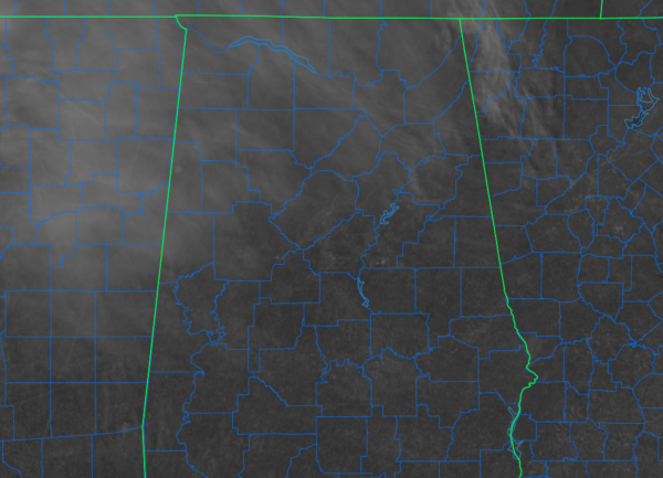
THIS WEEKEND: As of 12:26 pm, if you are located south of the I-59 corridor, you are most likely enjoying mainly sunny skies. But for those along and north of the I-59 corridor, you will notice that some thin cloud cover has started moving over your neck of the woods. Unfortunately, that cloud cover will eventually invade all areas of Central Alabama. At the noon roundup, temperatures were in the upper 40s to the upper 50s across the area. Gadsden and Jasper were tied as the cool spots at 48º. Troy was the warm spot at 59º. Birmingham was at 51º.
For the rest of the daylight hours, those thin clouds will continue to move deeper into Central Alabama, and we’ll end up with mostly cloudy skies by sunset. Highs will top out in the 50s for the most part with a couple locations in the extreme south and southeastern parts potentially reaching the lower 60s. For tonight through the overnight, skies will be mostly cloudy with overnight lows dipping into the lower 30s to the lower 40s.
We’ll have a mix of sun and clouds through much of the day on Sunday, but just before sunset and through the evening hours, those clouds will begin to move out of the area. Afternoon highs will top out in the lower to mid 60s.
SEVERE WEATHER AWARENESS WEEK: Sunday is the first day of the 2023 Severe Weather Awareness Week across Alabama, which is getting started a couple of weeks earlier this year due to the increased severe weather that has occurred earlier in the year over the past couple of years. However, the Alabama Tax Holiday for severe weather supplies has not changed and will take place Feb. 24-26. Please watch for our special post we’ll have each day through the week pertaining to severe weather awareness and safety.
NEXT WEEK: Temperatures will continue to rise on Monday as a ridge will be set up over the southeast. Skies will be sunny with highs in the mid 60s to the lower 70s. A system begins to develop off to our west on Tuesday, and moisture will begin to be pulled up from the Gulf of Mexico. For now, we look to stay dry during the daylight and evening hours, but a stray shower or two may be possible during the overnight. Highs in the upper 60s to the mid 70s.
A surface low develops and will be located over northeastern Arkansas on Wednesday afternoon, which will increase rain and thunderstorm chances during the day, with the heavier activity moving in during the evening and late-night hours. Some weak instability may be located over the area, and with decent shear in place, we may see a few strong storms. Highs in the upper 60s to the upper 70s. The system will continue to move through and eventually out of the area by late Thursday afternoon, which will keep rain and some thunder likely for the eastern half of the area, while chances diminish for the western half. Highs in the upper 60s to the mid 70s.
And at the end of the forecast period on Friday… A very deep trough will be moving in our direction that will bring a clipper-type system into the area late in the day. Showers will be possible mainly for the northern two-thirds of the area while much colder air begins to move in. Daytime highs will likely occur in the morning, reaching the lower 60s to the lower 70s, but dropping into the upper 30s to the mid 60s from northwest to southeast by mid-afternoon. Moisture will move out late, but a few flurries may be possible over the Tennessee Valley after dark. No travel issues are expected at this time.
The GFS has been consistent with the idea of the Friday clipper system over the last several runs, along with the European model. Could we see temperatures drop far enough that some snow showers may become possible earlier than sunset? We’ll get a better idea as we get closer, but both models have come into a little better agreement on placement and precipitation type. We’ll just have to wait and see at this point.
Category: Alabama's Weather, ALL POSTS, Winter Weather


