Tornado Watch Issued Just Off to Our West in Mississippi; A Quick Radar Check
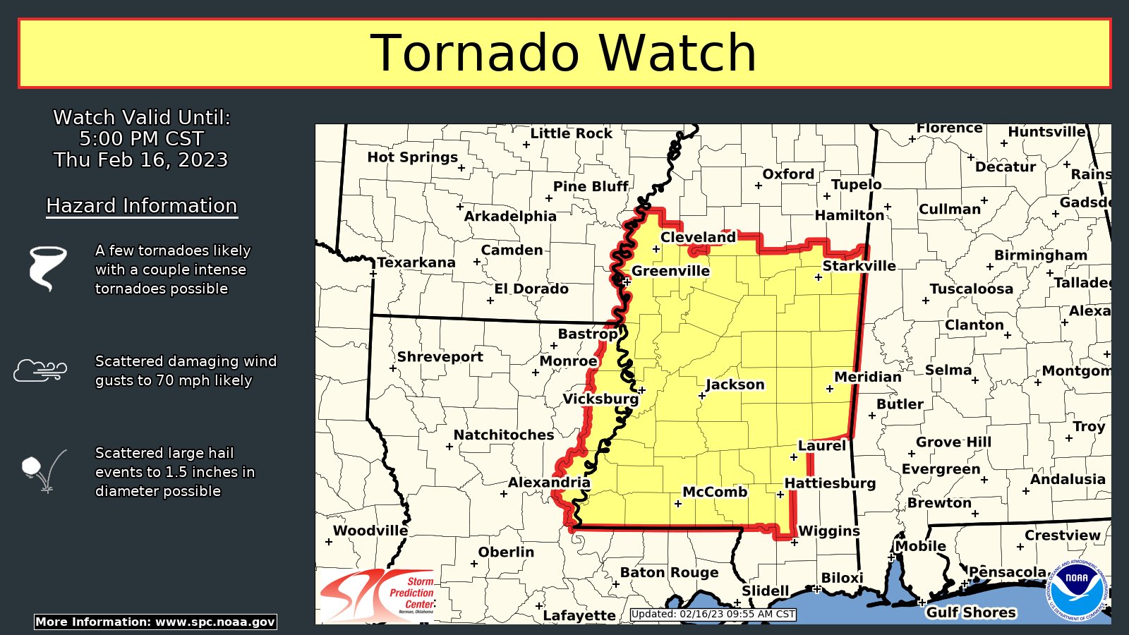
While the weather is calm across Central Alabama at the 10 am hour, the Storm Prediction Center has issued a Tornado Watch for much of Mississippi and for a small chunk of Louisiana until 5 pm this evening. Here is the text of the watch from the SPC…
The NWS Storm Prediction Center has issued a
* Tornado Watch for portions of
Extreme northeast Louisiana
Central and southern Mississippi
* Effective this Thursday morning and afternoon from 955 AM until 500 PM CST.
* Primary threats include…
A few tornadoes likely with a couple intense tornadoes possible
Scattered damaging wind gusts to 70 mph likely
Scattered large hail events to 1.5 inches in diameter possible
SUMMARY… Scattered supercells are expected to spread northeastward into central Mississippi through the afternoon, with the threat for a strong tornado or two, damaging gusts of 60-70 mph, and isolated large hail up to 1.5 inches in diameter.
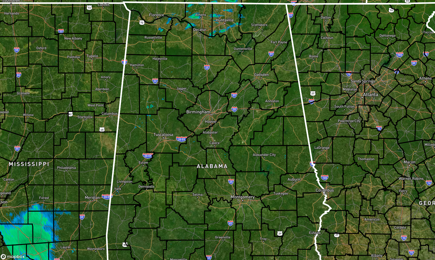
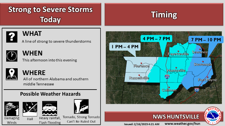
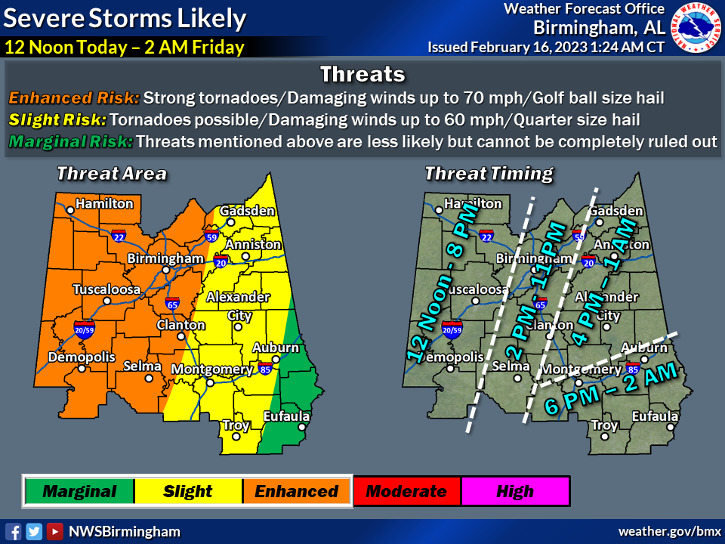
For now, radar is calm across much of the area, except for a few scattered light showers north of the Tennessee River in North Alabama. Skies across the area are partly to mostly cloudy, and temperatures as of 10 am were in the upper 60s to the mid 70s already. Below are the timing graphics for both the Tennessee Valley and Central Alabama…
Stay weather aware today! Be ready to act if your location goes under a warning.
Category: Alabama's Weather, ALL POSTS, Severe Weather
About the Author (Author Profile)
Scott Martin is an operational meteorologist, professional graphic artist, musician, husband, and father. Not only is Scott a member of the National Weather Association, but he is also the Central Alabama Chapter of the NWA president. Scott is also the co-founder of Racecast Weather, which provides forecasts for many racing series across the USA. He also supplies forecasts for the BassMaster Elite Series events including the BassMaster Classic.Subscribe
If you enjoyed this article, subscribe to receive more just like it.


