Early Evening Look at Our Weather Situation
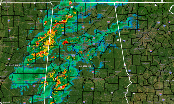
RADAR CHECK 4:52 PM — At this point, rain and thunderstorms continue to move farther into Central Alabama from Mississippi. The air has actually become more stable, as the earlier rain and storms that moved in over the southwestern portions of the area actually cutoff the flow from the south.
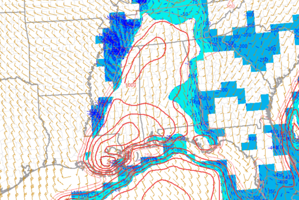
Instability values have dropped to 1,000 J/kg or less across much of Central Alabama, while the northwestern parts of the area still have readings over 1,000 J/kg. Significant Tornado Parameter values are down to 1.0 for a good part of the area, with the higher number being located over the southwestern parts of the state and back into Southern Mississippi and the far eastern parts of Louisiana.
For now, it looks like our severe threat is dropping, but the night is not over with yet. I can’t rule out some gusty winds and a brief tornado along and ahead of these storms, but they will be moving into more stable air in the eastern half of the state. We’ll stay with you through the night.
Category: Alabama's Weather, ALL POSTS, Severe Weather


