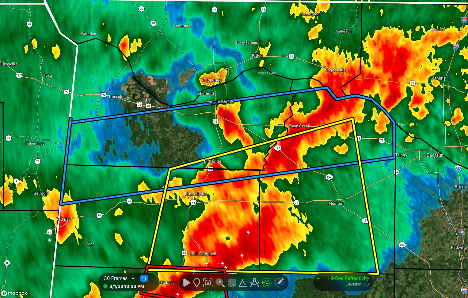
Flash Flood Warning — Parts of Colbert, Franklin, Lawrence Co. Until 1:30 am
The National Weather Service in Huntsville has issued a
* Flash Flood Warning for…
Colbert County in northwestern Alabama…
Northern Franklin AL County in northwestern Alabama…
Northern Lawrence County in northwestern Alabama…
* Until 130 AM CST.
* At 1031 PM CST, Doppler radar indicated thunderstorms producing
heavy rain across the warned area. Between 1 and 3 inches of rain
have fallen. The expected rainfall rate is 0.25 to 1 inch in 1
hour. Additional rainfall amounts of 1 to 2 inches are possible in
the warned area. Flash flooding is ongoing or expected to begin
shortly.
HAZARD…Flash flooding caused by thunderstorms.
SOURCE…Radar.
IMPACT…Flash flooding of small creeks and streams, urban
areas, highways, streets and underpasses as well as
other poor drainage and low-lying areas.
* Some locations that will experience flash flooding include…
Muscle Shoals, Russellville, Sheffield, Tuscumbia, Town Creek,
Littleville, Leighton, Courtland, North Courtland, Hillsboro,
Colbert Heights, La Grange, Northwest Alabama Regional Airport,
Whiteoak, New Bethel, Crooked Oak, Posey Loop, Ne Smith, Red Rock
and Srygley Church.
PRECAUTIONARY/PREPAREDNESS ACTIONS…
Be especially cautious at night when it is harder to recognize the
dangers of flooding.
Category: Alabama's Weather, ALL POSTS, Severe Weather
About the Author (Author Profile)
Scott Martin is an operational meteorologist, professional graphic artist, musician, husband, and father. Not only is Scott a member of the National Weather Association, but he is also the Central Alabama Chapter of the NWA president. Scott is also the co-founder of Racecast Weather, which provides forecasts for many racing series across the USA. He also supplies forecasts for the BassMaster Elite Series events including the BassMaster Classic.Subscribe
If you enjoyed this article, subscribe to receive more just like it.


