Late Thursday Evening Look at Friday’s Severe Weather Threat
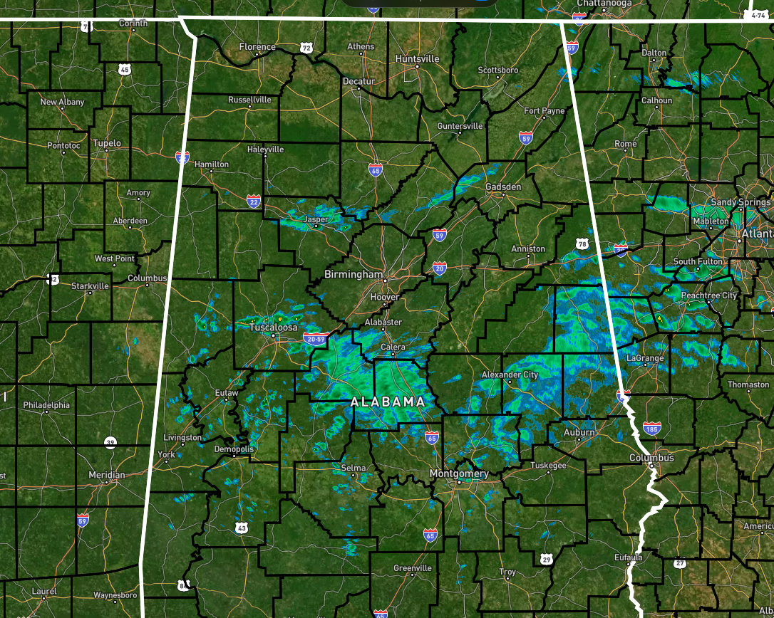
As of 9:30 pm, we have some scattered light showers out there across the central and south-central parts of Central Alabama, mainly in-between the I-59/20 and I-85 corridors. A few light showers are also over the northern parts of Walker County and over portions of northern Blount and Etowah counties. For now, the stronger to severe storms are in the eastern portions of Texas and about to cross over into Arkansas and Louisiana.
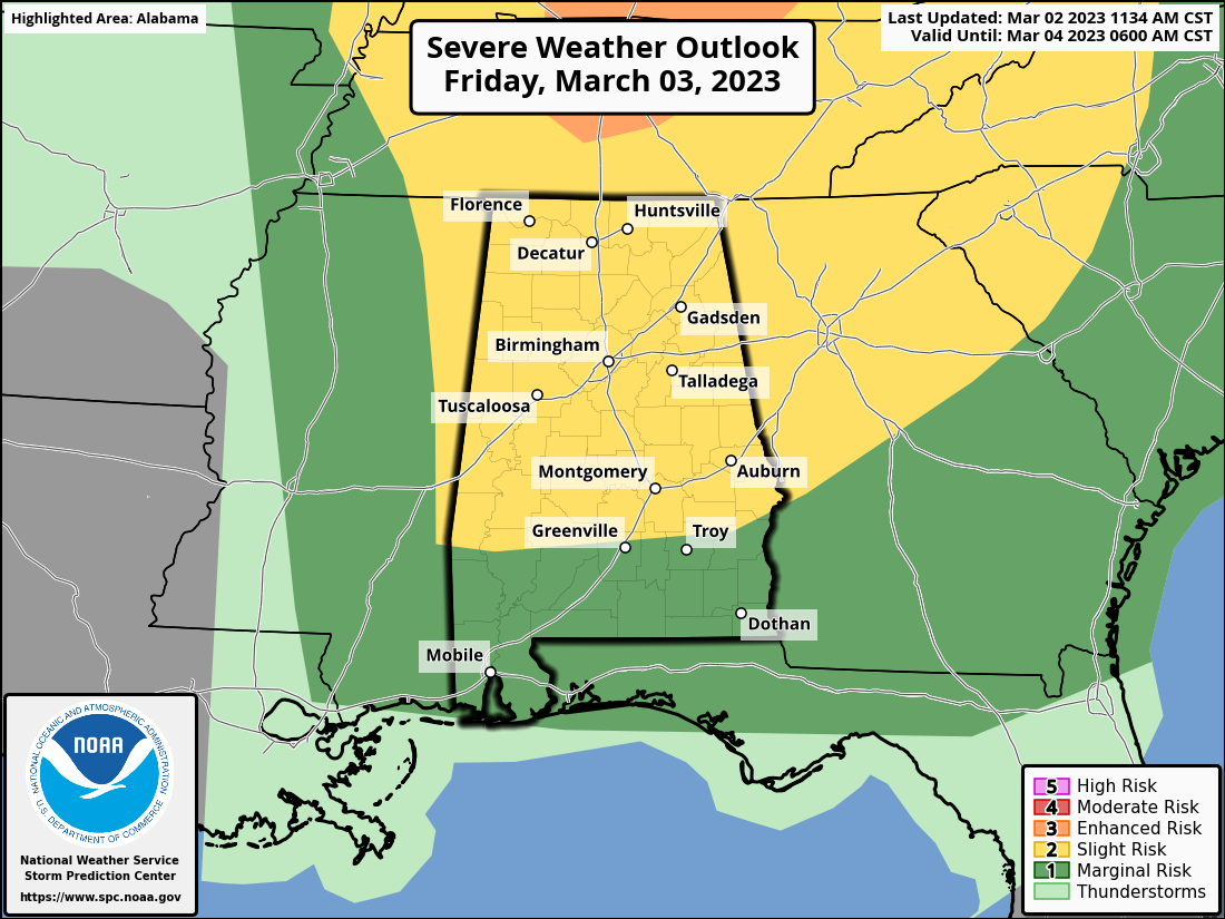
SPC continues a Slight Risk for all of North/Central Alabama on Friday along and north of a line from Thomasville to Greenville to just north of Eufaula. South of that, a Slight Risk for severe storms is up. The main window for the threat of severe storms will be from roughly 6 am to 2 pm across the area from west to east. Here is the timing broke down into sections…
• 6 am – 10 am… along and west of a line from Addison to Cottondale to Sweet Water
• 8 am – 12 pm… east to a line from Cedar Bluff to Goodwater to Fort Deposit
• 10 am – 2 pm… east to the Alabama/Georgia state line
The main threats will be from damaging wind gusts up to 60 mph and a few tornadoes. We’ll also have a threat of strong winds outside the thunderstorm activity. A High Wind Warning goes into effect at 6am Friday for the Tennessee Valley counties, as wind gusts up to 60 mph are expected. A Wind Advisory starts tonight for the Central Alabama counties as wind gusts up to 50 mph are expected.
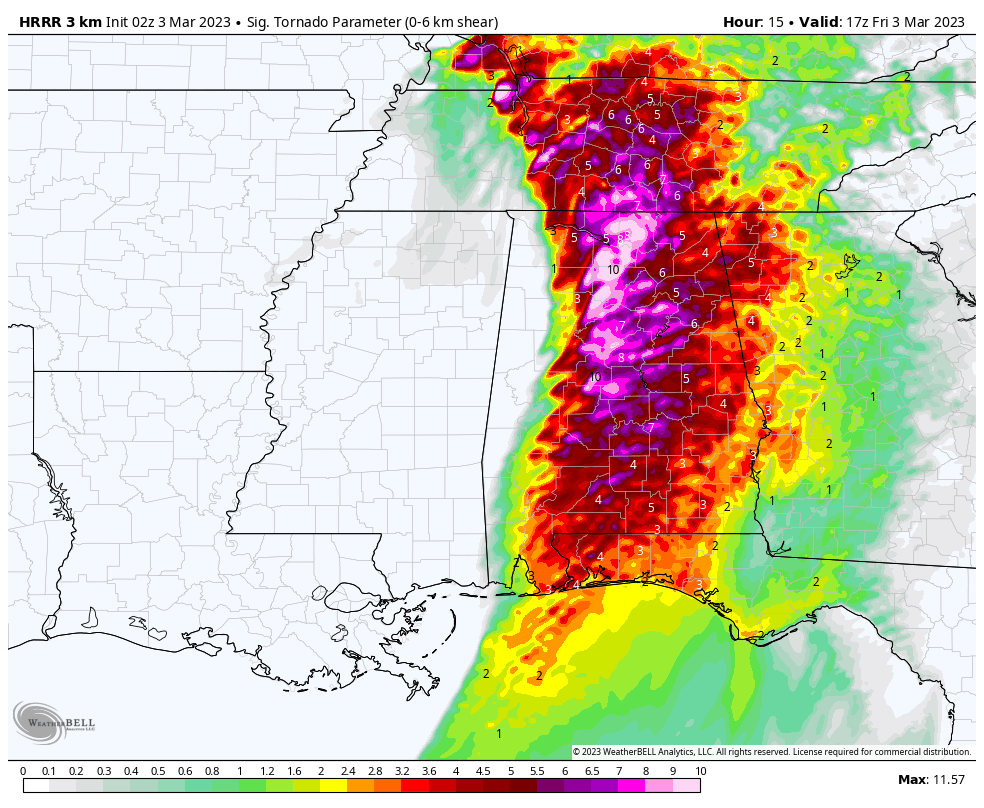
The activity will start off weaker as it enters the state in the morning, but as the daytime heating builds, so will the instability values. The latest run of the HRRR shows STP values reaching as high as 10 in the southern parts of the Tennessee Valley and in the northern parts of Central Alabama around 11 am. Instability values will be higher for this time of the year, ranging from 900-1,300 J/kg. There will be plenty of shear & helicity in place, so if any storms that can survive not being torn apart by the higher winds, rotating updrafts and tornadoes will be possible.
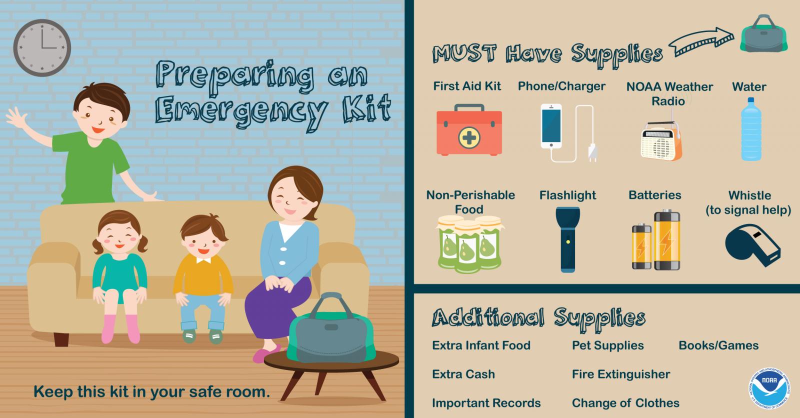
We always talk about having an emergency kit with you in your safe place when severe weather threatens your area. It’s simple… Gather items, place in a bag, leave in your chosen safe place or where it is easily accessible. That’s it! Make sure your kit fits your needs.
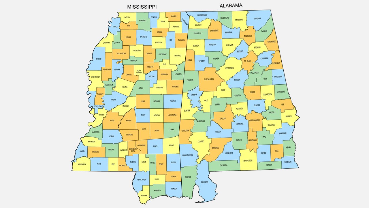
Not knowing where you are on a map is not being fully prepared. Print and save this useful Alabama/Mississippi county map. Use it to be able to determine your risk & take action if needed during this and future severe weather threats.
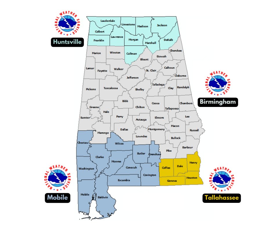
Also, remember which NWS office covers your county. All the Tennessee Valley counties are covered by NWS Huntsville. All the Central Alabama counties are covered by NWS Birmingham. South and southwest Alabama is covered by NWS Mobile, and southeast Alabama is covered by NWS Tallahassee.
Category: Alabama's Weather, ALL POSTS, Severe Weather
About the Author (Author Profile)
Scott Martin is an operational meteorologist, professional graphic artist, musician, husband, and father. Not only is Scott a member of the National Weather Association, but he is also the Central Alabama Chapter of the NWA president. Scott is also the co-founder of Racecast Weather, which provides forecasts for many racing series across the USA. He also supplies forecasts for the BassMaster Elite Series events including the BassMaster Classic.Subscribe
If you enjoyed this article, subscribe to receive more just like it.


