Severe Thunderstorm Warning for Portions of Tuscaloosa County Until Noon
This warning includes Tuscaloosa, Northport, and the University of Alabama.
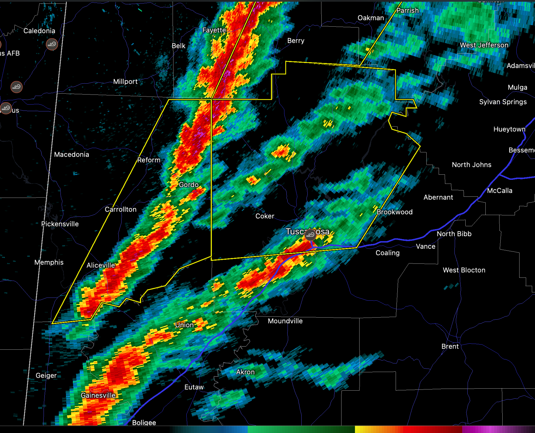
I am a little concerned about the strong storms that have been able to break out just ahead of the main squall line. If this capping inversion breaks over North and Central Alabama, we could have some really big tornadoes in addition to the widespread damaging wind reports we are getting now.
The National Weather Service in Birmingham has issued a
* Severe Thunderstorm Warning for…
Tuscaloosa County in west central Alabama…
* Until noon CST.
* At 1051 AM CST, severe thunderstorms were located along a line
extending from near Bankston to near Gordo, moving northeast at 60
mph.
HAZARD…60 mph wind gusts.
SOURCE…Radar indicated.
IMPACT…Expect damage to roofs, siding, and trees.
* Locations impacted include…
Tuscaloosa, Northport, Holt, Coker, Samantha, McFarland Mall, Lake
Lurleen State Park, Tuscaloosa Amphitheater, Bryant Denny Stadium,
Tuscaloosa Regional Airport, University Mall, Deerlick Creek
Campgrounds, Bankhead Lock And Dam, Binion Creek Landing, Bull
City, Whitson, Lake Tuscaloosa, Moores Bridge, Cottondale and
Windham Springs.
Category: Alabama's Weather, ALL POSTS, Severe Weather
About the Author (Author Profile)
Bill Murray is the President of The Weather Factory. He is the site's official weather historian and a weekend forecaster. He also anchors the site's severe weather coverage. Bill Murray is the proud holder of National Weather Association Digital Seal #0001 @wxhistorianSubscribe
If you enjoyed this article, subscribe to receive more just like it.


