Alabama Update at 115 p.m. Warnings Continue…A Fatality Reported
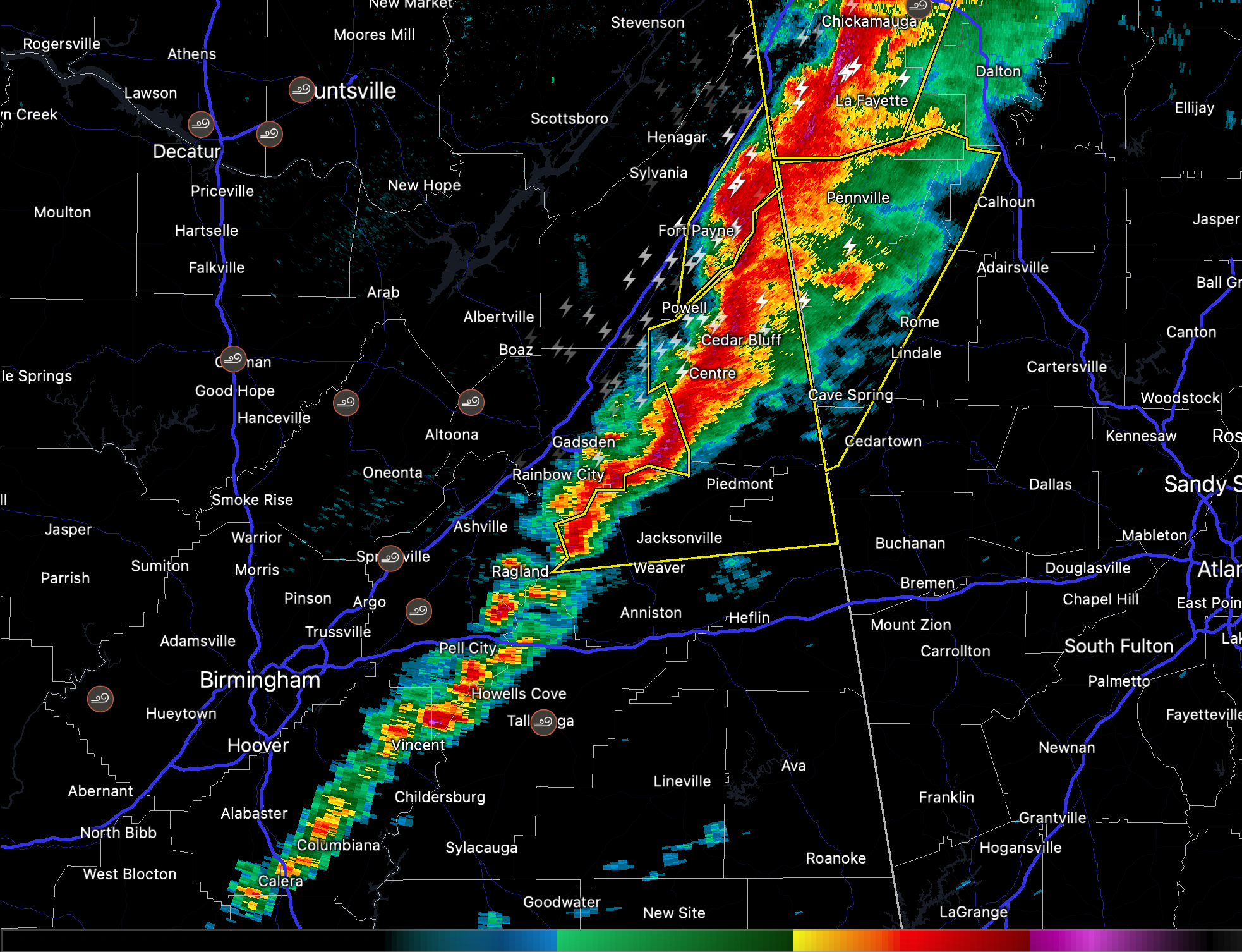
Our intense line of thunderstorms extends from Fort Payne to east of Gadsden to west of Ragland. The line becomes more broken south of I-20.
Things clear out quickly behind the line of storms, more like an Oklahoma dryline than what we are used to in Alabama.
Blount and Jefferson were just cleared from the tornado watch. Calhoun, Cherokee, Clay, Cleburne, Etowah, Randolph, Shelby, St. Clair, and Talladega continue under the tornado watch until 4 p.m.
Severe Thunderstorm Warnings continue ahead of the line of storms from Ohatchee, Jacksonville, and Piedmont northward in front of the storms to Centre, Cedar Bluff, and Gaylesville.
There have been dozens of wind damage reports across North and Central Alabama today, both from thunderstorms and from gradient winds. Unfortunately, there was one fatality in Talladega when a tree fell on a car.
Winds will slowly subside behind the line, but wind gusts will continue to reach 35-45 mph for several hours.
Category: Alabama's Weather, ALL POSTS, Severe Weather
About the Author (Author Profile)
Bill Murray is the President of The Weather Factory. He is the site's official weather historian and a weekend forecaster. He also anchors the site's severe weather coverage. Bill Murray is the proud holder of National Weather Association Digital Seal #0001 @wxhistorianSubscribe
If you enjoyed this article, subscribe to receive more just like it.


