Showers and Storms Pushing Southeastward Across Alabama
Showers and storms continue pushing southeastward across the state this morning ahead of a cold front.
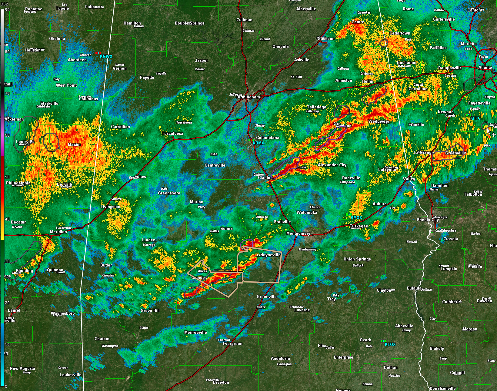
The strongest storms are over South Central Alabama from Benton along US-80 between Selma and Lowndesboro southwestward through Lowndes, Dallas, and Wilcox counties, from Minter and Snow Hill to north of Vredenburgh. These storms could have winds of 30-40 mph.
Elsewhere, heavy thunderstorms continue from southern Cleburne across Clay and into Coosa counties. Heavy rain, gusty winds, and occasional thunder are accompanying these storms.
0.77 inches of rain at the Birmingham Airport. I picked up 0.71 inches just off I-459 and Acton Road.
Waiting for the new 13z SPC Severe Weather Outlook. Will have it when published. The severe threat is over for areas behind the line of storms, namely from south of Heflin to Clanton to Linden.
Category: Alabama's Weather, ALL POSTS, Severe Weather
About the Author (Author Profile)
Bill Murray is the President of The Weather Factory. He is the site's official weather historian and a weekend forecaster. He also anchors the site's severe weather coverage. Bill Murray is the proud holder of National Weather Association Digital Seal #0001 @wxhistorianSubscribe
If you enjoyed this article, subscribe to receive more just like it.


