

Midday Nowcast: Sun Today, Storms Tomorrow
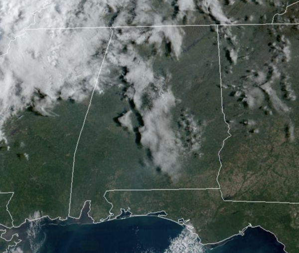
Today is a much warmer day for the state, as highs surge into the upper 60s and lower 70s with strong southerly flow returning. Tonight, clouds return ahead of a cold front that will bring rain and storms to Alabama tomorrow. It will be a strong cold front, and as it moves into and through the state, rain and storms will be widespread across the state. Some strong to severe storms are possible, mainly across southern portions of the state, where the SPC maintains the “slight risk” (level 2/5) of severe thunderstorms for the places like Mobile, Gulf Shores, Grove Hill, Evergreen, Opp, and Dothan. A “marginal risk” (level 1/5) extends as far north as Moundville, Calera, and Wedowee.
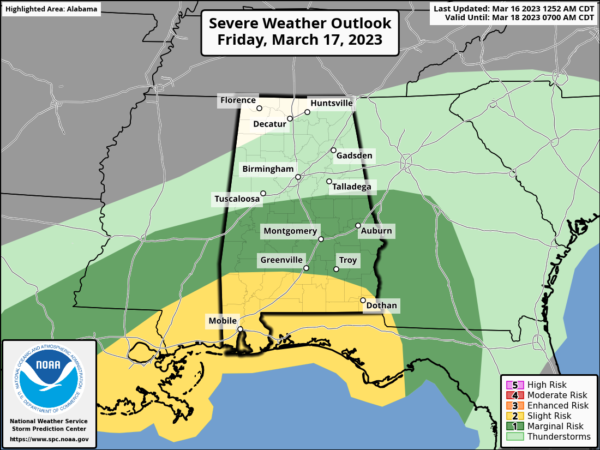
The main threat area is across far South Alabama and the Florida Panhandle, as the air will be a bit more unstable. The main concern will come from strong, gusty winds, but an isolated tornado can’t ruled out. For North Alabama, severe storms are not expected and tomorrow will be a day of falling rain and falling temperatures, as cold air rushes in behind the front. We start the day in the low 60s, but fall through the 50s and into the 40s by mid to late afternoon. Add in a brisk north wind, and it will be feeling much colder. Rain amounts will be around one inch tomorrow, with isolated heavier amounts.
COLDER WEEKEND: It will be a cold late season weekend across the Deep South. Temperatures will be in the low to mid 30s early Saturday with a brisk north wind. The sky will become sunny Saturday with a high in the 50s. Clear weather is the story Sunday with another late season freeze during the early morning hours…lows will dip into the 22-32 degree range. The high Sunday will be in the 50s, but we note, portions of North Alabama will likely see highs in the remain in the 40s both days this weekend.
NEXT WEEK: Another freeze is likely for North/Central Alabama early Monday with lows in the 20s, but the day will be mainly sunny with highs closer to 60°. Also, Spring officially arrives Monday afternoon at 4:24 PM CDT. We are removing the rain from the forecast Tuesday and Wednesday, as the Gulf low looks to be much farther south and east, where it will have little impacts on Alabama. We are going with dry weather Tuesday through Thursday with moderating temperatures, 60s Tuesday, become 70s by Thursday. Another cold front looks to arrive next Friday with more rain and some storms. Way too early to know if severe storms will be a factor.
BEACH FORECAST CENTER: Get the latest weather and rip current forecasts for the beaches from Fort Morgan to Panama City on our Beach Forecast Center page. There, you can select the forecast of the region that you are interested in visiting.
WORLD TEMPERATURE EXTREMES: Over the last 24 hours, the highest observation outside the U.S. was 113.0F at Akjiujt, Mauritania. The lowest observation was -70.1F at Vostok, Antarctica.
CONTIGUOUS TEMPERATURE EXTREMES: Over the last 24 hours, the highest observation was 93F at Rio Grande Village, TX. The lowest observation was -17F at Mackay, ID.
Category: Alabama's Weather, ALL POSTS
About the Author (Author Profile)
Macon, Georgia Television Chief Meteorologist, Birmingham native, and long time Contributor on AlabamaWX. Stormchaser. I did not choose Weather, it chose Me. College Football Fanatic. @Ryan_StinnetSubscribe
If you enjoyed this article, subscribe to receive more just like it.


