The Midday Report — First Day of Spring & Still Feels Like Winter
WHAT’S OUR WEATHER LIKE AT MIDDAY
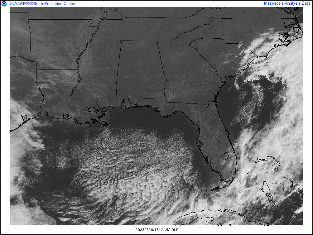
We have sunny skies across North and Central Alabama as we are making our way into the midday hour on this first day of Spring. However, these temperatures are giving us one last shot of Old Man Winter, as we are only in the upper 30s to the upper 40s as of 11 am. We’ll eventually make it up into the mid to upper 50s across the area underneath sunny skies, but Winter will try to sneak back in tonight, as overnight lows will be in the upper 20s to the mid 30s.
FREEZE WARNINGS & FROST ADVISORY IN EFFECT FOR THE OVERNIGHT
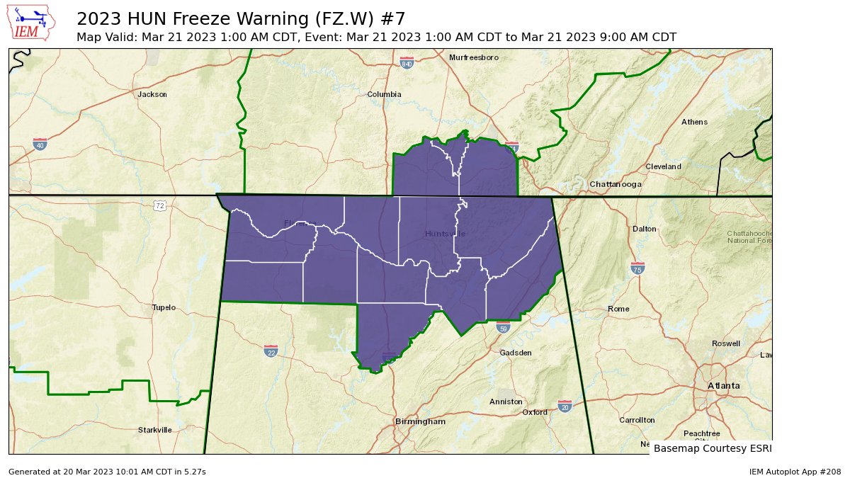
NWS Huntsville has upgraded the Freeze Watch to a FREEZE WARNING for all 11 counties in the Tennessee Valley of North Alabama (Colbert, Cullman, DeKalb, Franklin, Jackson, Lauderdale, Lawrence, Limestone, Madison, Marshall, and Morgan). It is set to run from 1 am to 9 am Tuesday morning.
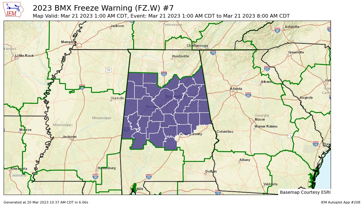
NWS Birmingham has upgraded the Freeze Watch to a FREEZE WARNING for the following counties in Central Alabama: Autauga, Bibb, Blount, Calhoun, Chambers, Cherokee, Chilton, Clay, Cleburne, Coosa, Dallas, Elmore, Etowah, Fayette, Greene, Hale, Jefferson, Lamar, Lowndes, Marengo, Marion, Perry, Pickens, Randolph, Shelby, St. Clair, Sumter, Talladega, Tallapoosa, Tuscaloosa, Walker, and Winston. It is set to run from 1 am to 8 am Tuesday morning.
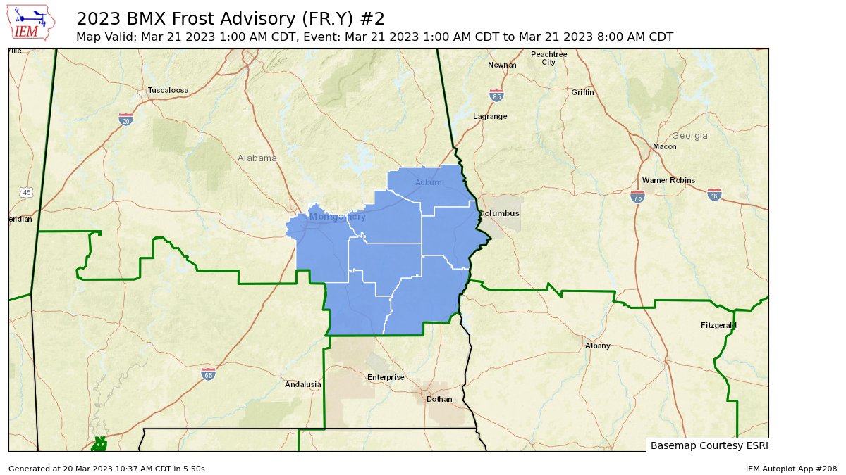
NWS Birmingham has issued a FROST ADVISORY for the following counties in Central Alabama: Barbour, Bullock, Lee, Macon, Montgomery, Pike, and Russell. It is set to run from 1 am to 8 am Tuesday morning.
THE MIDDLE OF THE WORK WEEK
A big warming trend will be the main story as we make our way through Tuesday, Wednesday, and Thursday. We’ll have partly to mostly sunny skies tomorrow, with highs in the 60s. We go warmer on Wednesday, with mostly sunny skies and highs in the 70s. And break out the shorts on Thursday as highs will reach the lower to mid 80s across the area with mainly sunny skies.
STRONG TO SEVERE STORMS POSSIBLE FOR PARTS OF THE AREA ON FRIDAY
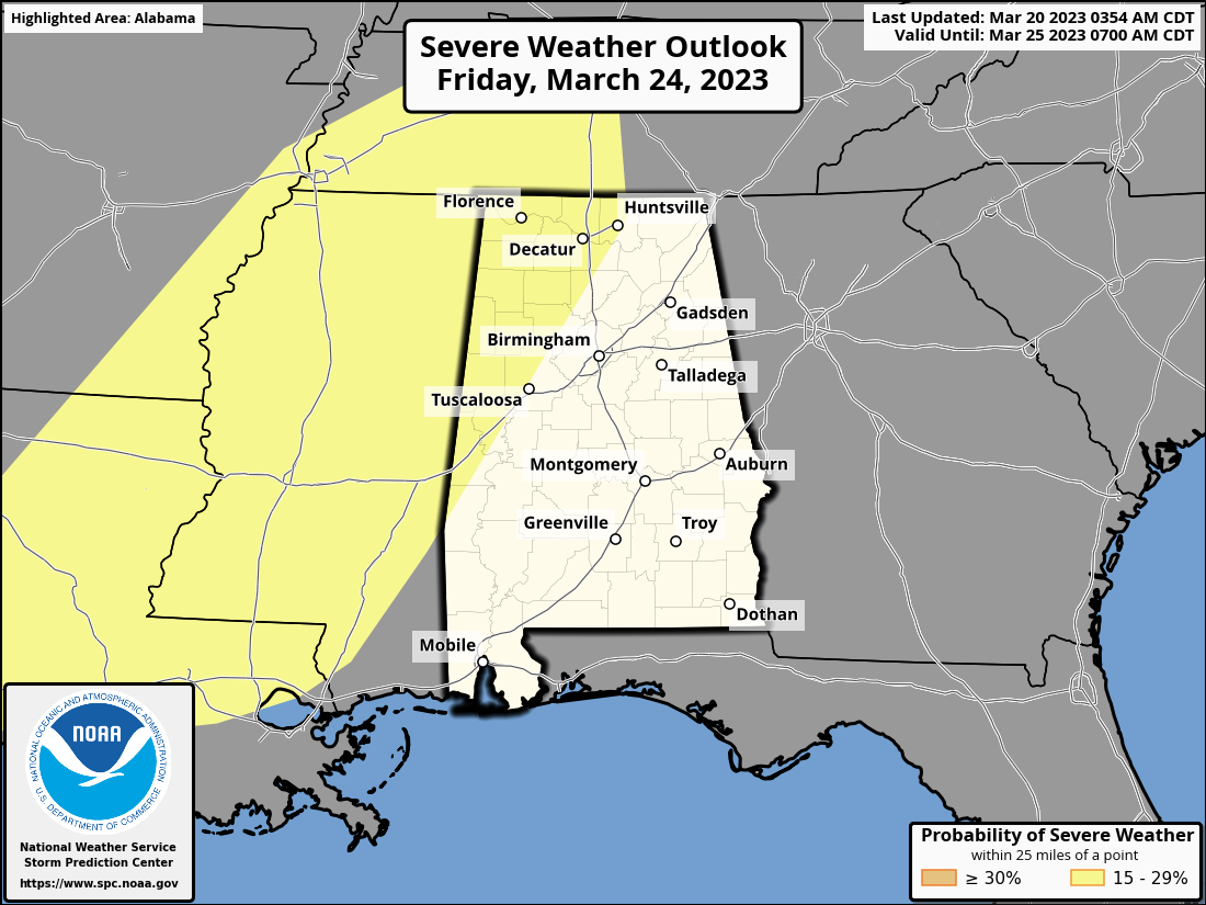
The good news from when I did the email forecast late last night is that the Storm Prediction Center has reduced the Slight Risk for severe storms over North and Central Alabama to only include locations along and west of a line from Tuscaloosa to Cullman to Huntsville. For now, there is no threat of severe storms on Saturday.
Much of your Friday will be warm and dry, but a cold front approaching the area will bring an increase of clouds through the latter half of the day. Right now, the threat of severe storms looks to be from 6 pm Friday night until 6 am Saturday morning, with the main threat coming from damaging winds. However, a brief tornado or two cannot be ruled out. We’ll get a better idea of magnitude and timing later this week when the high-resolution models come into play. Friday’s highs will be in the lower to mid 80s.
THE WEEKEND AHEAD
It will be one of the nicer weekends we have had in a while in Central Alabama, once the rain moves out on Saturday morning. Skies will clear out and highs will be in the 70s. Sunday will be a touch warmer, with sunny skies and highs in the mid 70s to the lower 80s.
Category: Alabama's Weather, ALL POSTS, Severe Weather, Winter Weather
About the Author (Author Profile)
Scott Martin is an operational meteorologist, professional graphic artist, musician, husband, and father. Not only is Scott a member of the National Weather Association, but he is also the Central Alabama Chapter of the NWA president. Scott is also the co-founder of Racecast Weather, which provides forecasts for many racing series across the USA. He also supplies forecasts for the BassMaster Elite Series events including the BassMaster Classic.Subscribe
If you enjoyed this article, subscribe to receive more just like it.


