New Tornado Watch to our West
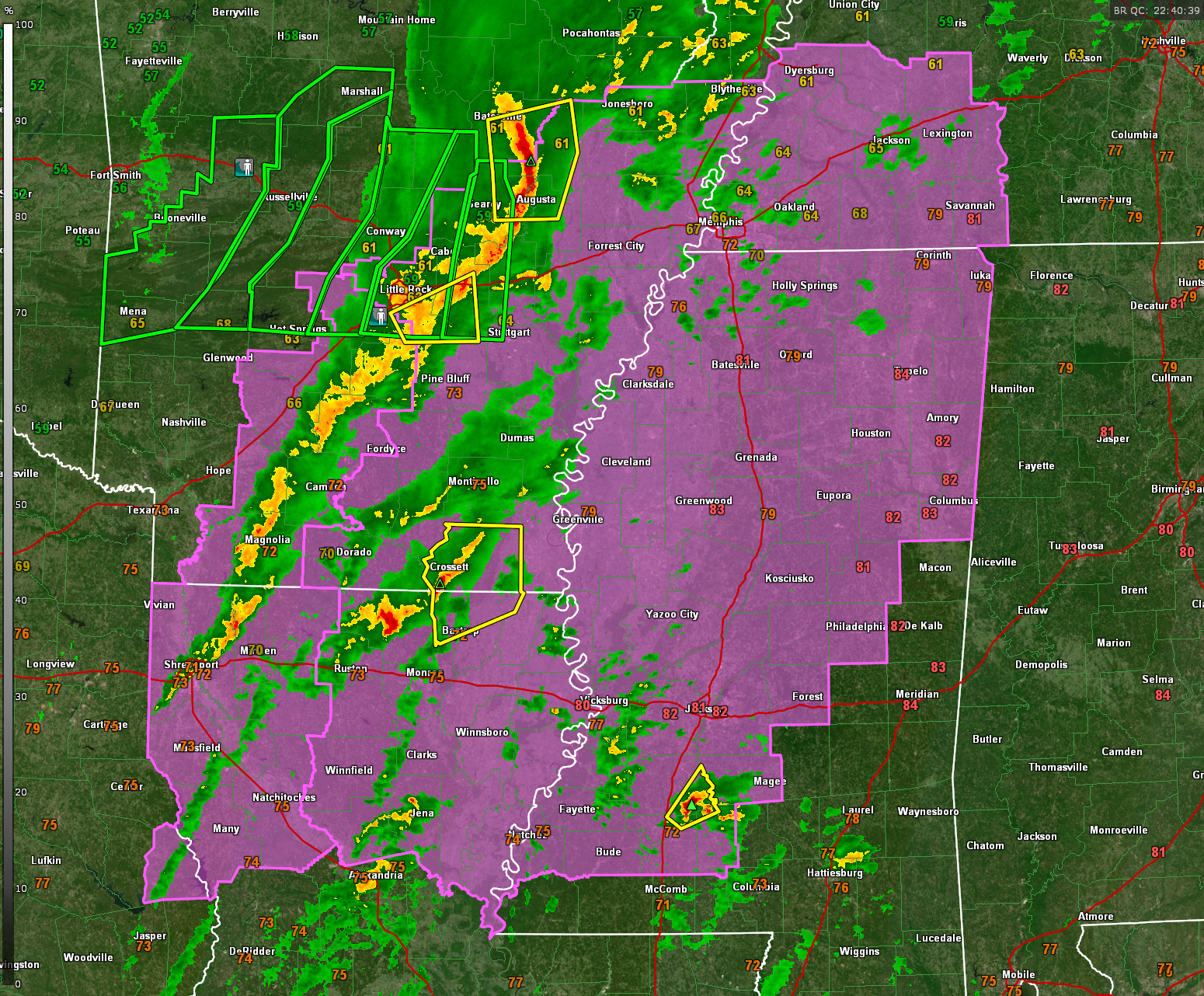
A new tornado watch has been issued that will be in effect until midnight tonight for eastern Arkansas, northeastern Louisiana, and much of Mississippi. The watch comes right up to the border with Alabama’s northwestern counties.
Strong storms have developed ahead of the main line over southern Arkansas and northern Louisiana, north of Ruston and Monroe. Severe thunderstorm warnings have been issued.
A severe storm is over South Central Mississippi northeast of Brookhaven.
These storms that are out in front of the main line cause us extra concern and they will be watched closely. Instabilities are increasing over this region and there is plenty of speed shear. The best low level directional shear over southern Arkansas, but that will change with time as we go through the night. Right now the best combination of instability and shear is over southern Arkansas and northern Louisiana. This will shift into the Mississippi Delta Counties this evening.
The main line extends from near Batesville AR to Little Rock to near Shreveport. IT will have a high probability of damaging winds with it along with large hail and heavy rain.
Wind advisores are also in effect in areas outside thunderstorms where normal gradient winds could gust to 45 mph overnight.
Category: Alabama's Weather, ALL POSTS, Severe Weather
About the Author (Author Profile)
Bill Murray is the President of The Weather Factory. He is the site's official weather historian and a weekend forecaster. He also anchors the site's severe weather coverage. Bill Murray is the proud holder of National Weather Association Digital Seal #0001 @wxhistorianSubscribe
If you enjoyed this article, subscribe to receive more just like it.


