SPC Indicates Sharkey/Humphreys Tornado is at Least EF3
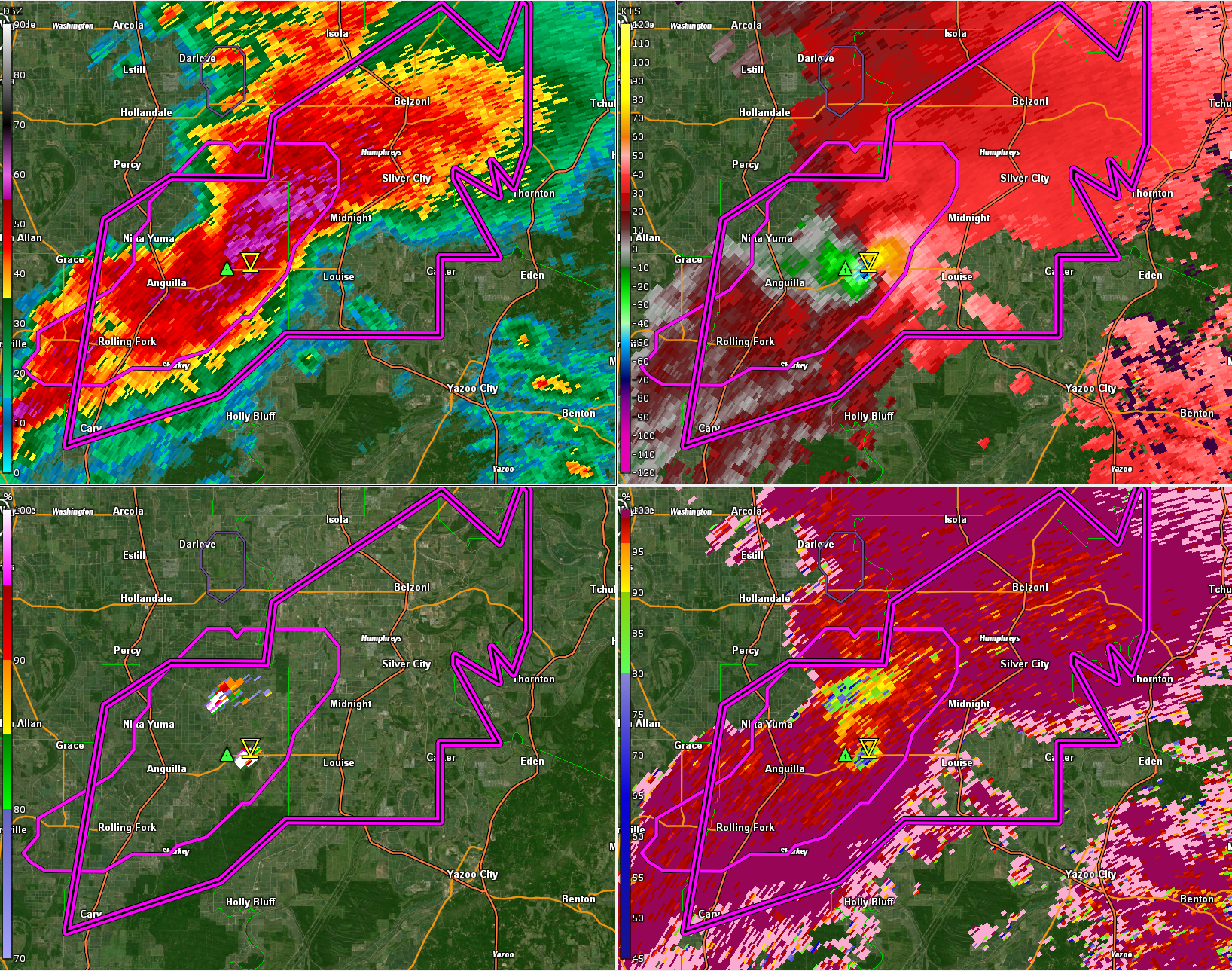
The tornado is on the ground east of Anguilla. The tornado passed directly over Rolling Fork.
The storm is moving toward Midnight, Silver City, and Belzoni.
If you have friends in the Mississippi Delta, make sure they are aware.
Mesoscale Discussion 0329
NWS Storm Prediction Center Norman OK
0813 PM CDT Fri Mar 24 2023
Areas affected…North-central MS
Concerning…Tornado Watch 76…
Valid 250113Z – 250215Z
The severe weather threat for Tornado Watch 76 continues.
SUMMARY…An intense tornado (EF3+) is likely ongoing with a
supercell tracking northeastward across western Sharkley County MS,
and this storm should persist for the next 30-60 min.
DISCUSSION…Latest radar data shows an organized cyclonic supercell
tracking northeastward across western Sharkley County MS, with a
VROT above 70 kt and well-defined TDS up to 13k ft — indicative of
an intense tornado (EF3+) given the parameter space (STP of 4). The
downstream environment features a large, clockwise-curved hodograph
per DGX VWP (around 430 m2/s2 0-1 km SRH) amid rich boundary-layer
moisture. This will support the maintenance of this intense
supercell toward the northeast for the next 30-60 min.
..Weinman.. 03/25/2023
Category: Alabama's Weather, ALL POSTS, Severe Weather
About the Author (Author Profile)
Bill Murray is the President of The Weather Factory. He is the site's official weather historian and a weekend forecaster. He also anchors the site's severe weather coverage. Bill Murray is the proud holder of National Weather Association Digital Seal #0001 @wxhistorianSubscribe
If you enjoyed this article, subscribe to receive more just like it.


