EXPIRED Tornado Warning — Parts of Jackson, Madison, Marshall, Morgan Co. Until 1:15 am
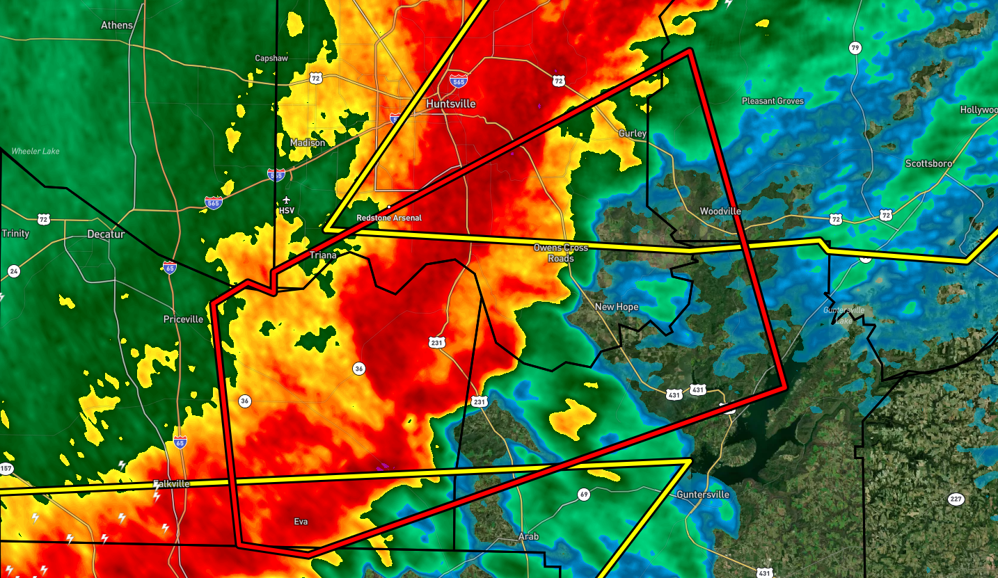
* Tornado Warning for…
Northwestern Marshall County in northeastern Alabama…
West central Jackson County in northeastern Alabama…
Southern Madison County in north central Alabama…
Southeastern Morgan County in north central Alabama…
* Until 115 AM CDT.
* At 1244 AM CDT, severe thunderstorms capable of producing a
tornadoes was located northeast and southeast of Somerville,
moving east at 40 mph.
HAZARD…Tornado.
SOURCE…Radar indicated rotation.
IMPACT…Flying debris will be dangerous to those caught without
shelter. Mobile homes will be damaged or destroyed.
Damage to roofs, windows, and vehicles will occur. Tree
damage is likely.
* This dangerous storm will be near…
Morgan City around 1255 AM CDT.
Owens Cross Roads around 110 AM CDT.
Grant and Woodville around 115 AM CDT.
Other locations impacted by this tornadic thunderstorm include Paint
Rock, Valhermoso Springs, Hampton Cove, Columbus City, Cole Springs,
Eva, Laceys Spring, Farley, Ryan Crossroads and Florette.
PRECAUTIONARY/PREPAREDNESS ACTIONS…
TAKE COVER NOW! Move to a basement or an interior room on the lowest
floor of a sturdy building. Avoid windows. If you are outdoors, in a
mobile home, or in a vehicle, move to the closest substantial shelter
and protect yourself from flying debris.
Category: Alabama's Weather, ALL POSTS, Severe Weather
About the Author (Author Profile)
Scott Martin is an operational meteorologist, professional graphic artist, musician, husband, and father. Not only is Scott a member of the National Weather Association, but he is also the Central Alabama Chapter of the NWA president. Scott is also the co-founder of Racecast Weather, which provides forecasts for many racing series across the USA. He also supplies forecasts for the BassMaster Elite Series events including the BassMaster Classic.Subscribe
If you enjoyed this article, subscribe to receive more just like it.


