Reports from Autauga and Elmore Including Possible Tornado
Multiple reports of wind damage including a possible tornado are coming in from Autauga and Elmore Counties late this evening. This same storm is near US-280 now between Dadeville and Camp Hill.
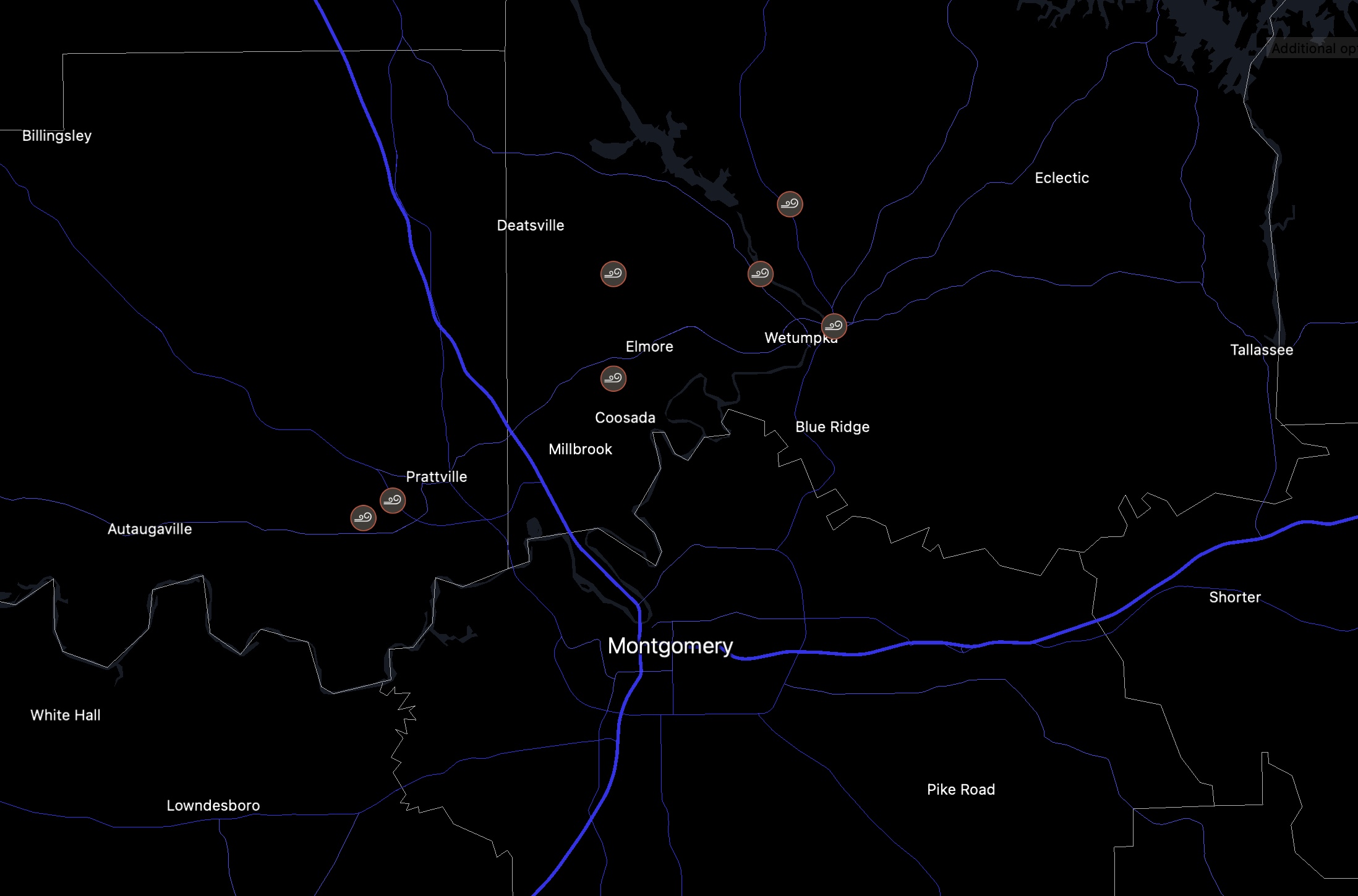
Winds gusted to 56 mph at the Prattville Airport.
…1 SSW Wetumpka Muni Air [Elmore Co, AL] emergency mngr reports TSTM WND DMG at 09:45 PM CDT — multiple trees were blown down on Airport Road near Meadowlane.
…2 ENE Autauga County Ai [Autauga Co, AL] NWS employee reports TSTM WND DMG at 09:39 PM CDT — trees and powerlines down along with at least minor structural damage. Possible tornado.
…2 WSW Wallsboro [Elmore Co, AL] emergency mngr reports TSTM WND DMG at 09:57 PM CDT — trees down blocking the roadway near Holtville Road and Crnshaw Road.
…2 E Jordan Dam [Elmore Co, AL] emergency mngr reports TSTM WND DMG at 09:56 PM CDT — trees blown down on Shadow Wood Lane.
…1 E Wetumpka [Elmore Co, AL] emergency mngr reports TSTM WND DMG at 09:57 PM CDT — trees blown down near Georgia Road and Tallassee Hwy
… WNW Autaugaville [Autauga Co, AL] emergency mngr reports TSTM WND DMG at 09:28 PM CDT — tstm wnd dmg report from 3 wnw autaugaville. a tree was blown down and was blocking the roadway. a vehicle struck the downed tree.
Category: Alabama's Weather, ALL POSTS, Severe Weather
About the Author (Author Profile)
Bill Murray is the President of The Weather Factory. He is the site's official weather historian and a weekend forecaster. He also anchors the site's severe weather coverage. Bill Murray is the proud holder of National Weather Association Digital Seal #0001 @wxhistorianSubscribe
If you enjoyed this article, subscribe to receive more just like it.


