Areal Flood Advisory — Parts of Dallas, Lowndes, Montgomery Co. Until 3:45 am
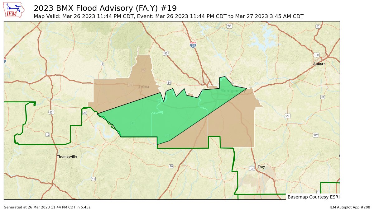
…FLOOD ADVISORY IN EFFECT UNTIL 345 AM CDT MONDAY…
* WHAT…Urban and small stream flooding caused by excessive
rainfall is expected.
* WHERE…A portion of central Alabama, including the following
counties, Dallas, Lowndes and Montgomery.
* WHEN…Until 345 AM CDT.
* IMPACTS…Minor flooding in low-lying and poor drainage areas.
River or stream flows are elevated.
* ADDITIONAL DETAILS…
– At 1144 PM CDT, Doppler radar indicated heavy rain due to
thunderstorms. This will cause urban and small stream
flooding. Between 1 and 3 inches of rain have fallen.
– Additional rainfall amounts of 1 to 2 inches are expected
over the area. This additional rain will result in minor
flooding.
– Some locations that will experience flooding include…
Montgomery, Mosses, Hayneville, Coosada, White Hall,
Gordonville, Lowndesboro, Benton, Beechwood, Tyler, Belknap,
Dallas Lake, Dannelly Field, Hunter, Woodcrest, Hope Hull,
Maxwell Air Force Base, Hyundai Motors Of Alabama, Dannelly
Reservoir and Montgomery Riverwalk Stadium.
PRECAUTIONARY/PREPAREDNESS ACTIONS…
Turn around, don’t drown when encountering flooded roads. Most flood
deaths occur in vehicles.
Category: Alabama's Weather, ALL POSTS
About the Author (Author Profile)
Scott Martin is an operational meteorologist, professional graphic artist, musician, husband, and father. Not only is Scott a member of the National Weather Association, but he is also the Central Alabama Chapter of the NWA president. Scott is also the co-founder of Racecast Weather, which provides forecasts for many racing series across the USA. He also supplies forecasts for the BassMaster Elite Series events including the BassMaster Classic.Subscribe
If you enjoyed this article, subscribe to receive more just like it.


