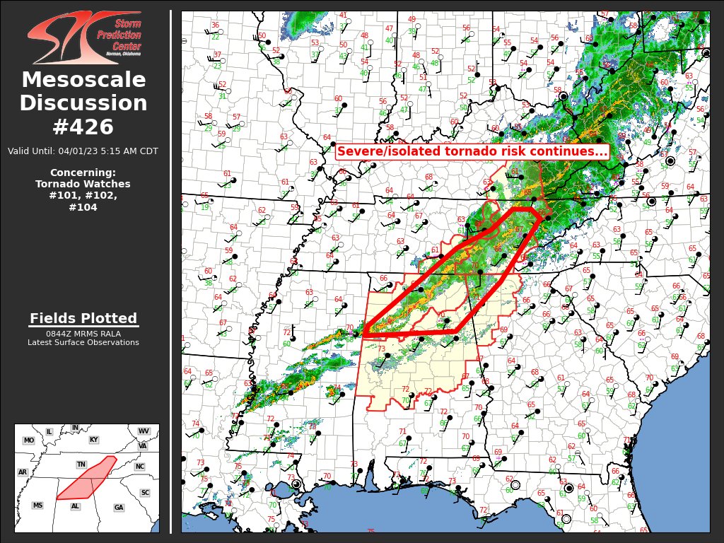
Mesoscale Discussion 426: Isolated Tornado Risk Continues
The severe weather threat for Tornado Watch 101, 102, 104 continues.
SUMMARY… Severe risk continues across portions of eastern
Tennessee, and into adjacent northern Alabama and northwestern
Georgia. Along with risk for locally damaging winds, tornado risk
persists locally as well.
DISCUSSION… Latest radar loop shows a complex band of storms
shifting eastward across eastern Tennessee and northern Alabama.
Within this band, several more intense/occasionally rotating
updrafts continue to occur. A couple of these circulations have
tightened into low-level mesocyclones sporadically over the past
hour, indicative of continued/local tornado potential.
Overall, aside from the southern part of this band across northern
Alabama, the convection is beginning to encounter the more stable
airmass that exists with eastern extent into the southern
Appalachians. As such, the overall risk is expected to decrease as
storms reach/cross the Tennessee mountains. Farther south however,
risk is expected to continue across northern Alabama and into
northern Georgia over the next couple of hours.
Category: Alabama's Weather, ALL POSTS, Severe Weather
About the Author (Author Profile)
Scott Martin is an operational meteorologist, professional graphic artist, musician, husband, and father. Not only is Scott a member of the National Weather Association, but he is also the Central Alabama Chapter of the NWA president. Scott is also the co-founder of Racecast Weather, which provides forecasts for many racing series across the USA. He also supplies forecasts for the BassMaster Elite Series events including the BassMaster Classic.Subscribe
If you enjoyed this article, subscribe to receive more just like it.


