Low End Severe Threat for Parts of the Area Monday Afternoon
We are going to have an unsettled week across North and Central Alabama with an active frontal boundary lying across the area and a few disturbances swinging by in the atmosphere above our heads.
Today will be a pretty day with a decent supply of sunshine and temperatures warming mostly into the 70s. High clouds are spreading rapidly across the sky over the North Central part of the state, giving some character to the sky. Thicker clouds are working across Mississippi and into Southwest Alabama. These clouds will become thicker as we go through the afternoon and into the overnight.
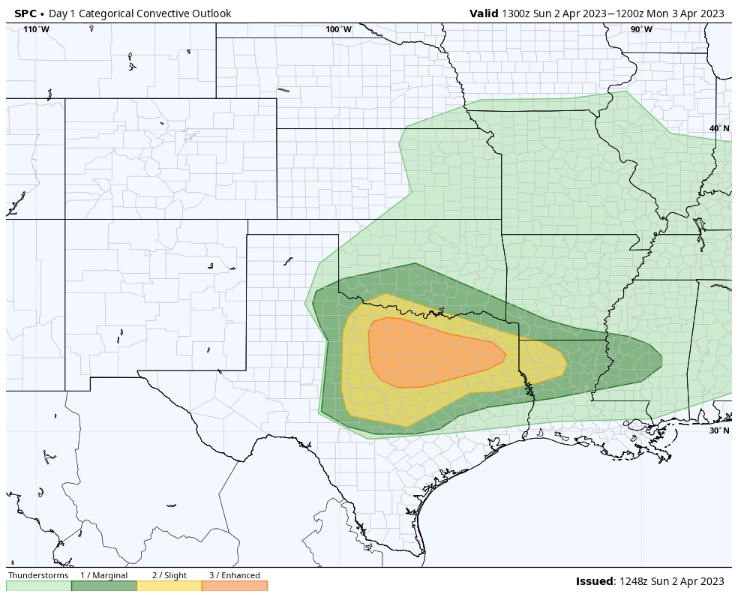
This is thanks to a disturbance that is moving east out of New Mexico today. It will help to trigger severe thunderstorms as the dryline mixes eastward into a warm, moist airmass that is strongly capped. They are expecting large hail, some damaging winds, and a short window for tornadoes between about 5-9 p.m. over North Texas. In response, the SPC has outlooked that area for severe weather today and tonight with everything from a Marginal Risk (1/5) to Slight (2/5) to Enhanced (3/5).
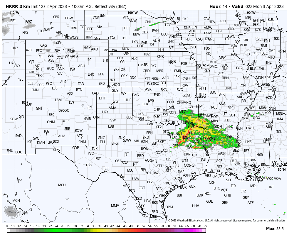
Here is what the radar may look like around 9 p.m.:
The best chance for tornadoes will be in the 5-9 pm window over Central Texas in the Enhanced Risk region.
These storms will weaken overnight as they cross Louisiana and Mississippi and move into West Alabama about 2-3 a.m. The SPC does bring a Slight Risk to the Shreveport area and then a Marginal Risk into Central Mississippi as the storms travel along I-20. They will not be severe when they get to Alabama, but we will keep an eye on them.
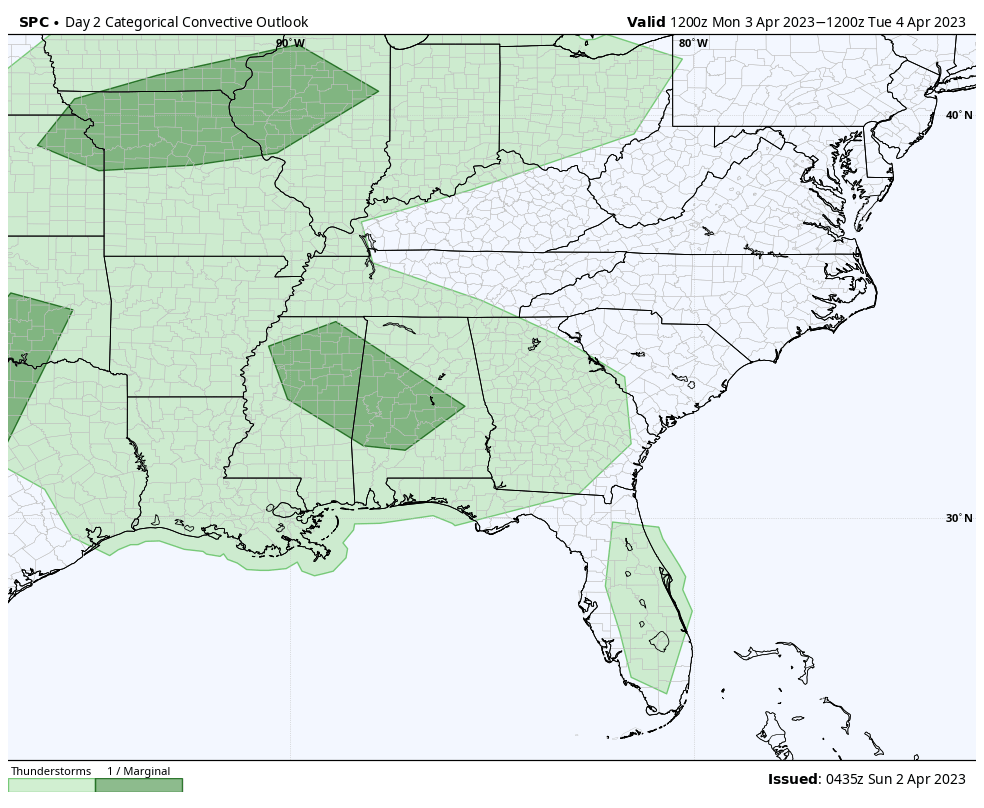
We will be wet and stormy Monday morning as the area of storms and rain moves across our area. They will be into Georgia by early afternoon. But a warm, moist atmosphere will be in place across Alabama with surface dewpoints surging into the 60s everywhere in our state except for Northeast Alabama. With temperatures in the 70s, instabilities will climb into the 1,500-2,2000 joules/kg range across the area. They will approach 3,000 joules/kg over Southwest Alabama. It doesn’t look like many storms will form, but if any do, they will be able to produce large hail and damaging winds. No tornado threat.
Here is the SPC Day Two for Monday and Monday night showing that Marginal Risk (1/5) for Mississippi and Alabama.
A much larger upper-level system will move out of the southwestern United States on Tuesday with a deepening surface low moving from eastern Colorado to Nebraska during the day. ALl of the ingredients for severe weather will be in place Tuesday.
The SPC has issued another double-barrelled outlook for Day 3:
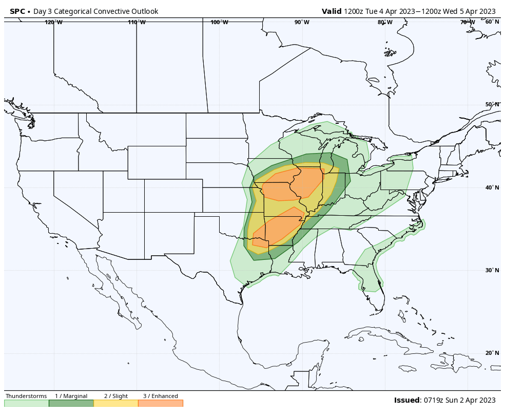
Those Enhanced Risk areas are especially concerning for a tornado threat. I am very concerned about Northern Illinois and eastern Iowa. Large, violent, long-track tornadoes are possible there.
Here in Alabama, the line of storms will move in Wednesday during the day slowly. The storms will intensify as they use the heating of the day to become stronger. But indications are that there will not be significant severe weather. We will continue to monitor this possibility.
The front will move ever so slowly southeastward, keeping us in rain chances into the weekend.
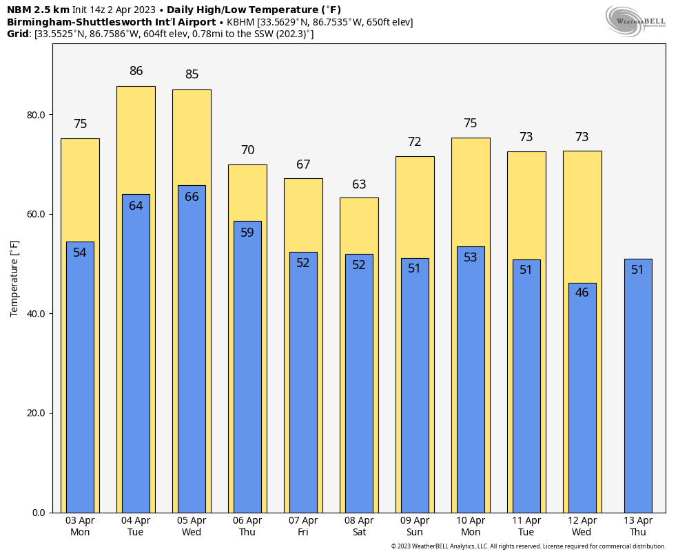
No cold air over the next seven days, although there is a cool down starting Thursday. Some cool morning temps around the 12th and 13th (Wednesday and Thursday) will have to be watched in case they present a threat of frost.
Category: Alabama's Weather, ALL POSTS
About the Author (Author Profile)
Bill Murray is the President of The Weather Factory. He is the site's official weather historian and a weekend forecaster. He also anchors the site's severe weather coverage. Bill Murray is the proud holder of National Weather Association Digital Seal #0001 @wxhistorianSubscribe
If you enjoyed this article, subscribe to receive more just like it.


