Mesoscale Discussion 450 — Watch Unlikely; However, Isolated Severe Storms Possible
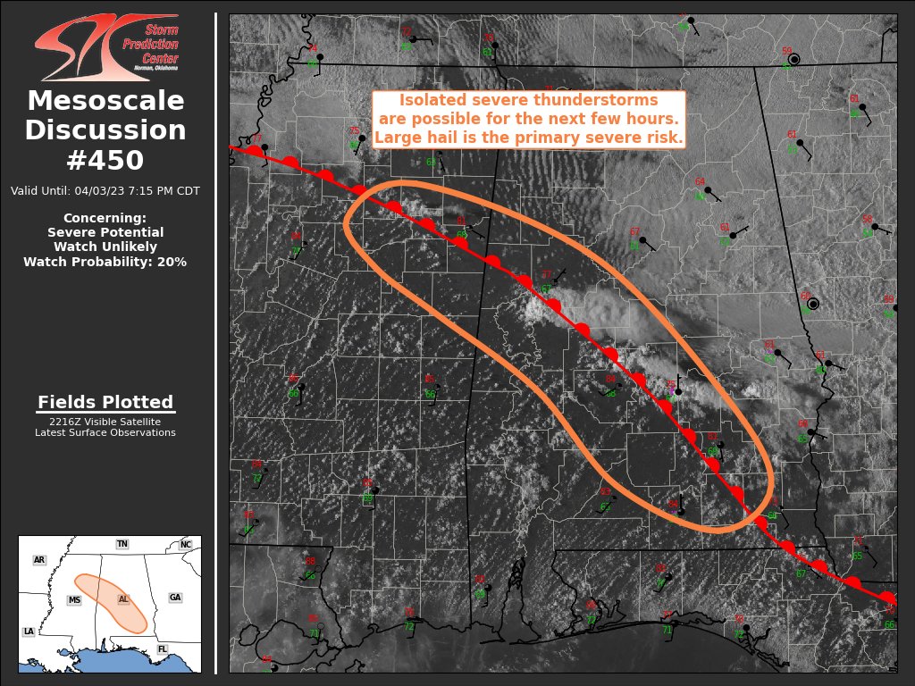
SUMMARY… Isolated severe thunderstorms capable of large hail and damaging gusts are possible for the next few hours.
DISCUSSION… Recent surface analysis places a warm front from northern MS southeastward into southeast AL and the western FL Panhandle. Air mass in the vicinity of this boundary is characterized by temperatures in the upper 70s/low 80s, dewpoints in the mid/upper 60s, and moderate buoyancy. Latest mesoanalysis estimated MLCAPE around 1000-1500 J/kg. Large-scale forcing is weak, but convergence along and in the vicinity of this boundary has initiated thunderstorms over central AL. Additional storm development is possible farther north across northeast MS, but the highest coverage of storms is expected to remain over central AL.
Given the moderate buoyancy and effective bulk shear on the order of 50 kt, storms may be able to mature into a supercell or two. Low-level flow is weak, mitigating the tornado threat, but the presence of the warm front and potential for rotating updrafts still suggests a non-zero risk. The primary risk with these storms is isolated large hail, with isolated damaging gusts possible as well. Overall storm coverage is expected to remain isolated to widely scattered, with storm intensity expected to diminish after sunset.
Category: Alabama's Weather, ALL POSTS, Severe Weather
About the Author (Author Profile)
Scott Martin is an operational meteorologist, professional graphic artist, musician, husband, and father. Not only is Scott a member of the National Weather Association, but he is also the Central Alabama Chapter of the NWA president. Scott is also the co-founder of Racecast Weather, which provides forecasts for many racing series across the USA. He also supplies forecasts for the BassMaster Elite Series events including the BassMaster Classic.Subscribe
If you enjoyed this article, subscribe to receive more just like it.


