Severe Thunderstorm Warning for Parts of Lauderdale and Colbert Counties Until pm
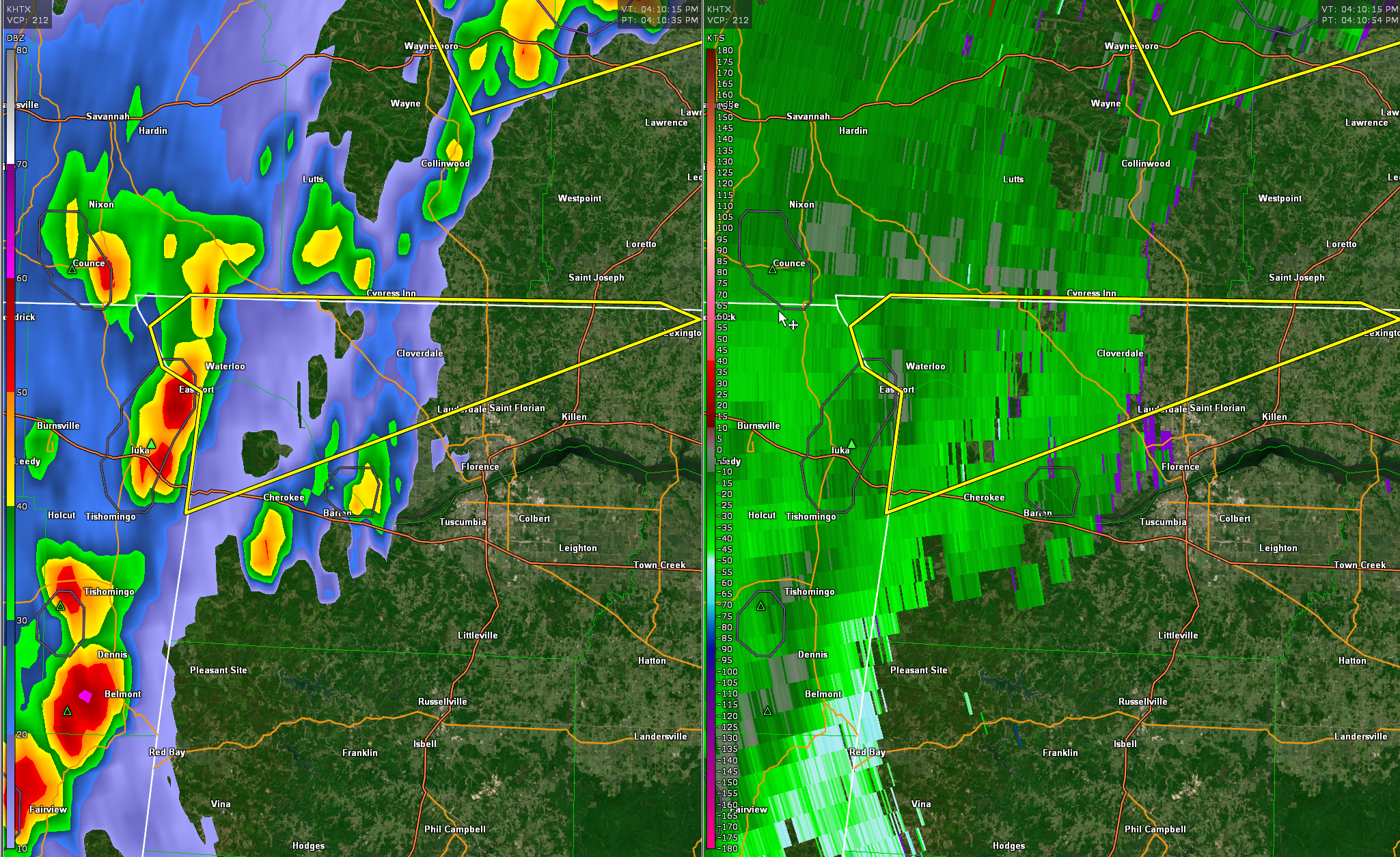
The NWS in Huntsville has issued a Severe Thunderstorm Warning for western Lauderdale and Colbert Counties. At 412 PM CDT, a severe thunderstorm was located near J P Coleman State Park, moving northeast at 25 mph. Be in the safer part of a substantial structure as these dangerous storms approach.
The National Weather Service in Huntsville Alabama has issued a
* Severe Thunderstorm Warning for…
Northwestern Lauderdale County in northwestern Alabama…
Northwestern Colbert County in northwestern Alabama…
* Until 500 PM CDT.
* At 412 PM CDT, a severe thunderstorm was located near J P Coleman
State Park, moving northeast at 25 mph.
HAZARD…60 mph wind gusts and quarter size hail.
SOURCE…Radar indicated.
IMPACT…Hail damage to vehicles is expected. Expect wind damage
to roofs, siding, and trees.
* Locations impacted include…
Lexington, Underwood-Petersville, Waterloo, Green Hill, Zip City,
Threet, Margerum, Riverton and Wright.
PRECAUTIONARY/PREPAREDNESS ACTIONS…
For your protection move to an interior room on the lowest floor of a
building.
&&
LAT…LON 3501 8812 3501 8741 3499 8735 3474 8812
3489 8810 3492 8816 3497 8818
TIME…MOT…LOC 2112Z 240DEG 23KT 3489 8811
HAIL THREAT…RADAR INDICATED
MAX HAIL SIZE…1.00 IN
WIND THREAT…RADAR INDICATED
MAX WIND GUST…60 MPH
Category: Alabama's Weather, ALL POSTS, Severe Weather
About the Author (Author Profile)
Bill Murray is the President of The Weather Factory. He is the site's official weather historian and a weekend forecaster. He also anchors the site's severe weather coverage. Bill Murray is the proud holder of National Weather Association Digital Seal #0001 @wxhistorianSubscribe
If you enjoyed this article, subscribe to receive more just like it.


