The Midday Report — Very Nice for Now; Rain & Storms Later Today & Tonight
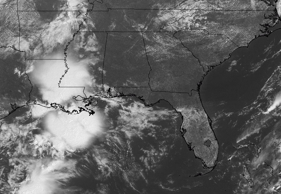
As we approach the midday hour, it is nice, mainly sunny, and warming on up across Central Alabama. Unfortunately, we do see those clouds over in Mississippi and Louisiana, and those will move in later this afternoon and tonight. The closest rain activity is located over the extreme southwestern parts of Mississippi and south-central parts of Louisiana. Temperatures were in the 70s across the area, and we’re looking to top out in the lower to mid 80s.
Showers and storms will be possible this afternoon over the western half of the area, but rain and storms will be likely across all of Central Alabama later tonight and through the overnight hours. A strong storm may be possible near the Alabama/Mississippi state line, but the system will be weakening as it moves deeper into the area. Lows in the upper 50s to the mid 60s.
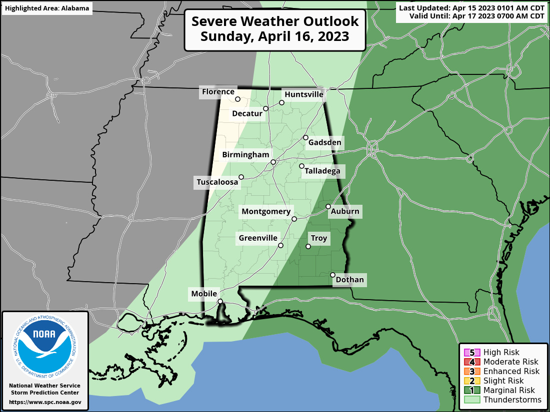
The system will be exiting the area during the latter part of the afternoon on Sunday, that will end the rain chances for Central Alabama. Behind the front, we’ll have cooler and drier air moving in. There is a Marginal Risk up for the southeastern parts of the area during the morning and into the early afternoon hours until the front moves out. Damaging wind gusts and large hail look to be the main threats, but the better dynamics will be far off to the north and will limit those threats. Highs in the mid 60s to the upper 70s.
Category: Alabama's Weather, ALL POSTS, Severe Weather
About the Author (Author Profile)
Scott Martin is an operational meteorologist, professional graphic artist, musician, husband, and father. Not only is Scott a member of the National Weather Association, but he is also the Central Alabama Chapter of the NWA president. Scott is also the co-founder of Racecast Weather, which provides forecasts for many racing series across the USA. He also supplies forecasts for the BassMaster Elite Series events including the BassMaster Classic.Subscribe
If you enjoyed this article, subscribe to receive more just like it.


