Historic Storm?
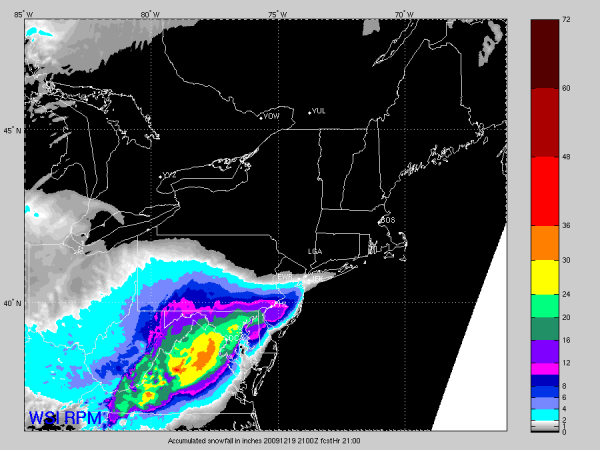
Check out the RPM (Rapid Precision Mesoscale) model accumulated snow potential for the next 24 hours:
This is suggesting some of the DC suburbs (mainly across the Potomac in Virginia) would see over 30 inches of snow from this monster.
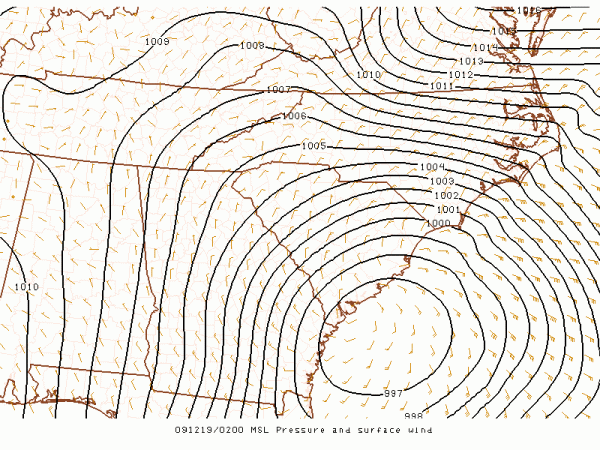
The surface low is now just east of Savannah…
It will be very interesting to watch this unfold. We will continue to post images as they come in from that region.
Also, we note the 18Z GFS is pulling the surface low with our pre-Christmas storm much farther to the south. That is another situation we will watch with great interest this weekend…
Category: Uncategorized


