Storms Marching Eastward at 6:35 p.m.
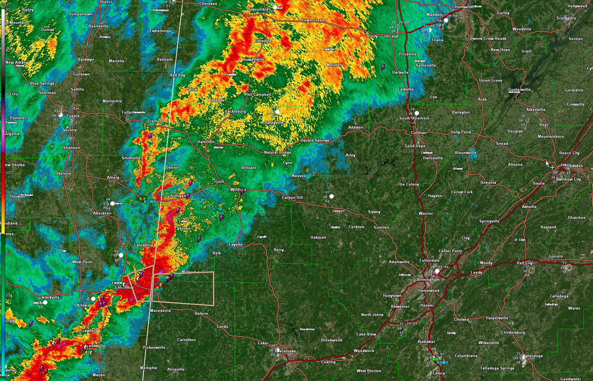
An area of rain and embedded thunderstorms covers much of Northwest Alabama early this evening.
South of that, a line of thunderstorms, some strong, extends from near Sulligen in Lamar County to near Columbus MS to west of Macon and Philadelphia MS to east of Jackson and east of Natchez.
There are a few severe thunderstorm warnings over South Central Mississippi, but all near and south of I-20.
The strongest storms in Alabama are entering southern Lamar and northern Pickens Counties. They are approaching Millport. Expect winds to 40 mph and some pea sized hail with these stronger storms. Heavy rain will also accompany them.
The line will push east, reaching the Birmingham area around 930-10 p.m. The storms are not expected to be severe, although they could hold their own as they push further eastward into Central Alabama. Instability values are actually a little higher from west of Birmingham down to Selma. There is also a little more bulk shear.
Category: Alabama's Weather, ALL POSTS
About the Author (Author Profile)
Bill Murray is the President of The Weather Factory. He is the site's official weather historian and a weekend forecaster. He also anchors the site's severe weather coverage. Bill Murray is the proud holder of National Weather Association Digital Seal #0001 @wxhistorianSubscribe
If you enjoyed this article, subscribe to receive more just like it.


