Strong Storms Rolling Through Birmingham Metro
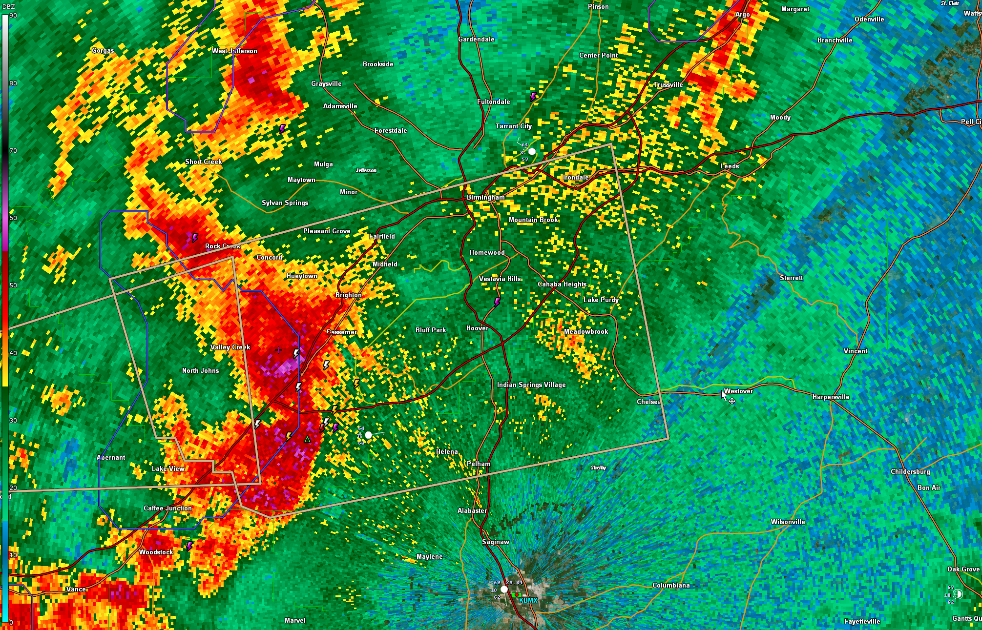
Storms moving through Jefferson and northern Shelby County are producing gusty winds, very heavy rain, dangerous lightning, and even some small hail, but they are not severe and should stay below severe limits.
The storms extend from Rock Creek to Hueytown to Bessemer, and then back to near Woodstock and West Blocton.
The storms are moving to the east-northeast at 30 mph.
A significant weather advisory is in effect for parts of southern Jefferson and northern Shelby Counties.
Elsewhere, a line of storms extends generally along I-59 from Northeast Alabama back to the Mississippi border around Sumter County. The line will continue pushing east-southeast and push out of Alabama by 1 a.m. A few lingering showers will remain until around sunrise.
Tomorrow promises to be a nice day, with clearing skies, a fresh northerly breeze, and mild temperatures in the lower and middle 70s.
Our next rain chance will come late in the day on Tuesday. That will herald the beginning of an unsettled period across Alabama with several waves of rain between Wednesday and Sunday night.
Rainfall amounts could approach 2-3 inches areawide over the next ten days.
Category: ALL POSTS
About the Author (Author Profile)
Bill Murray is the President of The Weather Factory. He is the site's official weather historian and a weekend forecaster. He also anchors the site's severe weather coverage. Bill Murray is the proud holder of National Weather Association Digital Seal #0001 @wxhistorianSubscribe
If you enjoyed this article, subscribe to receive more just like it.


