EXPIRED Severe Thunderstorm Warning for Parts of Cullman County Until 215 am
The storm in Cullman County has now gone severe. The hail core is now east of Cullman on US-278. Hail up to 1.5 inches is possible.
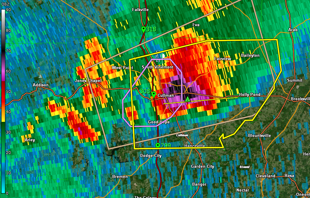
The National Weather Service in Huntsville Alabama has issued a
* Severe Thunderstorm Warning for…
Northeastern Cullman County in north central Alabama…
* Until 215 AM CDT.
* At 145 AM CDT, a severe thunderstorm was located over Cullman,
moving east at 25 mph.
HAZARD…60 mph wind gusts and quarter size hail.
SOURCE…Radar indicated.
IMPACT…Hail damage to vehicles is expected. Expect wind damage
to roofs, siding, and trees.
* Locations impacted include…
Cullman, Hanceville, Good Hope, Holly Pond, Dodge City, Baldwin,
Vinemont, Baileyton, West Point and Phelan.
Category: Alabama's Weather, ALL POSTS, Severe Weather
About the Author (Author Profile)
Bill Murray is the President of The Weather Factory. He is the site's official weather historian and a weekend forecaster. He also anchors the site's severe weather coverage. Bill Murray is the proud holder of National Weather Association Digital Seal #0001 @wxhistorianSubscribe
If you enjoyed this article, subscribe to receive more just like it.


