The Midday Weather Report — Storms Are Forming to Our West; We’re Still Dry for Now
THIS WEEKEND
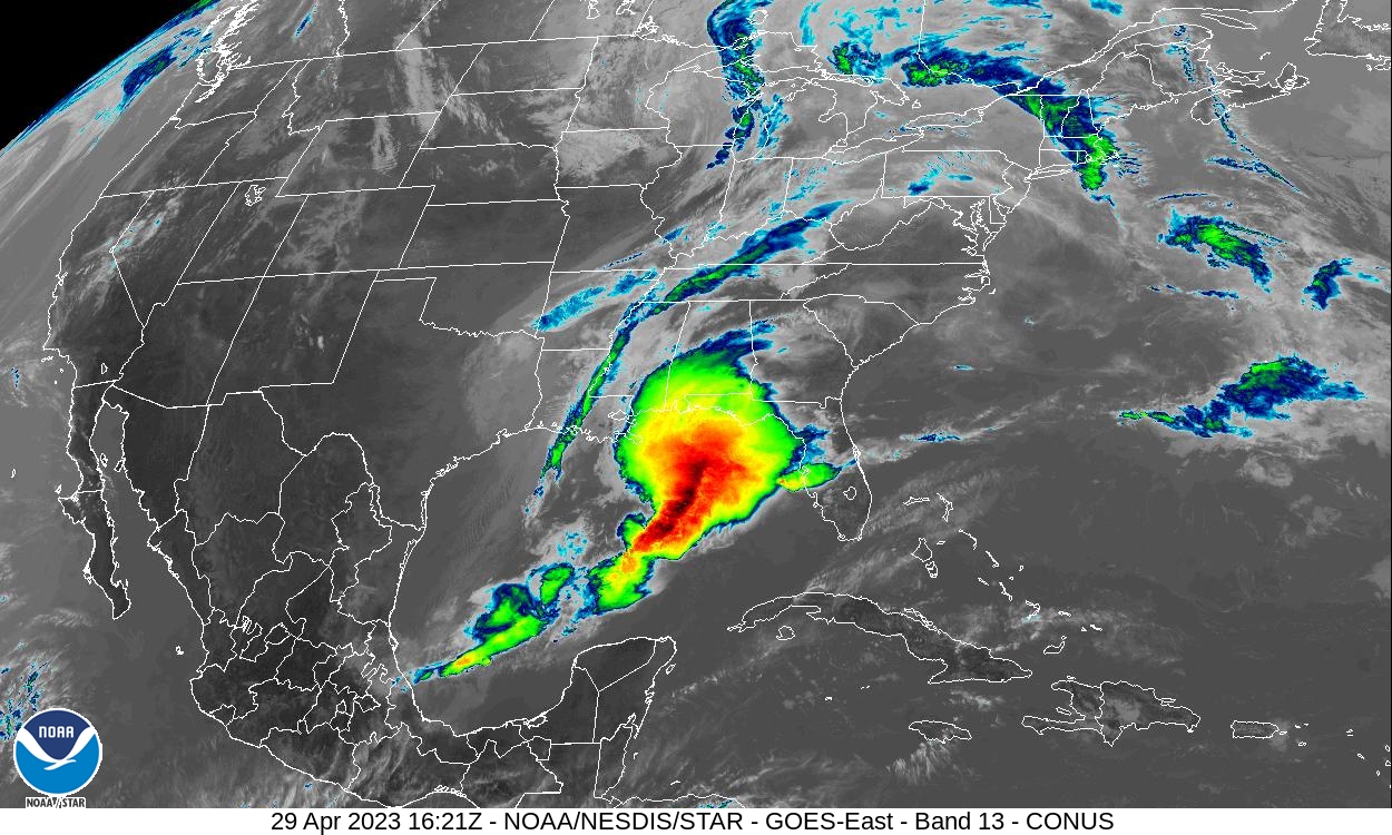
At 11:30 am, more clouds are moving into the area from the west and southwest, and showers and storms are forming out over the western parts of Mississippi and into the northern parts of Louisiana. For now, no precipitation is showing up in Central Alabama.
Temperatures as of the 11 am roundup were in the upper 60s to the lower 80s across Central Alabama. Eufaula was the warm spots at 80º. Haleyville was the cool spot at 67º. Birmingham was at 73º. Afternoon highs are expected to reach the upper 70s to the mid 80s.
Rain and storms will continue to develop out to our west and will begin to move into the western portions of the area this afternoon and slowly push eastward through the evening and overnight hours. No severe weather is expected for the northern 2/3rds of Central Alabama, but a few strong storms cannot be ruled out. It will be a wet Saturday night across the area, with lows reaching the mid to upper 50s for most.
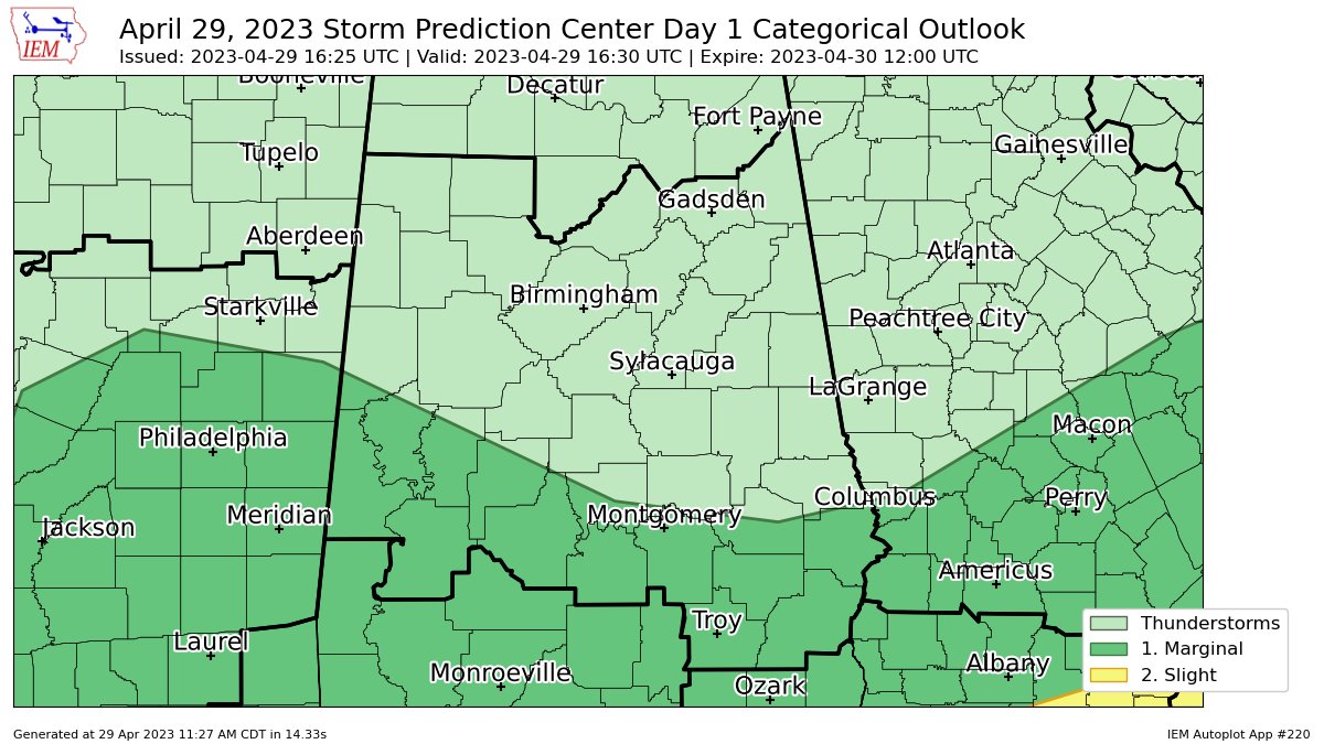
The Storm Prediction Center has a Marginal Risk up for locations along and south of a line from Aliceville to Prattville to Smiths Station. The main window for this strong to severe weather threat will be from 1 pm this afternoon until 8 pm this evening from west to east. Isolated damaging wind gusts up to 60 mph and quarter size hail will be possible, but we also can’t rule out a brief tornado.
Rain will be moving out of the area on Sunday morning, and that will leave us with clearing skies, cooler temperatures, and breezy conditions during the afternoon. Highs will be in the upper 60s to the upper 70s.
NEXT WEEK
Much of the work week ahead will be very nice and mild. Monday will be sunny and breezy at times as winds will be out of the west averaging around 5 to 15 mph, with gusts up to 30 mph. Highs in the upper 60s to the mid 70s. Same story, but just less wind on Tuesday. Sunny skies and highs in the lower 70s to the lower 80s. Sunshine will once again be in full force on Wednesday, with highs in the mid 70s to the lower 80s.
We’ll have sunny skies to start the day on Thursday, but there will be a short wave heading in our direction that will bring a chance of showers and storms to the area during the nighttime and overnight hours. Highs in the upper 70s to the mid 80s. And at the end of the forecast period on Friday… We’ll continue to have a chance of showers and storms through the day. At this point, severe weather doesn’t look likely, but we’ll keep an eye on it. Highs in the upper 70s to the mid 80s.
Category: Alabama's Weather, ALL POSTS, Severe Weather
About the Author (Author Profile)
Scott Martin is an operational meteorologist, professional graphic artist, musician, husband, and father. Not only is Scott a member of the National Weather Association, but he is also the Central Alabama Chapter of the NWA president. Scott is also the co-founder of Racecast Weather, which provides forecasts for many racing series across the USA. He also supplies forecasts for the BassMaster Elite Series events including the BassMaster Classic.Subscribe
If you enjoyed this article, subscribe to receive more just like it.


