Flash Flood Warning for Parts of Lawrence County Until 630pm
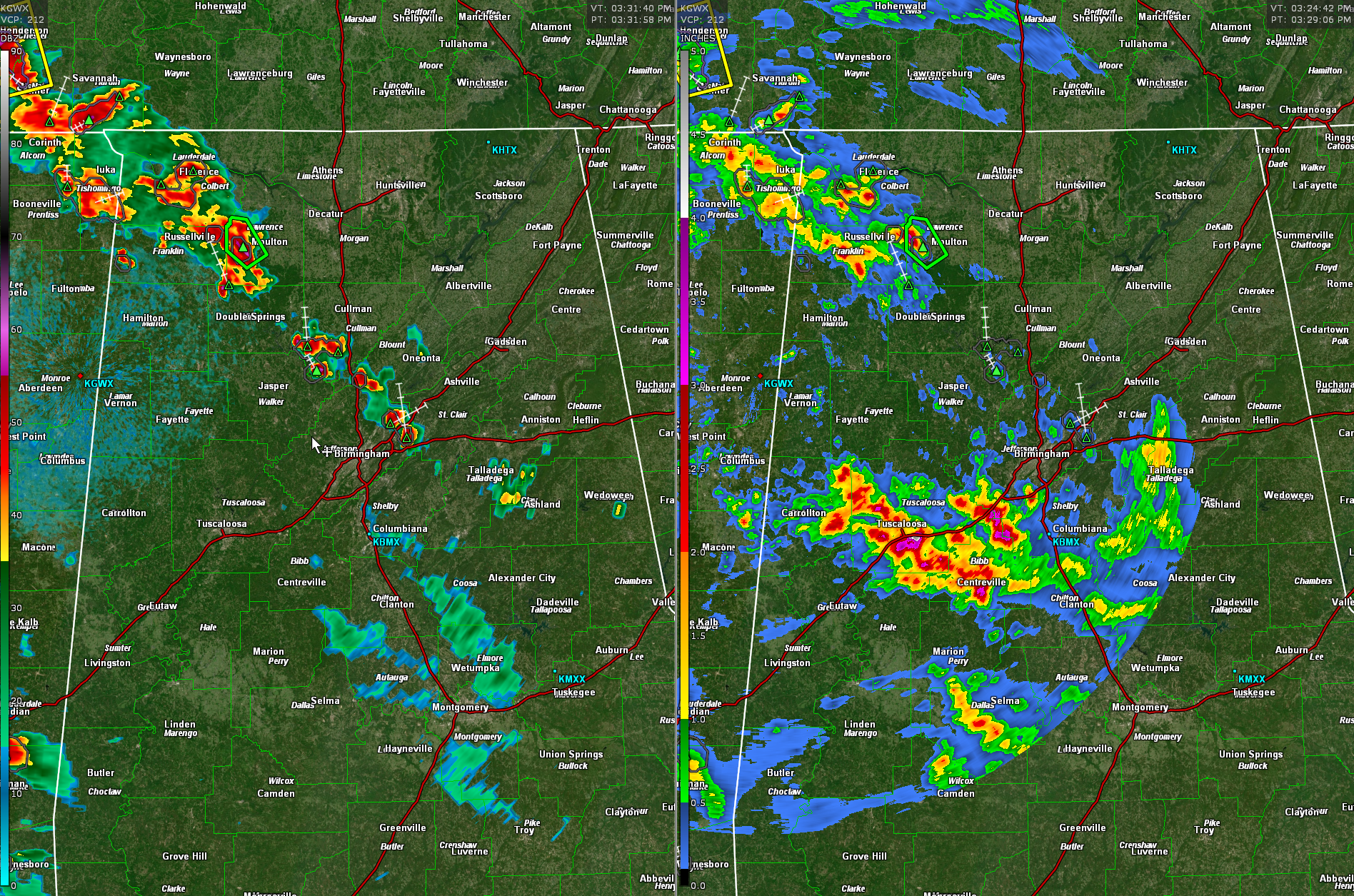
Active storms over Northwest Alabama are dumping heavy rainfall in addition to some small hail and wind gusts.
2-3″ has already fallen near Moulton and the heavy rain continues at 3:30.
Storms extend back to the southeast in a band all the way to the Northeast side of Birmingham.
The strongest storm in Alabama is near Florence. There is a severe thunderstorm warning in Southwest Tennessee.
Left side is reflectivity, right side is storm total rainfall which include last evening.
The National Weather Service in Huntsville has issued a
* Flash Flood Warning for…
Southwestern Lawrence County in northwestern Alabama…
* Until 630 PM CDT.
* At 329 PM CDT, Doppler radar indicated thunderstorms producing
heavy rain across the west central portions of Lawrence County,
between Moulton and the Franklin County line. Between 2 and 3
inches of rain have fallen in the last hour, with additional
rainfall amounts of 1 to 2 inches are possible in the next hour.
Flash flooding is ongoing or expected to begin shortly.
HAZARD…Flash flooding caused by thunderstorms.
SOURCE…Radar.
IMPACT…Flash flooding of small creeks and streams, urban
areas, highways, streets and underpasses as well as
other poor drainage and low-lying areas.
* Some locations that will experience flash flooding include…
Landersville, Mt Hope, Hatton, Ne Smith and Bankhead National
Forest.
Category: Alabama's Weather, ALL POSTS, Severe Weather
About the Author (Author Profile)
Bill Murray is the President of The Weather Factory. He is the site's official weather historian and a weekend forecaster. He also anchors the site's severe weather coverage. Bill Murray is the proud holder of National Weather Association Digital Seal #0001 @wxhistorianSubscribe
If you enjoyed this article, subscribe to receive more just like it.


