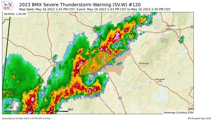
Severe T-Storm Warning — Parts of Bibb, Shelby Co. Until 2:30 pm
The National Weather Service in Birmingham has issued a
* Severe Thunderstorm Warning for…
Southwestern Shelby County in central Alabama…
Northeastern Bibb County in central Alabama…
* Until 230 PM CDT.
* At 143 PM CDT, severe thunderstorms were located along a line
extending from Riverchase to West Blocton, moving east at 20 mph.
HAZARD…60 mph wind gusts and quarter size hail.
SOURCE…Radar indicated.
IMPACT…Hail damage to vehicles is expected. Expect wind damage
to roofs, siding, and trees.
* Locations impacted include…
Hoover, Alabaster, Pelham, Helena, Montevallo, West Blocton,
Wilton, American Village, Maylene, Oak Mountain Amphitheater,
University Of Montevallo, Shelby County Airport, Oak Mountain State
Park, North Bibb, Joe Tucker Park, Camp Branch, Siluria, Alabaster
Veterans Park, Hebron and Saginaw.
PRECAUTIONARY/PREPAREDNESS ACTIONS…
For your protection move to an interior room on the lowest floor of a
building.
Category: Alabama's Weather, ALL POSTS, Severe Weather
About the Author (Author Profile)
Scott Martin is an operational meteorologist, professional graphic artist, musician, husband, and father. Not only is Scott a member of the National Weather Association, but he is also the Central Alabama Chapter of the NWA president. Scott is also the co-founder of Racecast Weather, which provides forecasts for many racing series across the USA. He also supplies forecasts for the BassMaster Elite Series events including the BassMaster Classic.Subscribe
If you enjoyed this article, subscribe to receive more just like it.


