The Midday Report — A Few Rogue Showers Out There
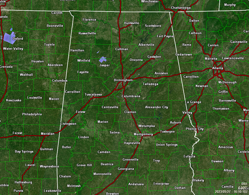
TODAY: As of 11:13 am, there is a small batch of showers moving westward over portions of Winston and Walker counties, while the rest of Central Alabama is dry at this point. However, we had some rogue showers that moved across portions of Etowah and Blount County, but those have dissipated. Temperatures were in the upper 60s to the mid 70s across the area. Troy was the warm spot at 75º, while Haleyville was the cool spot at 69º. Birmingham was at 70º. The forecast still calls for a very small chance of a few isolated showers or thunderstorms over the northwestern and north-central parts of Central Alabama, with highs topping out in the upper 70s to the lower 80s. Rain chances will spread over the western half of the area during the nighttime, but chances will remain small. Lows in the 50s
TOMORROW: We’ll have a small chance of a few isolated to scattered showers and storms across Central Alabama, mainly across the southwestern half of the area south of a line from Hamilton to Birmingham to Auburn. Highs in the upper 70s to the lower 80s.
MEMORIAL DAY: It will be very nice, but for those who will be hitting the swimming pools or lakes, it might be a little cool for comfort. Skies will be mostly sunny, with highs in the upper 70s to the lower 80s.
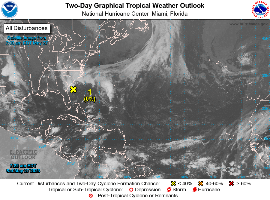
TROPICS: A non-tropical low pressure system located about 150 miles south of Charleston, South Carolina, continues to produce gusty winds and disorganized showers and thunderstorms over portions of the southeastern United States and western Atlantic Ocean. This low is expected to remain a frontal system while it moves northward and inland over the Carolinas tonight or early Sunday. Even though development into a subtropical or tropical cyclone is not expected, the system will produce gusty winds and dangerous surf and rip current conditions along portions of the southeastern United States coast through Sunday. Heavy rainfall is expected in portions of the Carolinas and Virginia during the next couple of days. Hazardous marine conditions are also expected over the coastal and offshore waters, where gale and storm warnings are in effect.
* Formation chance through 48 hours…low…near 0 percent.
* Formation chance through 7 days…low…near 0 percent.
Category: Alabama's Weather, ALL POSTS
About the Author (Author Profile)
Scott Martin is an operational meteorologist, professional graphic artist, musician, husband, and father. Not only is Scott a member of the National Weather Association, but he is also the Central Alabama Chapter of the NWA president. Scott is also the co-founder of Racecast Weather, which provides forecasts for many racing series across the USA. He also supplies forecasts for the BassMaster Elite Series events including the BassMaster Classic.Subscribe
If you enjoyed this article, subscribe to receive more just like it.


