Mid-Afternoon Weather Check — A Few Showers/Storms Over the Western Parts of the Area
REST OF TODAY & MEMORIAL DAY
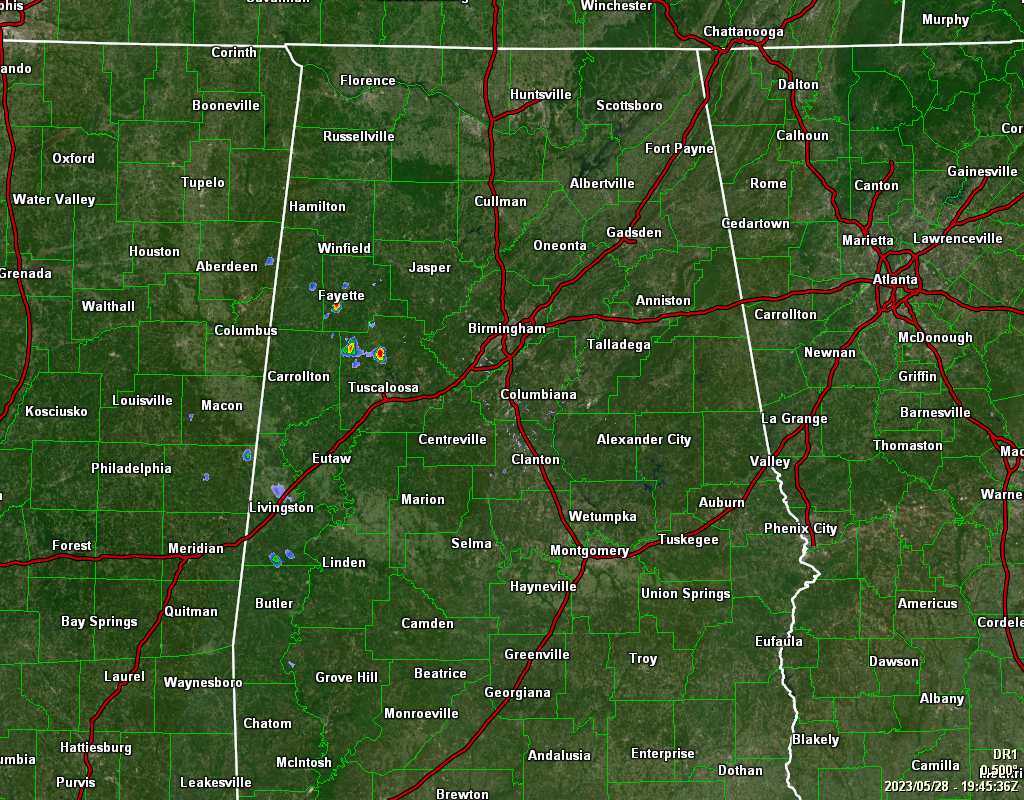
As of 2:45 pm, we have a few scattered showers and storms over the western portions of the area, while the rest of Central Alabama is dry and nice. However, isolated to scattered showers and storms will be possible across the area through the rest of the afternoon and into the early evening hours. 2 pm temperatures were in the mid 70s to the lower 80s, and should top out in the lower 80s across the area. A few showers and storms will remain possible tonight over the southern half of the area, but those should dissipate by the late-night hours and will leave us with partly cloudy skies. Lows in the lower 50s to the lower 60s.
Memorial Day will be very nice, but for those who will be hitting the swimming pools or lakes, it might be a little cool for comfort. We’ll have a mix of sun and clouds, with highs in the upper 70s to the mid 80s.
THE REST OF NEXT WEEK
We’ll start to see a warm-up begin on Tuesday, as we’ll have mainly sunny skies and highs in the mid 80s. It will be even warmer on Wednesday, as we’ll have mostly sunny skies and a small chance of an isolated afternoon shower or storm. Highs in the mid to upper 80s. An upper low looks to move across the Gulf Coast to end off the work week, which will bring an increase to our scattered shower and thunderstorm chances on Thursday. Highs in the mid 80s. Friday will be much of the same as the low hangs around and keeps the flow of moisture moving across Central Alabama. Scattered showers and storms will be possible, with highs in the lower to mid 80s. And at the end of the forecast period on Saturday… We’ll continue to have a chance of scattered showers and storms, but temperatures will be warmer. Highs in the mid to upper 80s.
TROPICAL UPDATE
Tropical cyclone formation is not expected during the next 7 days over the North Atlantic, Caribbean Sea, and the Gulf of Mexico.
BEACH FORECAST CENTER
Get the latest weather and rip current forecasts for the beaches from Dauphin Island, AL, to Panama City Beach, FL, on our Beach Forecast Center page. There, you can select the forecast of the region that you are interested in.
ON THIS DAY IN WEATHER HISTORY
1947 – A storm produced heavy snow across Wisconsin, with ten inches reported at Gay Mills. The snow damaged fruit and other trees, and downed power lines. The storm was followed by the coldest weather of the month for much of the High Plains Region and Missouri Valley. Williston ND reported a low of 21 degrees the morning of the 28th, and the next morning Cheyenne WY reported a morning low of 16 above zero.
Category: Alabama's Weather, ALL POSTS
About the Author (Author Profile)
Scott Martin is an operational meteorologist, professional graphic artist, musician, husband, and father. Not only is Scott a member of the National Weather Association, but he is also the Central Alabama Chapter of the NWA president. Scott is also the co-founder of Racecast Weather, which provides forecasts for many racing series across the USA. He also supplies forecasts for the BassMaster Elite Series events including the BassMaster Classic.Subscribe
If you enjoyed this article, subscribe to receive more just like it.


