Severe Thunderstorm Warning for Morgan, Limestone and Madison Counties Until 1245pm
Strong storm has a developing hail core over the northern portion fo Decatur. It will move east northeast into western Madison County around the town of Madison.
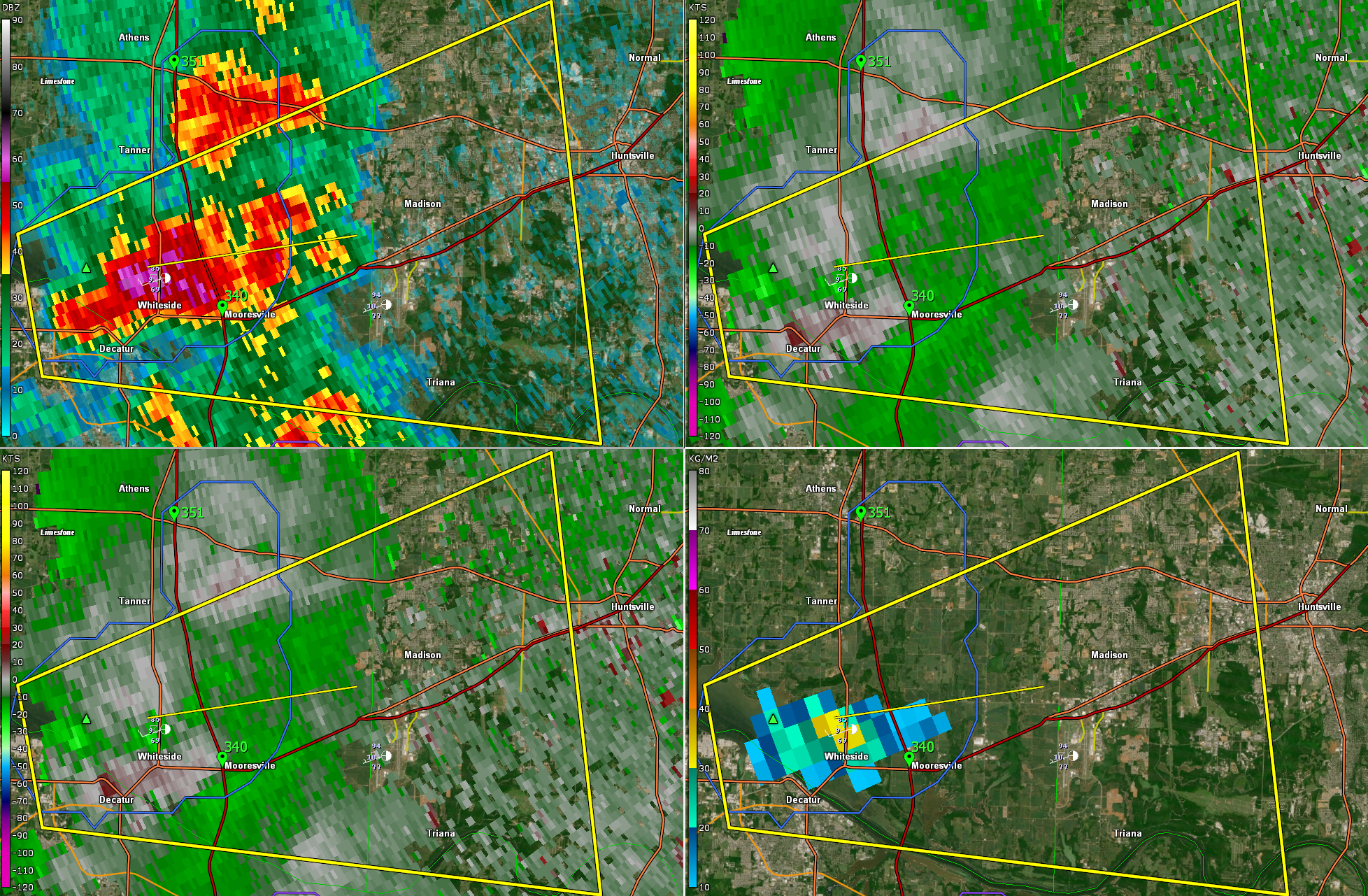
The National Weather Service in Huntsville Alabama has issued a
* Severe Thunderstorm Warning for…
Southwestern Madison County in north central Alabama…
Southeastern Limestone County in north central Alabama…
Northern Morgan County in north central Alabama…
* Until 1245 PM CDT.
* At 1222 PM CDT, a severe thunderstorm was located near Tanner, or
near Decatur, moving east at 25 mph.
HAZARD…60 mph wind gusts and quarter size hail.
SOURCE…Radar indicated.
IMPACT…Hail damage to vehicles is expected. Expect wind damage
to roofs, siding, and trees.
* Locations impacted include…
Northwestern Huntsville, Decatur, Madison, Redstone Arsenal,
Triana, Marshall Space Flight Center, University Of Alabama In
Huntsville, Huntsville International Airport, Tanner and
Mooresville.
Category: Alabama's Weather, ALL POSTS, Severe Weather
About the Author (Author Profile)
Bill Murray is the President of The Weather Factory. He is the site's official weather historian and a weekend forecaster. He also anchors the site's severe weather coverage. Bill Murray is the proud holder of National Weather Association Digital Seal #0001 @wxhistorianSubscribe
If you enjoyed this article, subscribe to receive more just like it.


