

Storms Across Alabama this Afternoon
Here’s a look at the Alabama weather situation at 4:45 pm.
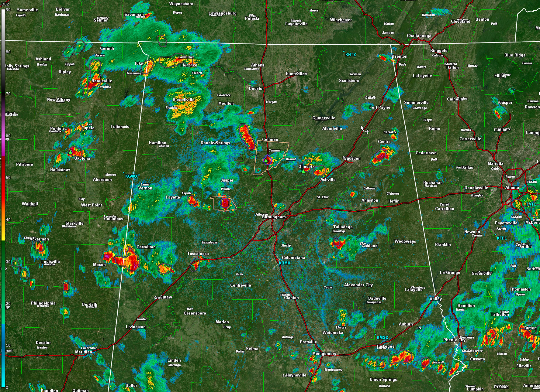
Thunderstorms developed over north eastern Mississippi this afternoon and have moved into Western Alabama.
They are fairly numerous from the Shoals area of Northwest Alabama down through Winston, Walker, Fayette, and Lamar counties into Pickens county near Aliceville, with a developing thunderstorm near Tuscaloosa. Other showers and storms extend from south of I-59 in Sumter county through Demopolis, Butler and Thomasville into Northwestern Monroe County.
Over northeast Alabama showers and thunderstorms are scattered from south east of Cullman to Oneonta into Cherokee County and DeKalb County near Fort Payne.
In East Alabama, thunderstorms extend from there I-20 around Pell City down through southern St. Clair county with additional storms in the I-85 corridor, extending from northeast of Montgomery to near Auburn and Phenix City. There could be some small hail in the thunderstorm south of Talladega.
So far the thunderstorms are not severe, but they are strong with gusty winds torrential rains, deadly lightning and possibly some small hail.
Thunderstorms over Walker and Fayette County will eventually push southeast into the Birmingham area.
Right now the strongest storm in Alabama is over western Pickens County to the west of Aliceville with another strong storm north of Union in Greene County.
Be alert to any strong storms in your vicinity.
Category: Alabama's Weather, ALL POSTS
About the Author (Author Profile)
Bill Murray is the President of The Weather Factory. He is the site's official weather historian and a weekend forecaster. He also anchors the site's severe weather coverage. Bill Murray is the proud holder of National Weather Association Digital Seal #0001 @wxhistorianSubscribe
If you enjoyed this article, subscribe to receive more just like it.


