Alabama Weather Update at 4:15 pm
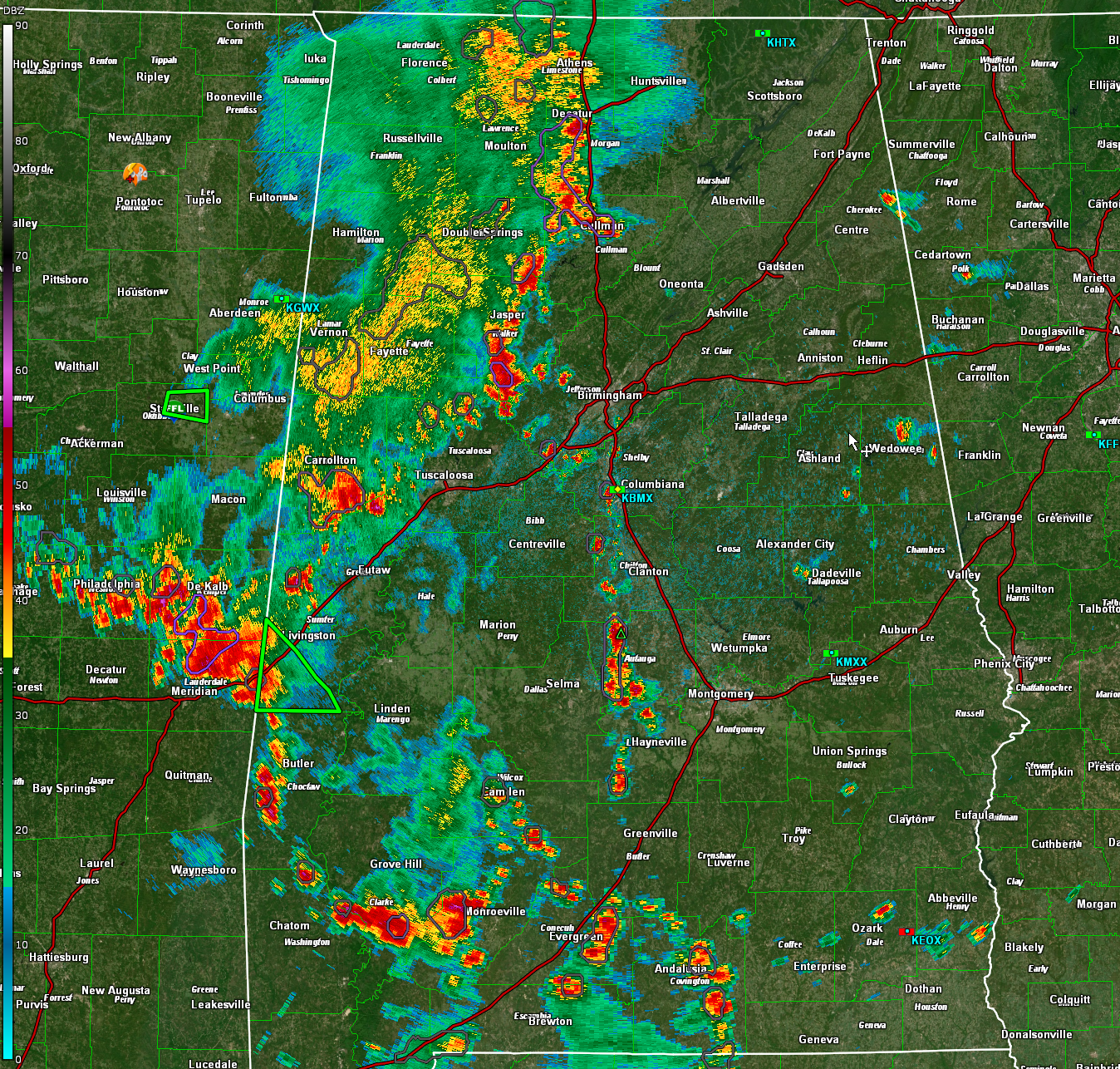
Flash flood warning for parts of Sumter County til 715 pm. Heavy rain is pushing into parts of Sumter County southwest of Livingston, including York, where crazy amounts of rain fell yesterday. The CoCoRaHS observer in Scooba MS, just across the border from Sumter County recorded 5.67 inches of rain yesterday and radar estimates were as much as 10-12 inches in the York, Alabama area.
Unfortunately, we don’t have any observers in Sumter County. The NWS estimated 3-4 inches across that area.
This afternoon, 3-6 inches may fall across the flash flood warning so serious flooding will ensue.
Elsewhere, a large mass of rain and storms extends from Decatur and Cullman down to Jasper to Aliceville to between Meridian MS and York along I-59.
Others extend from Autauga and Lowndes County up into Chilton County. Most of the rest are over Southwest Alabama.
The strongest storm is north of Meridian. None of the storms are severe at this time, but they all have torrential rain, deadly lightning, and gusty winds.
Storms are building into the Birmingham area from the northwest. They seem to be tracking along a boundary, so they could give them a little extra impetus. Be alert for the heavy rain and lightning.
Category: Alabama's Weather, ALL POSTS, Severe Weather
About the Author (Author Profile)
Bill Murray is the President of The Weather Factory. He is the site's official weather historian and a weekend forecaster. He also anchors the site's severe weather coverage. Bill Murray is the proud holder of National Weather Association Digital Seal #0001 @wxhistorianSubscribe
If you enjoyed this article, subscribe to receive more just like it.


