The Early Afternoon Report — More Rain is On Its Way
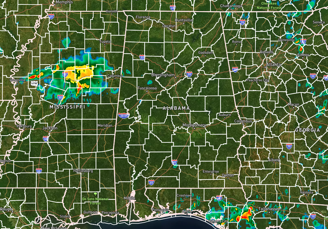
For the most part, nearly all of North and Central Alabama is free from any rain as we have crossed over into the 1 pm hour. There are a couple of small showers located over parts of Tuscaloosa and Lamar counties, but another cluster of rain and storms are moving through Mississippi and will begin to enter the western portions of the area by 2-3 pm. Temperatures were in the lower 80s to the mid 90s across the area. Cullman was the cool spot at 82º. Montgomery was at 94º as the hot spot. Birmingham was sitting at 87º. Highs are expected to reach the upper 80s to the mid 90s.
From now through the rest of the daylight hours, rain chances will rise, and rain and storms will become likely. Most of the activity will come from those storms in Mississippi, but other storms will develop across the area in more of a scattered fashion. One or two storms may become strong or briefly severe with strong, gusty winds. Once we lose the daylight, storms will begin to dissipate in coverage. Lows in the lower to mid 70s.
Slightly drier air will move into the area on Sunday, and rain chances will be lower. We’ll have a chance of a few isolated to scattered showers and storms by the afternoon hours. Highs in the lower to mid 90s.
Category: Alabama's Weather, ALL POSTS
About the Author (Author Profile)
Scott Martin is an operational meteorologist, professional graphic artist, musician, husband, and father. Not only is Scott a member of the National Weather Association, but he is also the Central Alabama Chapter of the NWA president. Scott is also the co-founder of Racecast Weather, which provides forecasts for many racing series across the USA. He also supplies forecasts for the BassMaster Elite Series events including the BassMaster Classic.Subscribe
If you enjoyed this article, subscribe to receive more just like it.


