The Midday Report — Quiet for Now; Storms Likely to Form This Afternoon
———- CENTRAL ALABAMA’S WEATHER ———-
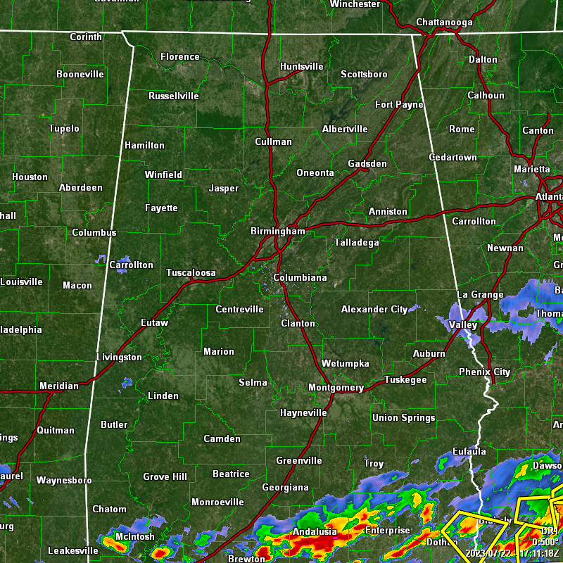
Nearly everyone in Central Alabama is rain-free for the moment, but the southern portions could see more storms develop during the afternoon and into the early evening hours as a boundary continues to slip to the south across the area. Some of those storms may be strong to severe with strong winds, heavy rain, and dangerous cloud-to-ground lightning.
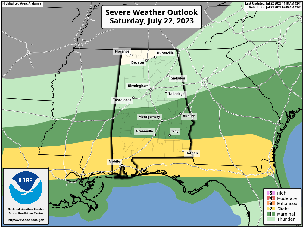
A Marginal Risk for severe storms is up for locations along and south of a line from Boligee to Clanton to Roanoke for today, while South Alabama and the extreme southern portions of Pike and Barbour counties in Central Alabama have been placed under a Slight Risk. The main window for the potential of severe storms will be from 1 pm this afternoon to 9 pm tonight. Current temperatures are in the upper 70s to the mid 80s, and expected to top out in the lower 80s to the lower 90s. A few isolated showers or storms will be possible over the central parts of the area tonight, with the higher coverage over the southern third of the area. Lows will be much more refreshing, dipping down into the mid 60s to the lower 70s.
No change in the thoughts for Sunday… Much of Central Alabama will remain dry as the boundary will be stuck over the southern portions of the area. The higher rain chances will be along and south of I-85, while only an isolated shower or two will be possible south of the I-20 corridor. Highs in the mid 80s to the lower 90s.
———- THE TROPICS ———-
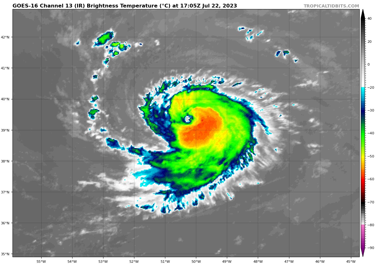
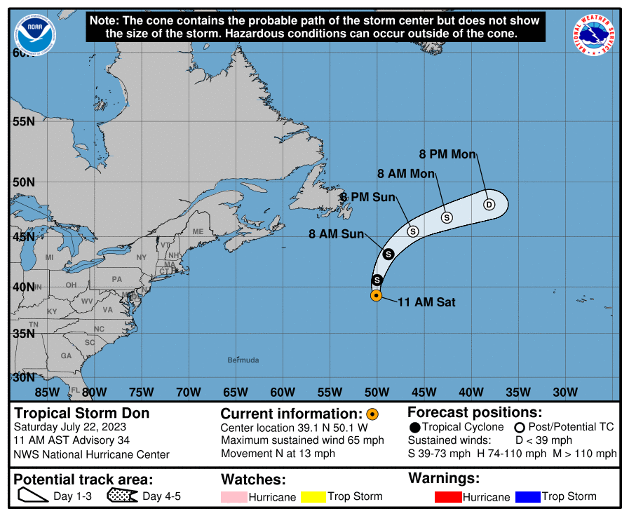
Tropical Storm Don’s convective structure has increased in organization this morning. A curved band has wrapped completely around the center with a ragged eye-like feature becoming apparent during the past couple of hours. With the more recent increase in organization, the intensity is raised to around 65 mph. Don has made its anticipated northward turn. A northward motion with some increase in forward speed is expected today as the cyclone is steered around the western periphery of a mid-level ridge. After that time, Don should turn north-northeastward and then northeastward within the mid-latitude westerlies. Some slight additional strengthening occurs within the next 6–12 hours while Don is over the slightly warmer Gulf Stream waters. After that time, a sharp decrease in SSTs along the track of Don and increasing vertical wind shear should cause weakening. Don is expected to become post-tropical around the 36-hour time period and dissipate by 72 hours.
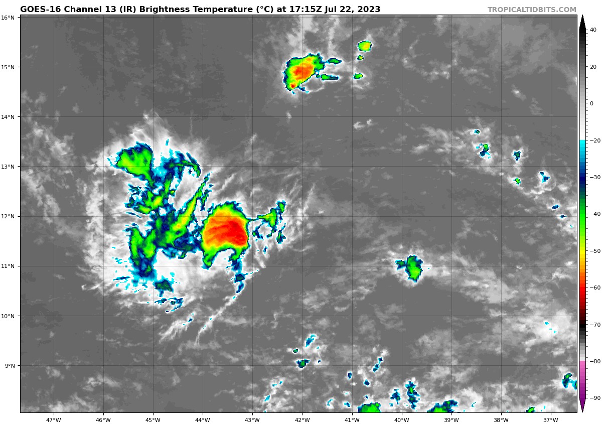
Central Tropical Atlantic (Invest 95L): Shower activity associated with a small area of low pressure located roughly midway between the Cabo Verde Islands and the Lesser Antilles has become a little less organized since yesterday. Environmental conditions are forecast to remain marginally conducive for some gradual development, and this system could become a tropical depression early next week while it moves westward across the tropical Atlantic. Interests in the Lesser Antilles should monitor the progress of this system.
* Formation chance through 48 hours…medium…40 percent.
* Formation chance through 7 days…medium…60 percent.
Category: Alabama's Weather, ALL POSTS, Severe Weather, Tropical
About the Author (Author Profile)
Scott Martin is an operational meteorologist, professional graphic artist, musician, husband, and father. Not only is Scott a member of the National Weather Association, but he is also the Central Alabama Chapter of the NWA president. Scott is also the co-founder of Racecast Weather, which provides forecasts for many racing series across the USA. He also supplies forecasts for the BassMaster Elite Series events including the BassMaster Classic.Subscribe
If you enjoyed this article, subscribe to receive more just like it.


