

A Few Isolated Strong Storms
A few isolated strong storms have formed across Central Alabama this afternoon in the heat and instability. Lapse rates are extreme in the lowest 3km of the atmosphere, over 9C!
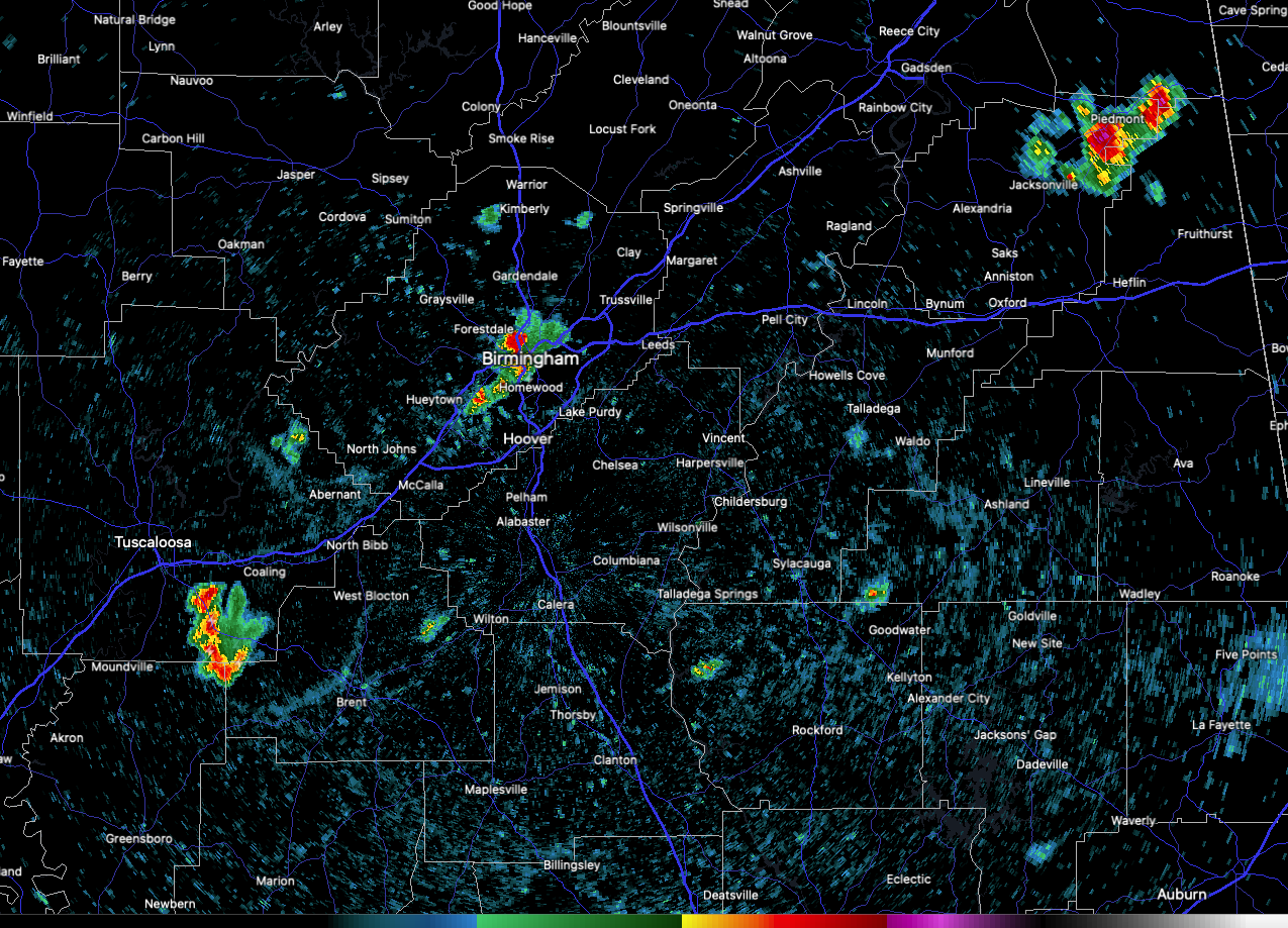
One such storm is over the Birmingham Metro area. It is raining heavily now in downtown and North Birmingham out to the Tallapoosa Street exit.
Other storms are forming over western sections of Birmingham as well.
Another strong storm is south of Piedmont in northern Cleburne County.
Others are are over southern Tuscaloosa County along US-82.
Another developing cell is over southwestern Clay County north of Goodwater.
The are drifting southwestward and should mainly rain themselves out fairly quickly.
The strongest storms will have torrential rain capable of producing local flooding, dangerous lightning, and gusty winds. Alex Sizemore at the NWS Birmingham did say that the atmosphere is moderately favorable for strong downburst winds so that is not out of the question with the stronger storms.
Category: Alabama's Weather, ALL POSTS, Severe Weather
About the Author (Author Profile)
Bill Murray is the President of The Weather Factory. He is the site's official weather historian and a weekend forecaster. He also anchors the site's severe weather coverage. Bill Murray is the proud holder of National Weather Association Digital Seal #0001 @wxhistorianSubscribe
If you enjoyed this article, subscribe to receive more just like it.


