Storms Affecting Much of Central & East-Central Alabama at Midday
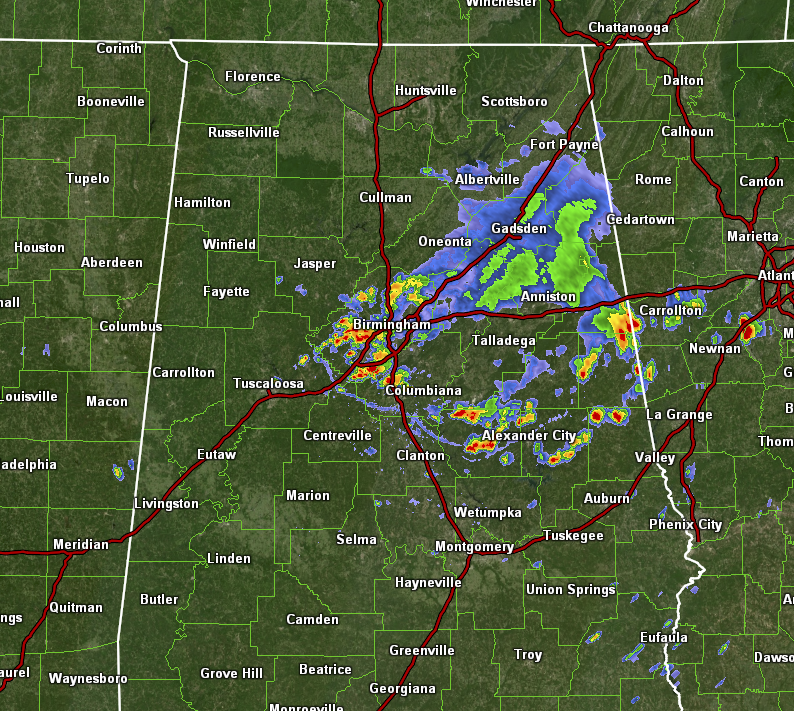
Some loud storms are progressing slowly southward through the central and east-central portions of Central Alabama at this time; so loud that I’m sure the thunder was louder than the music in most churches this morning. Just driving back through the northern portions of Jefferson County to return home from church, rain was still falling and there were plenty of big puddles on the sides and in the dips of the road.
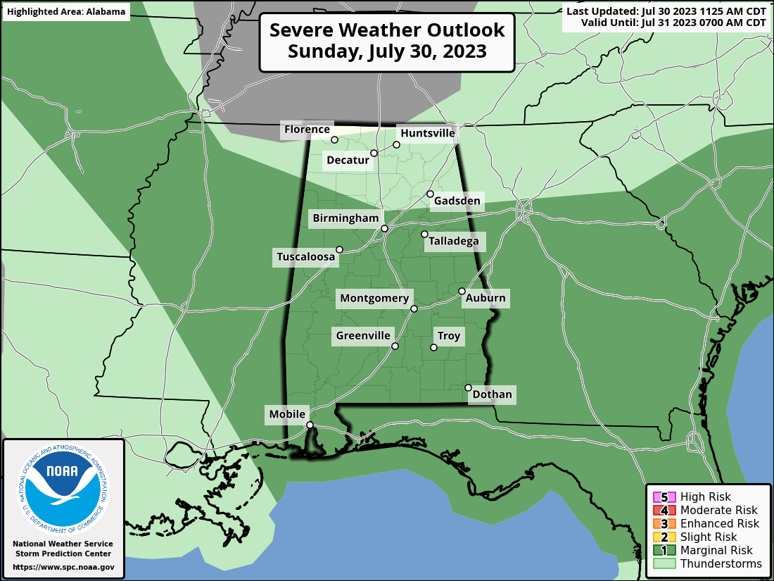
Storms are expected to develop even more during the afternoon hours, and a Marginal Risk is up for nearly all of Central Alabama through the rest of the day, with the main window for the threat of damaging winds and quarter-size hail already started and expected to go through 8pm tonight. For the northern third of the state, once the rain ends in a little bit, you may stay dry for the rest of the day. Highs were supposed to range throughout the 90s today, but with several locations already and currently receiving rain, some 80s may be seen as the maximum temperature in those places. Rain chances will eventually come to an end this evening and tonight, and lows will fall into the lower to mid 70s.
I’ll be with you through the day if any warnings are issued. I will also be doing the morning (recorded) videos for Spann this week as he will be out on vacation. So we will be on a one-a-day video schedule through Friday.
Category: Alabama's Weather, ALL POSTS, Severe Weather
About the Author (Author Profile)
Scott Martin is an operational meteorologist, professional graphic artist, musician, husband, and father. Not only is Scott a member of the National Weather Association, but he is also the Central Alabama Chapter of the NWA president. Scott is also the co-founder of Racecast Weather, which provides forecasts for many racing series across the USA. He also supplies forecasts for the BassMaster Elite Series events including the BassMaster Classic.Subscribe
If you enjoyed this article, subscribe to receive more just like it.


