Alabama Radar Update at 3:45 pm
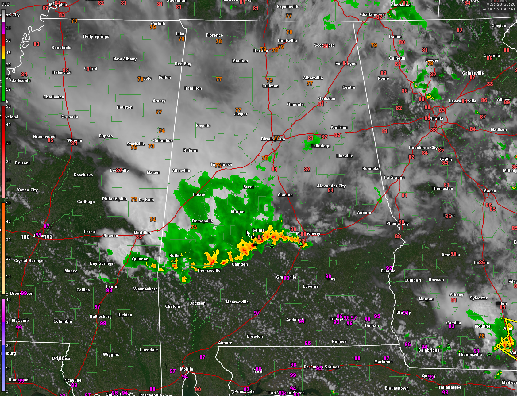
A strong line of thunderstorms is gobbling CAPE as it pushes southeast toward South Alabama and eventually the beach.
At 3:45 p.m., the line extends from south of Butler to north of Thomasville to Millers Ferry to east of Selma and then southwest of Montgomery.
Very heavy rain, pockets of intense lightning, wind gusts to 40 mph or higher, and pea size hail will accompany the stronger storms.
Across North Central Alabama, most of the rain is south of I-20 now. Skies are still mostly cloudy though with temperatures in the upper 70s and lower 80s.
Latest modelling shows less rain and storms tomorrow, but a grouping of weakening storms overnight Saturday night after midnight.
Category: Alabama's Weather, ALL POSTS, Severe Weather
About the Author (Author Profile)
Bill Murray is the President of The Weather Factory. He is the site's official weather historian and a weekend forecaster. He also anchors the site's severe weather coverage. Bill Murray is the proud holder of National Weather Association Digital Seal #0001 @wxhistorianSubscribe
If you enjoyed this article, subscribe to receive more just like it.


