EXPIRED Severe Thunderstorm Warning for Colbert and Lauderdale Until 10:30 am
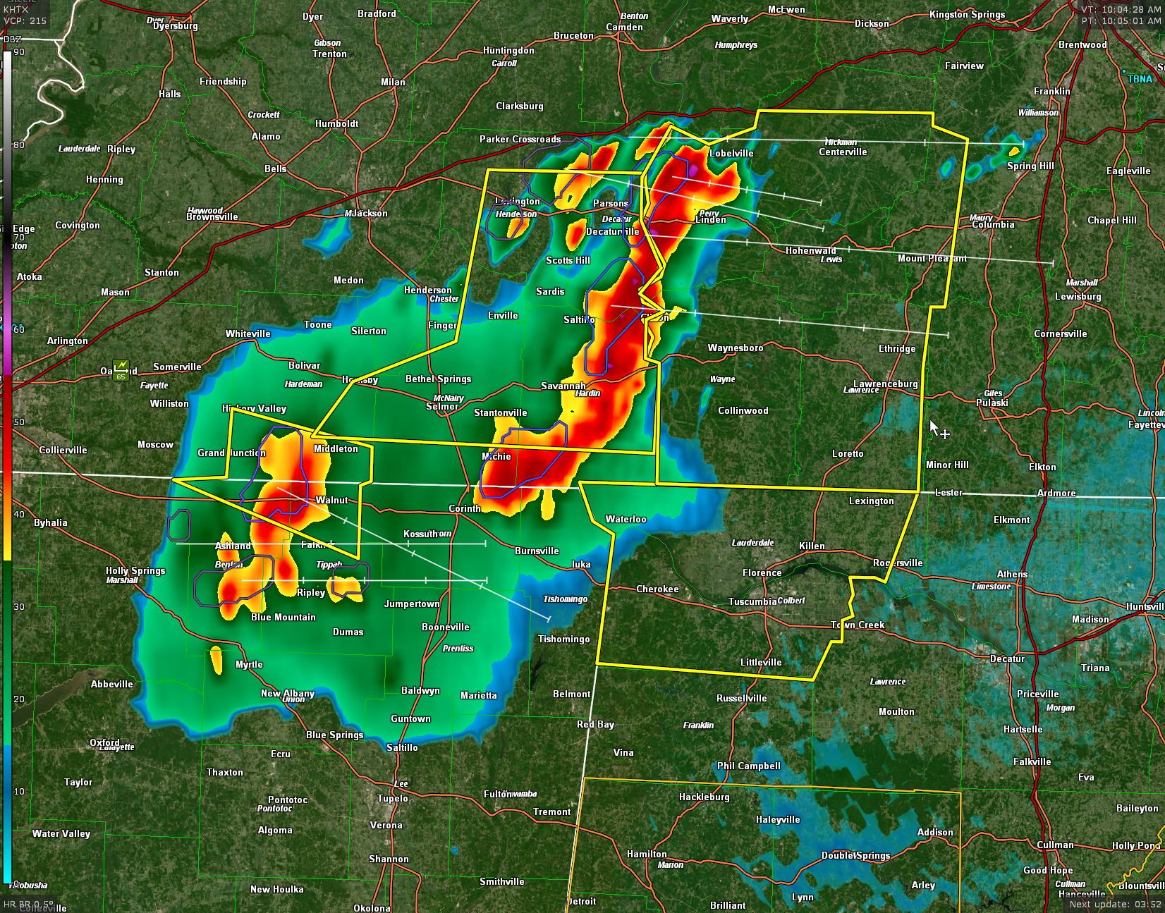
A line of severe thunderstorm is moving across southern Tennessee and Northeast Mississippi this morning. It is about to move into Northwest Alabama.
The storms will be intensifying and the threat for severe weather is increasing. 60 mph wind gusts and 1″ hail is possible.
Tornadoes are not out of the question for North Alabama today. In Central Alabama, the chance is small.
* Severe Thunderstorm Warning for…
Lauderdale County in northwestern Alabama…
Colbert County in northwestern Alabama…
* Until 1030 AM CDT.
* At 1000 AM CDT, severe thunderstorms were located along a line
extending from Savannah to near Shiloh to near Hinkle, moving
southeast at 50 mph.
HAZARD…60 mph wind gusts and quarter size hail.
SOURCE…Radar indicated.
IMPACT…Hail damage to vehicles is expected. Expect wind damage
to roofs, siding, and trees.
* Locations impacted include…
Florence, Muscle Shoals, Sheffield, Tuscumbia, Killen, Cherokee,
Littleville, Lexington, Leighton and St. Florian.
Category: Alabama's Weather, ALL POSTS, Severe Weather
About the Author (Author Profile)
Bill Murray is the President of The Weather Factory. He is the site's official weather historian and a weekend forecaster. He also anchors the site's severe weather coverage. Bill Murray is the proud holder of National Weather Association Digital Seal #0001 @wxhistorianSubscribe
If you enjoyed this article, subscribe to receive more just like it.


