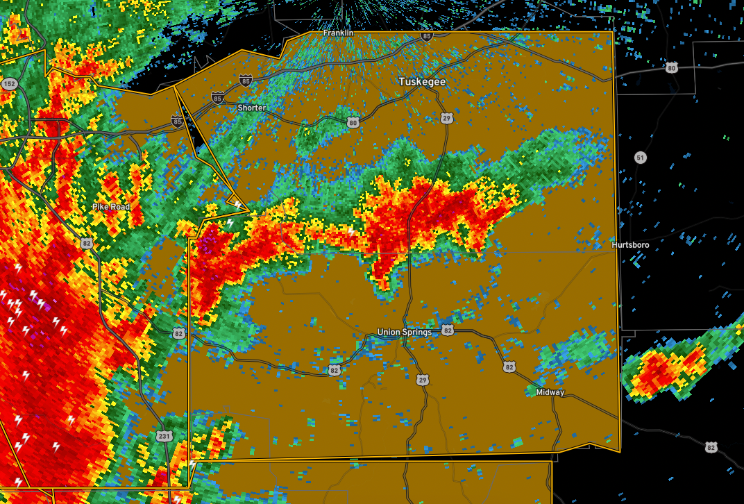
Severe Thunderstorm Warning for Pike, Bullock, and Macon
The National Weather Service in Birmingham has issued a
* Severe Thunderstorm Warning for…
North central Pike County in southeastern Alabama…
Bullock County in southeastern Alabama…
Macon County in southeastern Alabama…
* Until 330 PM CDT.
* At 209 PM CDT, severe thunderstorms were located along a line
extending from Montgomery to near Pine Level, moving east at 45
mph.
HAZARD…60 mph wind gusts.
SOURCE…Radar indicated.
IMPACT…Expect damage to roofs, siding, and trees.
* Locations impacted include…
Tuskegee, Union Springs, Midway, Milstead, Shorter, Franklin,
Aberfoil, Franklin Field, Lake Tuskegee, Beans Crossroads,
Guerryton, Shopton, Davisville, Liverpool, Hardaway, Tysonville,
Victoryland, Society Hill, Warriorstand and High Ridge.
Category: Alabama's Weather, ALL POSTS, Severe Weather
About the Author (Author Profile)
Bill Murray is the President of The Weather Factory. He is the site's official weather historian and a weekend forecaster. He also anchors the site's severe weather coverage. Bill Murray is the proud holder of National Weather Association Digital Seal #0001 @wxhistorianSubscribe
If you enjoyed this article, subscribe to receive more just like it.


