Severe Thunderstorm Warning for Lauderdale and Colbert Counties until 3 pm
The earlier rotation has weakened, but this storm is still capable of spinning up a tornado and has a good chance of producing damaging winds. Lots of lightning and torrential rains. Hail to one half inch.
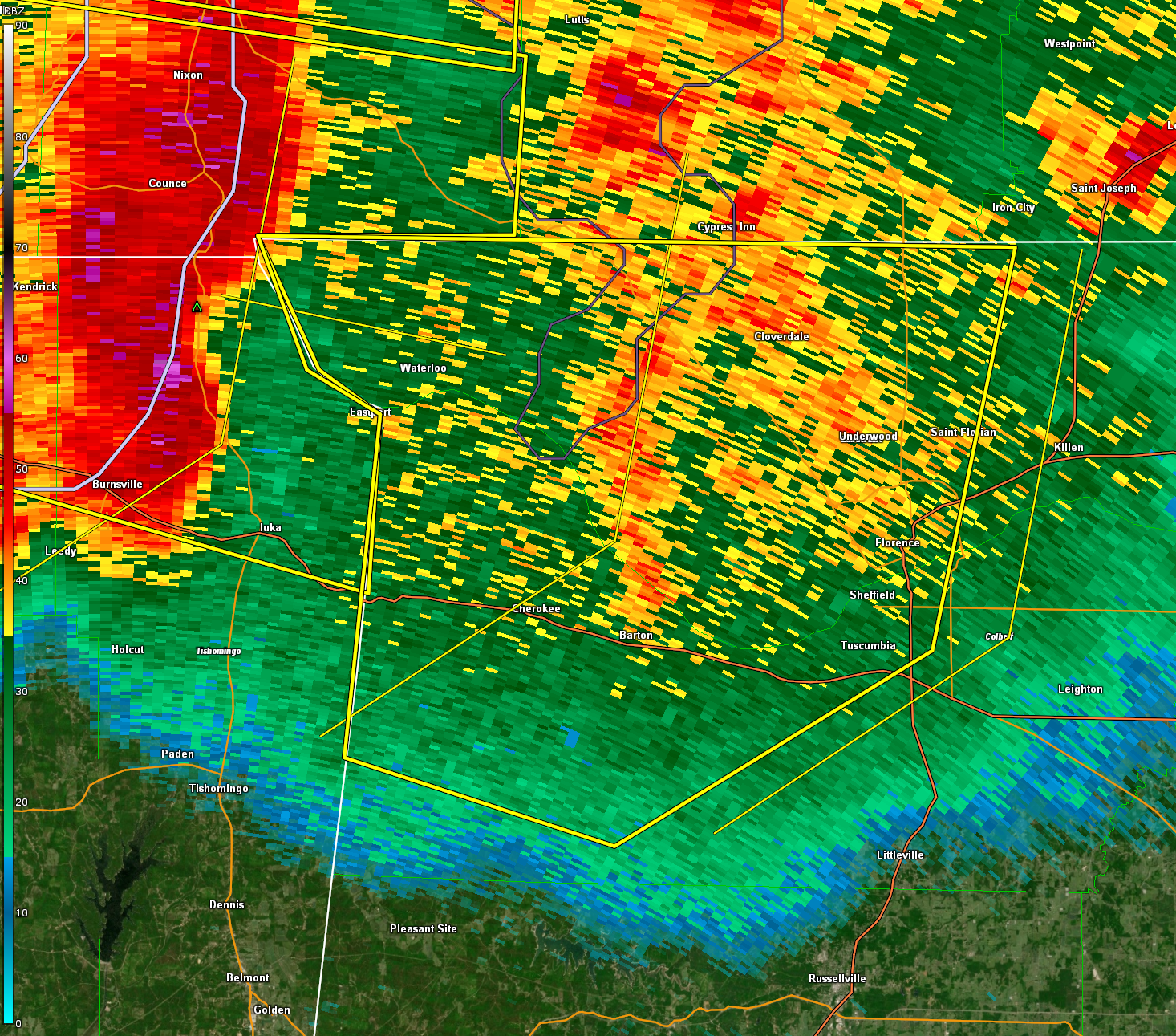
The National Weather Service in Huntsville Alabama has issued a
* Severe Thunderstorm Warning for…
Western Lauderdale County in northwestern Alabama…
Western Colbert County in northwestern Alabama…
* Until 300 PM CDT.
* At 211 PM CDT, severe thunderstorms were located along a line
extending from 6 miles northeast of Pickwick Landing State Park to
near Iuka to near Thrashers, moving east at 45 mph.
HAZARD…60 mph wind gusts.
SOURCE…Radar indicated.
IMPACT…Expect damage to roofs, siding, and trees.
* Locations impacted include…
Florence, Muscle Shoals, Sheffield, Tuscumbia, Cherokee, St.
Florian, Underwood-Petersville, Waterloo, Malone and Posey Loop.
Category: Alabama's Weather, ALL POSTS, Severe Weather
About the Author (Author Profile)
Bill Murray is the President of The Weather Factory. He is the site's official weather historian and a weekend forecaster. He also anchors the site's severe weather coverage. Bill Murray is the proud holder of National Weather Association Digital Seal #0001 @wxhistorianSubscribe
If you enjoyed this article, subscribe to receive more just like it.


