Severe Thunderstorm Warning for Blount and NE Jefferson: Golf Ball Sized Hail in Hayden
Hail core on I-65 just south of Smoke Rise. Hail larger than quarters possible. Emergency manager reporting golf ball sized hail in Hayden.
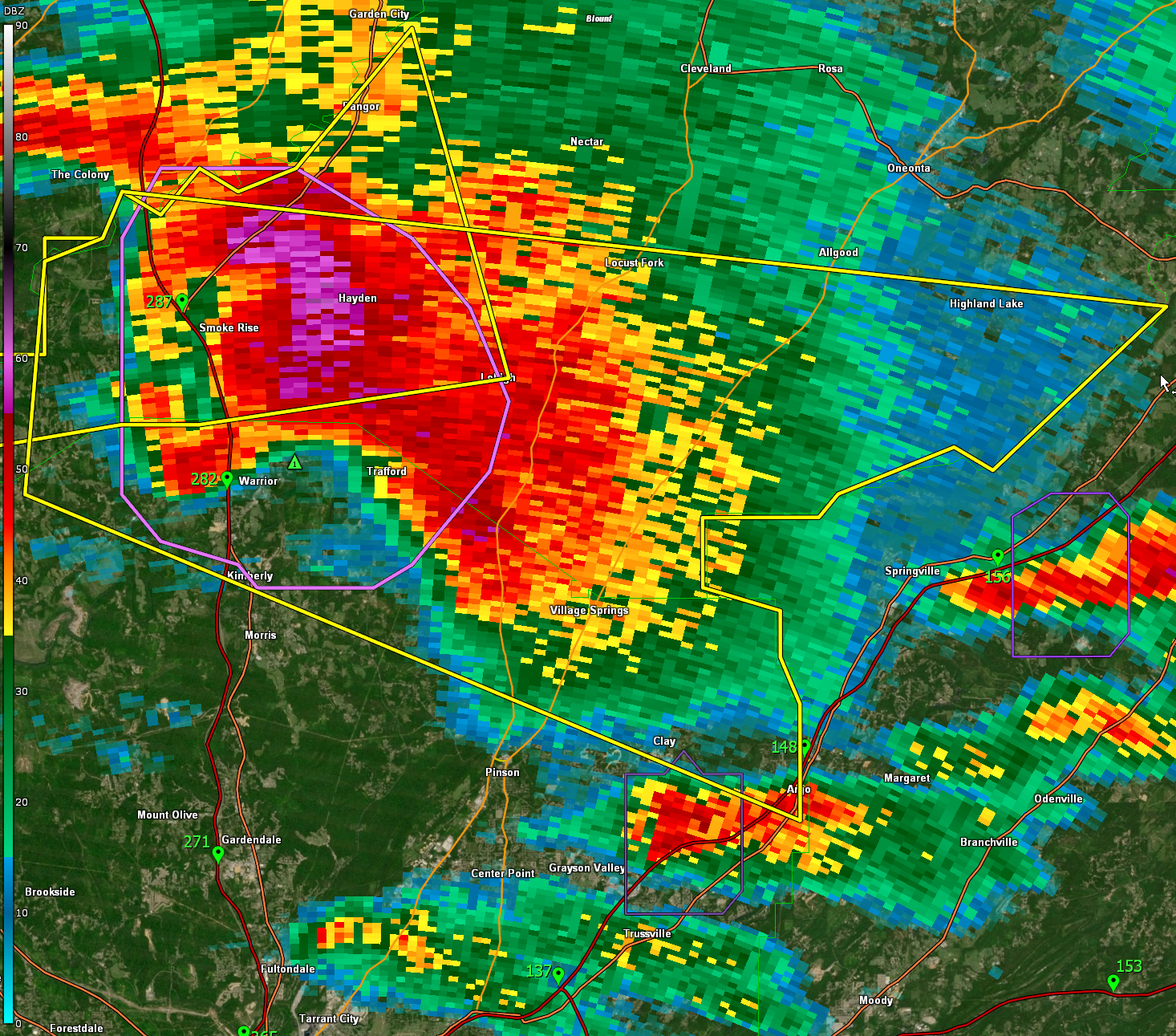
The National Weather Service in Birmingham has issued a
* Severe Thunderstorm Warning for…
Southern Blount County in central Alabama…
Northeastern Jefferson County in central Alabama…
* Until 615 PM CDT.
* At 526 PM CDT, a severe thunderstorm was located near Warrior, or
12 miles north of Gardendale, moving east at 30 mph.
HAZARD…60 mph wind gusts and half dollar size hail.
SOURCE…Radar indicated.
IMPACT…Hail damage to vehicles is expected. Expect wind damage
to roofs, siding, and trees.
* Locations impacted include…
Dallas, Clay, Pinson, Argo, Warrior, Kimberly, Locust Fork,
Trafford, Allgood, Hayden, County Line, Blount Springs, Inland
Lake, Highland Lake, Palmerdale, Smoke Rise, Holly Springs, Village
Springs, Remlap and Clear Springs.
Category: Alabama's Weather, ALL POSTS, Severe Weather
About the Author (Author Profile)
Bill Murray is the President of The Weather Factory. He is the site's official weather historian and a weekend forecaster. He also anchors the site's severe weather coverage. Bill Murray is the proud holder of National Weather Association Digital Seal #0001 @wxhistorianSubscribe
If you enjoyed this article, subscribe to receive more just like it.


