Another Warning for Southern St. Clair…Includes I-20 from Moody to Riverside
Very heavy rain and possible hail along I-20. Storm will push from Moody toward Pell City. Damaging winds are likely.
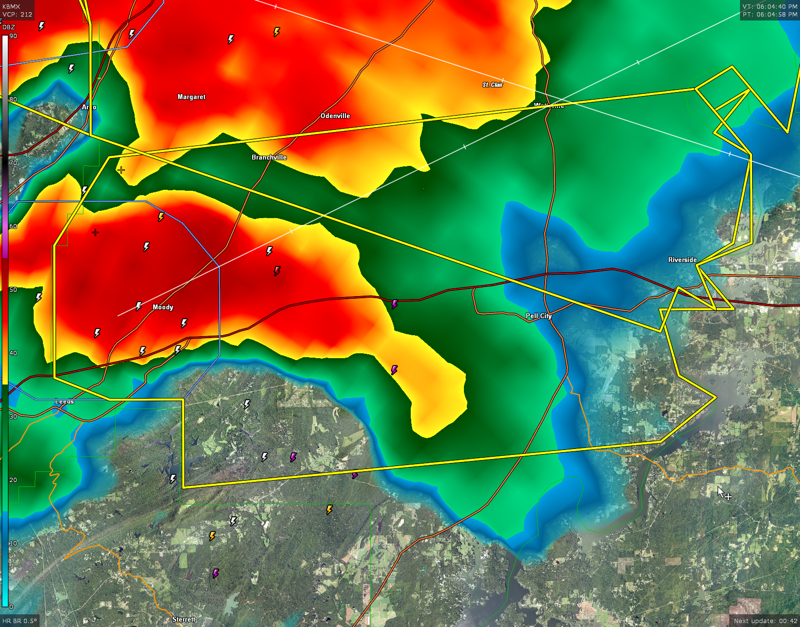
The National Weather Service in Birmingham has issued a
* Severe Thunderstorm Warning for…
Southwestern St. Clair County in central Alabama…
* Until 645 PM CDT.
* At 603 PM CDT, a severe thunderstorm was located over Moody, moving
east at 30 mph.
HAZARD…60 mph wind gusts and quarter size hail.
SOURCE…Radar indicated.
IMPACT…Hail damage to vehicles is expected. Expect wind damage
to roofs, siding, and trees.
* Locations impacted include…
Pell City, Leeds, Moody, Odenville, Margaret, Argo, Riverside, Bald
Rock, Logan Martin Lake, Harrisburg, Branchville, St. Clair County
Airport, Wattsville, Chula Vista, Camp Winnataska and Cropwell.
Category: Alabama's Weather, ALL POSTS, Severe Weather
About the Author (Author Profile)
Bill Murray is the President of The Weather Factory. He is the site's official weather historian and a weekend forecaster. He also anchors the site's severe weather coverage. Bill Murray is the proud holder of National Weather Association Digital Seal #0001 @wxhistorianSubscribe
If you enjoyed this article, subscribe to receive more just like it.


