Watch Expanded to 3 Additional Counties; New Warning for Randolph, Tallapoosa, Chambers, and Clay
The watch counties are shown in pink…
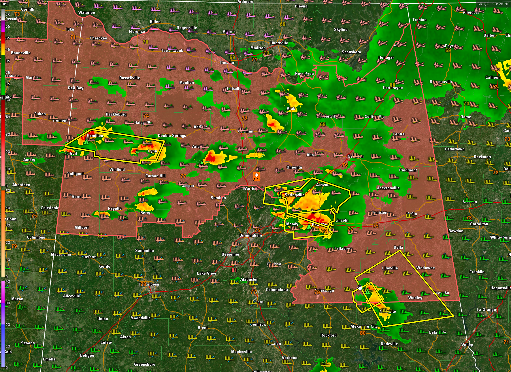
Current severe thunderstorm warnings are shown in yellow.
The wind barbs show wind speed and direction at 500 millibars (18,000 feet), 700 millibars (10,000 feet), and 850 millibars (5,000 feet). You can see the turning and change in velocity with height giving us extremely anomalous wind shear for August.
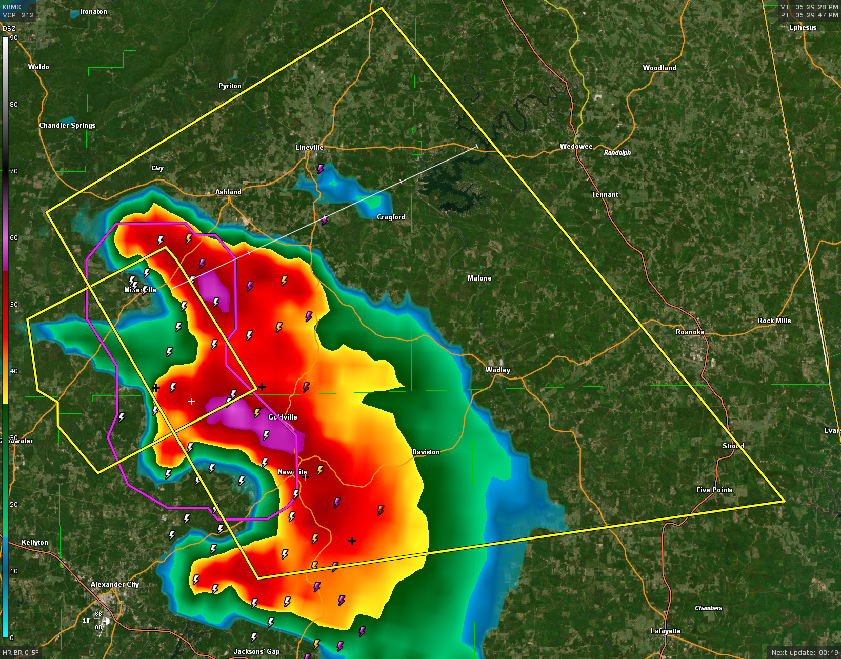
New Severe thunderstorm Warning for
The National Weather Service in Birmingham has issued a
* Severe Thunderstorm Warning for…
Southwestern Randolph County in east central Alabama…
Northeastern Tallapoosa County in east central Alabama…
Northwestern Chambers County in east central Alabama…
Southeastern Clay County in east central Alabama…
* Until 745 PM CDT.
* At 629 PM CDT, severe thunderstorms were located along a line
extending from near Ashland to near New Site, moving east at 25
mph.
HAZARD…60 mph wind gusts and quarter size hail.
SOURCE…Radar indicated.
IMPACT…Hail damage to vehicles is expected. Expect wind damage
to roofs, siding, and trees.
* Locations impacted include…
Roanoke, Lineville, Ashland, Lake Wedowee, Stroud, New Site,
Wadley, Five Points, Goldville, Malone, Barfield, Abanda, Penton,
Sparkling Springs, Daviston, Dickert, Cragford, R.L. Harris Dam,
Horseshoe Bend National Military Park and Ofelia.
Category: Alabama's Weather, ALL POSTS, Severe Weather
About the Author (Author Profile)
Bill Murray is the President of The Weather Factory. He is the site's official weather historian and a weekend forecaster. He also anchors the site's severe weather coverage. Bill Murray is the proud holder of National Weather Association Digital Seal #0001 @wxhistorianSubscribe
If you enjoyed this article, subscribe to receive more just like it.


