Severe Thunderstorm Warning for Talladega and Clay Counties
Another dangerous storm approaching Talladega. The storms extend from southeast of Pell City to near Munford, passing just south of Oxford.
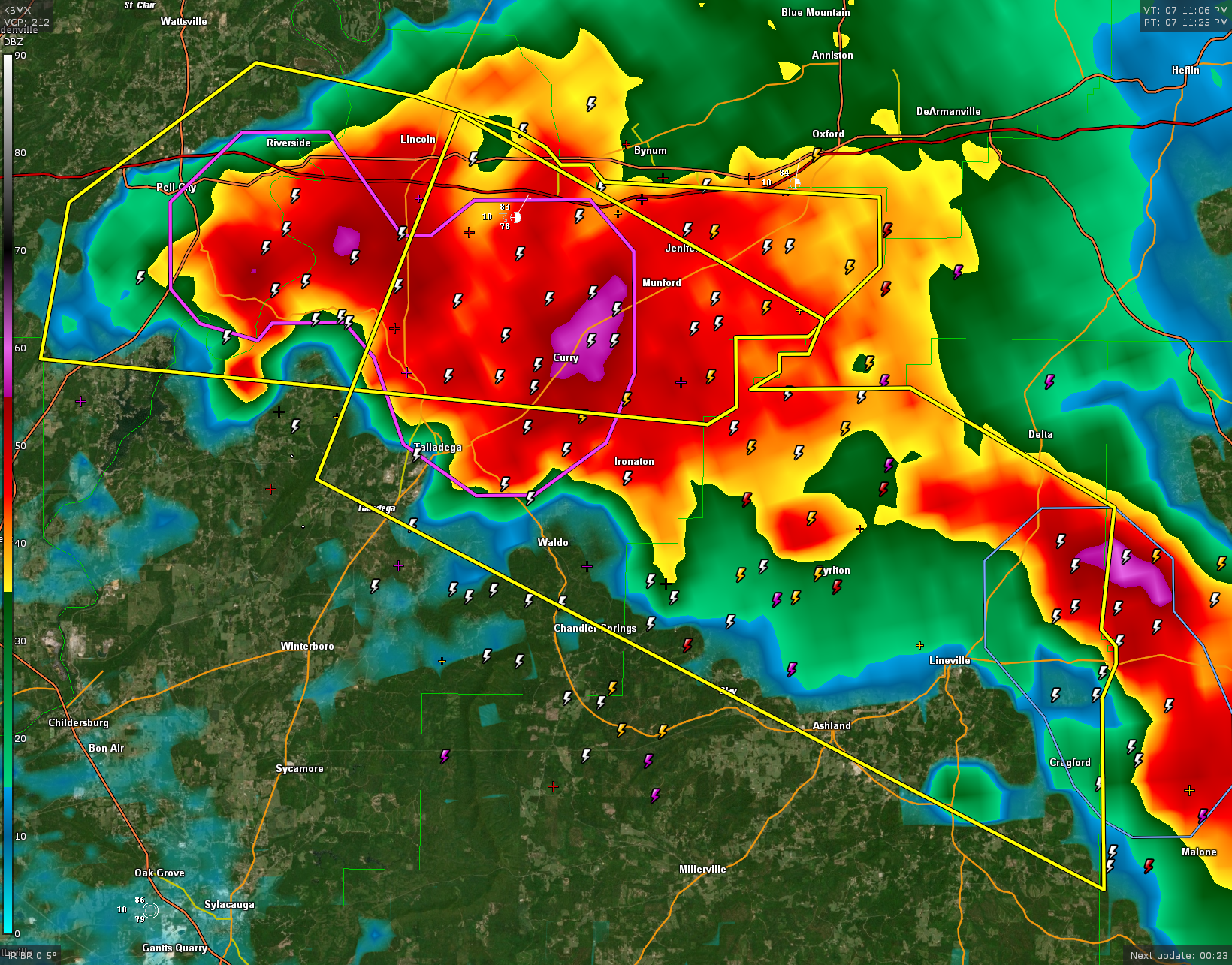
The National Weather Service in Birmingham has issued a
* Severe Thunderstorm Warning for…
Northeastern Talladega County in east central Alabama…
Northeastern Clay County in east central Alabama…
* Until 815 PM CDT.
* At 707 PM CDT, a severe thunderstorm was located over Talladega,
moving southeast at 25 mph.
HAZARD…Golf ball size hail and 60 mph wind gusts.
SOURCE…Radar indicated.
IMPACT…People and animals outdoors will be injured. Expect hail
damage to roofs, siding, windows, and vehicles. Expect
wind damage to roofs, siding, and trees.
* Locations impacted include…
Talladega, Lineville, Ashland, Lincoln, Munford, Waldo, Grant Town,
Barfield, Talladega Superspeedway, Talladega Municipal Airport,
Cragford, Camp Mac, Jackson Shoals, Ironaton, Jenifer, Lake
Chinnabee and Gunthertown.
Category: Alabama's Weather, ALL POSTS, Severe Weather
About the Author (Author Profile)
Bill Murray is the President of The Weather Factory. He is the site's official weather historian and a weekend forecaster. He also anchors the site's severe weather coverage. Bill Murray is the proud holder of National Weather Association Digital Seal #0001 @wxhistorianSubscribe
If you enjoyed this article, subscribe to receive more just like it.


