Wrap Up Just After 4:10 a.m.
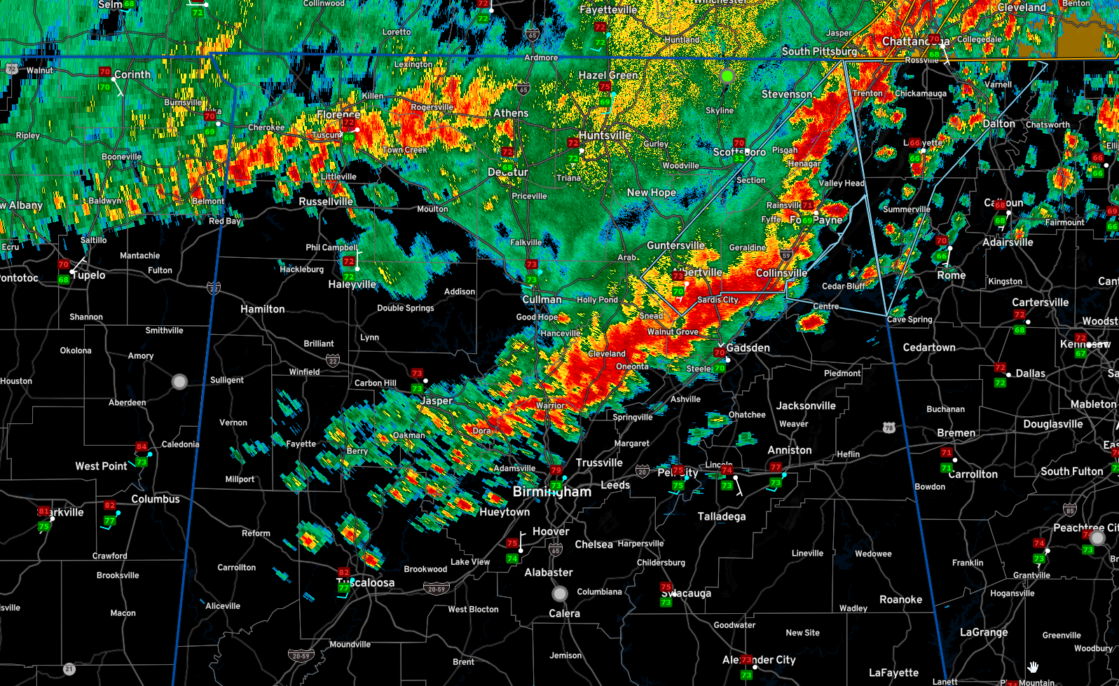
No reports of severe weather have been received from North or Central Alabama over the past few hours except f ro a tree reports down in Woodville in Jackson County.
Winds did gust to 54 mph at Decatur earlier.
There are no severe weather watches or warnings in effect across Alabama.
Our line of storms now extends from DeKalb and Cherokee counties back through Etowah, Marshall, Blount and Northern Jefferson Counties. The line becomes a little more broken back through Walker and Tuscaloosa Counties.
The storms will drop southeastward, gradually weakening.
No more severe weather is expected overnight, but keep your warning sources close by.
Storms may redevelop over South Central Alabama this afternoon.
In addition, another MCS will drop southward through Alabama this afternoon, affecting the Tennessee valley between 1-4pm, North Central Alabama betwen 4-8 pm, The I-20 Corridor between 7-10 pm. amd South Central Alabama between 9pm-1am. So get ready for another long day and night.
Then, severe weather is possible Friday afternoon mainly from the I-20 Corridor to the south between 10 am and 7 pm.
Have a good rest of your morning!
Category: Alabama's Weather, ALL POSTS, Severe Weather
About the Author (Author Profile)
Bill Murray is the President of The Weather Factory. He is the site's official weather historian and a weekend forecaster. He also anchors the site's severe weather coverage. Bill Murray is the proud holder of National Weather Association Digital Seal #0001 @wxhistorianSubscribe
If you enjoyed this article, subscribe to receive more just like it.


