Watch Issued: Strong Storms in the I-85 Corridor, Building Over North Alabama
Strong storms continue this evening in the I-85 Corridor from northern Lowndes County into southern Elmore and eastern Montgomery Counties, then through Macon and extreme southern Tallapoosa. The strongest ones are from near Shorter to Hardaway to east of Pike Road.
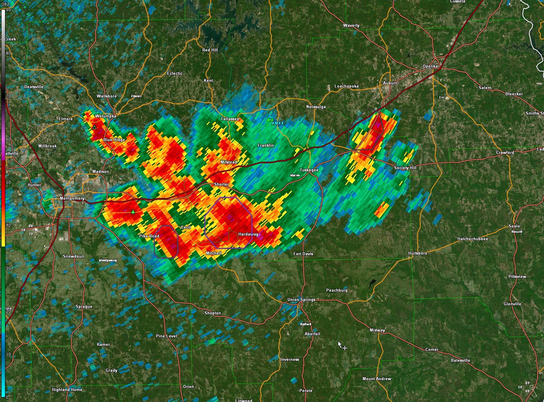
Lots of lightning, heavy rain, and gusty winds. There could be a little hail southeast of Pike Road.
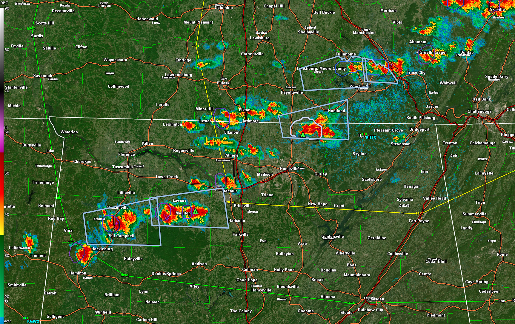
Storms are growing across the Tennessee Valley at this hour from northern Madison through Limestone, Lawrence, Lauderdale, and Franklin counties. The strongest storms are over Central Franklin County, south of Russellville. The one near Moulton is intensifying. Another is in northeastern Madison County, straddling the Tennessee line and about to move into Jackson County.
A severe thunderstorm watch has just been issued for areas from North Alabama across Northern Georgia and eastern Tennessee into southwestern Virginia. It goes until 2 a.m. CDT.
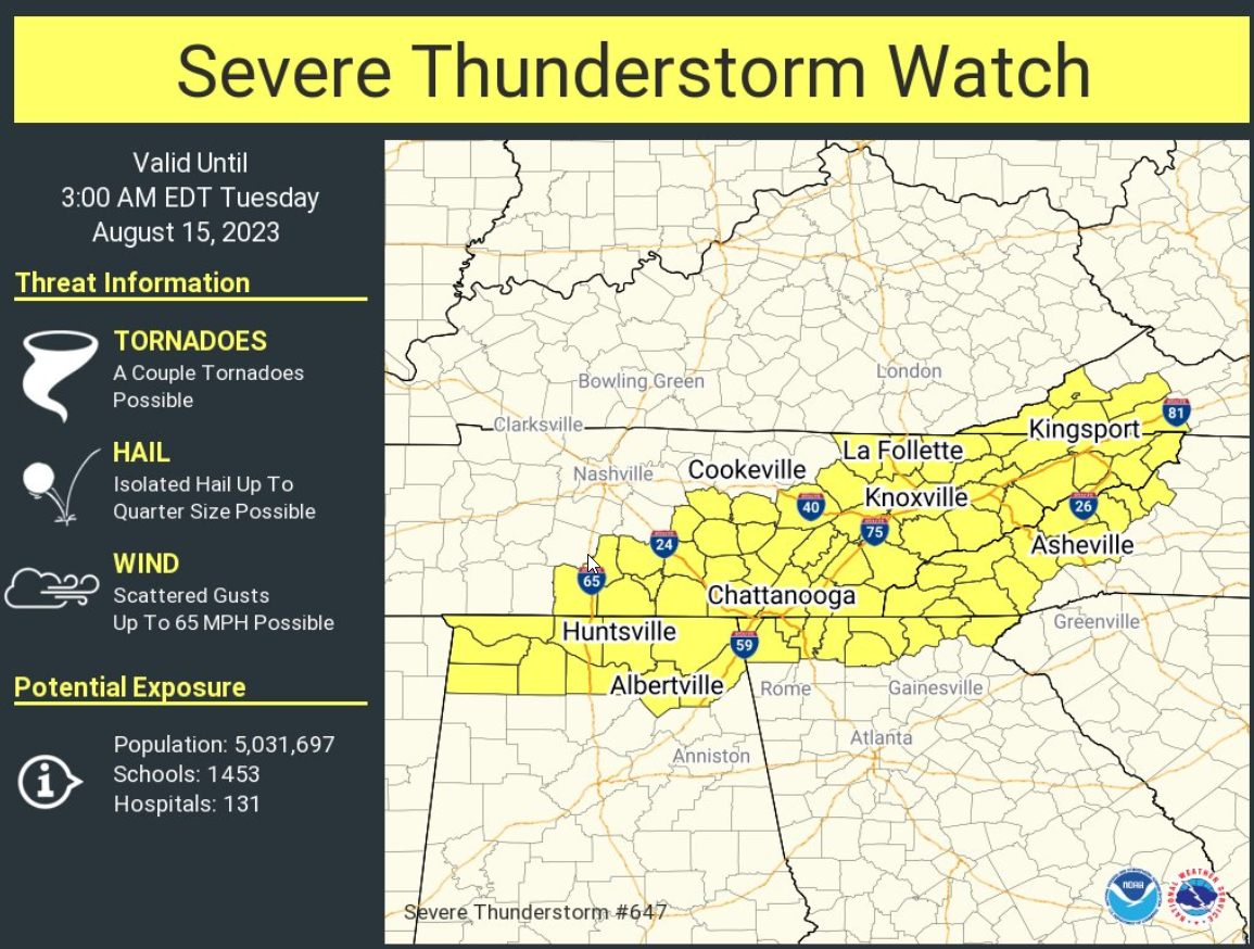
The risk of severe weather through 7 a.m. is over the northern quarter of Alabama, generally north of a line from Hamilton to Double Springs, to Cullman, Gadsden, and Cedartown GA. Keep your weather warning sources handy through the overnight over North Alabama.
There will a small marginal risk tomorrow generally from I-85 south after 1 pm in the afternoon. Same advice.
Category: Alabama's Weather, ALL POSTS, Spacey Stuff
About the Author (Author Profile)
Bill Murray is the President of The Weather Factory. He is the site's official weather historian and a weekend forecaster. He also anchors the site's severe weather coverage. Bill Murray is the proud holder of National Weather Association Digital Seal #0001 @wxhistorianSubscribe
If you enjoyed this article, subscribe to receive more just like it.


